Property Record
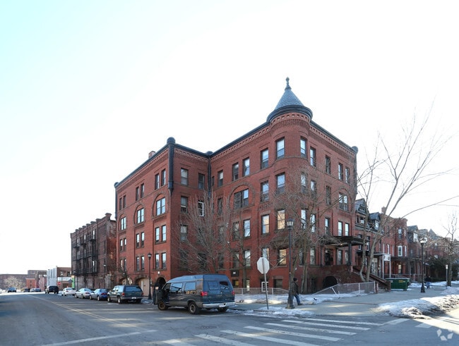
328 Maple St, Holyoke, MA 01040


NEARBY LISTINGS FOR SALE OR LEASE
Property Detail
328 Maple St
HOLY-000011-000008-000018
Hampden
Apartment
Massachusetts
X
18
25013C0203E
0.12 AC
2025
Downtown Holyoke
2025
Hartford
811600
Springfield, MA
15,820 SF
DEMOGRAPHICS near 328 Maple St
1 Mile
3 Mile
5 Mile
2024 Total Population
20,255
74,552
126,000
2029 Population
20,030
71,675
119,313
Pop Growth 2024-2029
(1.11%)
(3.86%)
(5.31%)
Average Age
37
41
41
2024 Total Households
8,153
31,565
52,628
HH Growth 2024-2029
(1.17%)
(4.14%)
(5.60%)
Median Household Inc
$28,458
$52,259
$57,885
Avg Household Size
2.40
2.30
2.30
2024 Avg HH Vehicles
1.00
1.00
2.00
Median Home Value
$191,880
$242,952
$252,384
Median Year Built
1948
1954
1956
Nearby Places
Map Layers
Map Styles
 Street
 Aerial
- Restaurants
- Banks
- Shops
- Fitness
- Groceries
PUBLIC TRANSPORTATION
COMMUTER RAIL
DRIVE
WALK
Distance
2 min
13 min
0.6 mi
DRIVE
WALK
Distance
12 min
8.1 mi
AIRPORT
Bradley International
DRIVE
WALK
Distance
Bradley International
39 min
20.5 mi
Nearby Properties
Address
Land Use
TOTAL SIZE
Lot Size
Zoning
Address
Land Use
TOTAL SIZE
Lot Size
Zoning
50.97 AC
BH
Address
Land Use
TOTAL SIZE
Lot Size
Zoning
22.15 AC
R-1A
Address
Land Use
TOTAL SIZE
Lot Size
Zoning
21.80 AC
106
Address
Land Use
TOTAL SIZE
Lot Size
Zoning
29.88 AC
105
Address
Land Use
TOTAL SIZE
Lot Size
Zoning
189,022 SF
10.62 AC
RA
Address
Land Use
TOTAL SIZE
Lot Size
Zoning
22.77 AC
111A
Address
Land Use
TOTAL SIZE
Lot Size
Zoning
138,504 SF
13.18 AC
RO
Address
Land Use
TOTAL SIZE
Lot Size
Zoning
17.72 AC
R-2
Address
Land Use
TOTAL SIZE
Lot Size
Zoning
171,241 SF
18.94 AC
106
Address
Land Use
TOTAL SIZE
Lot Size
Zoning
30.45 AC
106
Address
Land Use
TOTAL SIZE
Lot Size
Zoning
223,390 SF
13.83 AC
111A
Address
Land Use
TOTAL SIZE
Lot Size
Zoning
12.90 AC
IP
Address
Land Use
TOTAL SIZE
Lot Size
Zoning
2.41 AC
DR
Address
Land Use
TOTAL SIZE
Lot Size
Zoning
17.64 AC
105
Address
Land Use
TOTAL SIZE
Lot Size
Zoning
4.04 AC
107
Address
Land Use
TOTAL SIZE
Lot Size
Zoning
136,654 SF
11.71 AC
BG
Address
Land Use
TOTAL SIZE
Lot Size
Zoning
8.16 AC
RM40
Address
Land Use
TOTAL SIZE
Lot Size
Zoning
16.38 AC
RA
Address
Land Use
TOTAL SIZE
Lot Size
Zoning
72,239 SF
13.87 AC
R-1A
Address
Land Use
TOTAL SIZE
Lot Size
Zoning
23,111 SF
1.43 AC
IA
Address
Land Use
TOTAL SIZE
Lot Size
Zoning
138,289 SF
22.79 AC
IG
Address
Land Use
TOTAL SIZE
Lot Size
Zoning
4.66 AC
105
Address
Land Use
TOTAL SIZE
Lot Size
Zoning
196,705 SF
21.45 AC
RM20
Address
Land Use
TOTAL SIZE
Lot Size
Zoning
201,410 SF
13.16 AC
RM20
Address
Land Use
TOTAL SIZE
Lot Size
Zoning
191,133 SF
12.28 AC
RM-2
Address
Land Use
TOTAL SIZE
Lot Size
Zoning
62,808 SF
7.60 AC
R-1
Address
Land Use
TOTAL SIZE
Lot Size
Zoning
26.98 AC
BG
Address
Land Use
TOTAL SIZE
Lot Size
Zoning
194,875 SF
2.75 AC
IG
Address
Land Use
TOTAL SIZE
Lot Size
Zoning
64,638 SF
9.26 AC
RA2
Address
Land Use
TOTAL SIZE
Lot Size
Zoning
19.80 AC
105
The World's #1 Commercial Real Estate Marketplace
Connect with us
© 2026 CoStar Group
The information above has been obtained from sources believed reliable. While we do not doubt its accuracy we have not verified it and make no guarantee, warranty or representation about it. It is your responsibility to independently confirm its accuracy and completeness. Any projections, opinions, assumptions, or estimates used are for example only and do not represent the current or future performance of the property. The value of this transaction to you depends on tax and other factors which should be evaluated by your tax, financial, and legal advisors. You and your advisors should conduct a careful, independent investigation of the property to determine to your satisfaction the suitability of the property for your needs.