Property Record
225 N Gilbert Rd, Mesa, AZ 85203

NEARBY LISTINGS FOR SALE OR LEASE
Property Detail
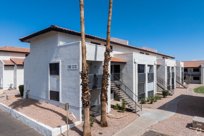
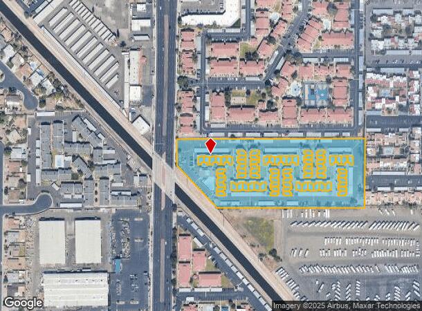
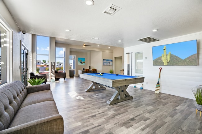
225 N Gilbert Rd
Phoenix
Rancho Palos Verdes Amd
Phoenix-Mesa-Scottsdale, AZ
Maricopa
140-25-669
Arizona
Condominium
4.81 AC
AH
Central Mesa
04013C2270M
DEMOGRAPHICS near 225 N Gilbert Rd
1 Mile
3 Mile
5 Mile
2024 Total Population
23,984
166,280
344,800
2029 Population
25,906
179,746
372,844
Pop Growth 2024-2029
+ 8.01%
+ 8.10%
+ 8.13%
Average Age
36
38
39
2024 Total Households
8,601
60,351
129,874
HH Growth 2024-2029
+ 8.27%
+ 8.48%
+ 8.49%
Median Household Inc
$52,452
$62,067
$63,189
Avg Household Size
2.70
2.60
2.60
2024 Avg HH Vehicles
2.00
2.00
2.00
Median Home Value
$264,241
$313,159
$332,508
Median Year Built
1977
1982
1984
Nearby Places
Map Layers
Map Styles
 Street
 Aerial
- Restaurants
- Banks
- Shops
- Fitness
- Groceries
PUBLIC TRANSPORTATION
TRANSIT/SUBWAY
Gilbert Rd/Main St (Valley Metro Rail - Valley Metro (Phoenix Light Rail))
DRIVE
WALK
Distance
Gilbert Rd/Main St (Valley Metro Rail - Valley Metro (Phoenix Light Rail))
2 min
11 min
0.6 mi
AIRPORT
Phoenix-Mesa Gateway
DRIVE
WALK
Distance
Phoenix-Mesa Gateway
24 min
14.9 mi
Phoenix Sky Harbor International
DRIVE
WALK
Distance
Phoenix Sky Harbor International
25 min
15.5 mi
Freight Ports
Port of San Diego
DRIVE
WALK
Distance
Port of San Diego
415 min
376.9 mi
Nearby Properties
Address
Land Use
TOTAL SIZE
Lot Size
Zoning
Address
Land Use
TOTAL SIZE
Lot Size
Zoning
125,356 SF
21.63 AC
R-9
Address
Land Use
TOTAL SIZE
Lot Size
Zoning
7.90 AC
Address
Land Use
TOTAL SIZE
Lot Size
Zoning
184,558 SF
6.18 AC
Address
Land Use
TOTAL SIZE
Lot Size
Zoning
377,442 SF
0.21 AC
C-DT
Address
Land Use
TOTAL SIZE
Lot Size
Zoning
400,798 SF
55.94 AC
PF
Address
Land Use
TOTAL SIZE
Lot Size
Zoning
281,301 SF
19.13 AC
I-1
Address
Land Use
TOTAL SIZE
Lot Size
Zoning
579,506 SF
17.78 AC
PF
Address
Land Use
TOTAL SIZE
Lot Size
Zoning
20.08 AC
Address
Land Use
TOTAL SIZE
Lot Size
Zoning
185,382 SF
23.37 AC
C-G
Address
Land Use
TOTAL SIZE
Lot Size
Zoning
454,015 SF
10.03 AC
DB1
Address
Land Use
TOTAL SIZE
Lot Size
Zoning
427,210 SF
38.33 AC
PF
Address
Land Use
TOTAL SIZE
Lot Size
Zoning
344,641 SF
21.43 AC
I-1
Address
Land Use
TOTAL SIZE
Lot Size
Zoning
1.46 AC
C-G
Address
Land Use
TOTAL SIZE
Lot Size
Zoning
478,411 SF
4.07 AC
CDT
Address
Land Use
TOTAL SIZE
Lot Size
Zoning
1.17 AC
Address
Land Use
TOTAL SIZE
Lot Size
Zoning
199,472 SF
4.79 AC
C-DT
Address
Land Use
TOTAL SIZE
Lot Size
Zoning
367,012 SF
19.91 AC
M-H
Address
Land Use
TOTAL SIZE
Lot Size
Zoning
26,951 SF
1.08 AC
I-1
Address
Land Use
TOTAL SIZE
Lot Size
Zoning
92,285 SF
7.90 AC
PEP
Address
Land Use
TOTAL SIZE
Lot Size
Zoning
233,188 SF
7.34 AC
RM4
Address
Land Use
TOTAL SIZE
Lot Size
Zoning
79,452 SF
37.59 AC
PF
Address
Land Use
TOTAL SIZE
Lot Size
Zoning
169,128 SF
27.30 AC
R-9
Address
Land Use
TOTAL SIZE
Lot Size
Zoning
147,408 SF
34.58 AC
PF
Address
Land Use
TOTAL SIZE
Lot Size
Zoning
536,470 SF
28.81 AC
M-H
Address
Land Use
TOTAL SIZE
Lot Size
Zoning
349,318 SF
18.47 AC
M-H
Address
Land Use
TOTAL SIZE
Lot Size
Zoning
160,843 SF
22.07 AC
PF
Address
Land Use
TOTAL SIZE
Lot Size
Zoning
266,240 SF
9.75 AC
M-H
Address
Land Use
TOTAL SIZE
Lot Size
Zoning
291,925 SF
17.70 AC
M-H
Address
Land Use
TOTAL SIZE
Lot Size
Zoning
219,685 SF
20.13 AC
I-1
Address
Land Use
TOTAL SIZE
Lot Size
Zoning
155,430 SF
9.19 AC
The World's #1 Commercial Real Estate Marketplace
Connect with us
© 2025 CoStar Group
The information above has been obtained from sources believed reliable. While we do not doubt its accuracy we have not verified it and make no guarantee, warranty or representation about it. It is your responsibility to independently confirm its accuracy and completeness. Any projections, opinions, assumptions, or estimates used are for example only and do not represent the current or future performance of the property. The value of this transaction to you depends on tax and other factors which should be evaluated by your tax, financial, and legal advisors. You and your advisors should conduct a careful, independent investigation of the property to determine to your satisfaction the suitability of the property for your needs.