Property Record
1129 Empire Blvd, Rochester, NY 14609

Property Detail
1129 Empire Blvd
264200-108-050-0002-009-100
L3 T13 R7 DEED MERGE
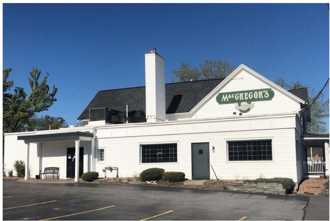
Restaurantbuilding
Monroe
LLD
New York
AE The base floodplain where base flood elevations are provided. AE Zones are now used on new format FIRMs instead of A1-A30 Zones.
9.100
2025
2.38 AC
2025
Northeast
011503
Rochester
8,326 SF
Rochester, NY
NEARBY LISTINGS FOR SALE OR LEASE
DEMOGRAPHICS near 1129 Empire Blvd
1 mile
3 mile
5 mile
2025 Total Population
3,070
79,611
232,559
2030 Population
3,076
78,789
230,446
Pop Growth 2025-2030
+ 0.20%
(1.03%)
(0.91%)
Average Age
46
42
41
2025 Total Households
1,411
35,105
104,387
HH Growth 2025-2030
+ 0.43%
(1.05%)
(0.90%)
Median Household Inc
$81,859
$74,612
$68,577
Avg Household Size
2.10
2.20
2.10
2025 Avg HH Vehicles
2.00
2.00
1.00
Median Home Value
$205,917
$196,819
$218,872
Median Year Built
1959
1954
1954
Nearby Places
Map Layers
Map Styles
 Street
 Aerial
Layers
 Traffic
 Biking
Places
Listings with unknown addresses are not visible on the map
- Restaurants
- Banks
- Shops
- Fitness
- Groceries
PUBLIC TRANSPORTATION
AIRPORT
Frederick Douglass/Greater Rochester International
Drive
Walk
Distance
Frederick Douglass/Greater Rochester International
18 min
10.0 mi
Nearby Properties
Address
Land Use
TOTAL SIZE
Lot Size
Zoning
Address
Land Use
TOTAL SIZE
Lot Size
Zoning
7.15 AC
Address
Land Use
TOTAL SIZE
Lot Size
Zoning
0.41 AC
Address
Land Use
TOTAL SIZE
Lot Size
Zoning
198,655 SF
31.05 AC
02 - SINGL
Address
Land Use
TOTAL SIZE
Lot Size
Zoning
0.65 AC
Address
Land Use
TOTAL SIZE
Lot Size
Zoning
161,812 SF
5.18 AC
06 - INDUS
Address
Land Use
TOTAL SIZE
Lot Size
Zoning
193,892 SF
18.62 AC
05 - COMME
Address
Land Use
TOTAL SIZE
Lot Size
Zoning
283,456 SF
40.76 AC
R-1-20
Address
Land Use
TOTAL SIZE
Lot Size
Zoning
742,711 SF
56.05 AC
Address
Land Use
TOTAL SIZE
Lot Size
Zoning
57.70 AC
Address
Land Use
TOTAL SIZE
Lot Size
Zoning
35,546 SF
34.12 AC
GB
Address
Land Use
TOTAL SIZE
Lot Size
Zoning
130,000 SF
2.76 AC
LLD
Address
Land Use
TOTAL SIZE
Lot Size
Zoning
52,716 SF
10.72 AC
LLD
Address
Land Use
TOTAL SIZE
Lot Size
Zoning
48,000 SF
19.51 AC
03 - MULTI
Address
Land Use
TOTAL SIZE
Lot Size
Zoning
8,064 SF
17.42 AC
Address
Land Use
TOTAL SIZE
Lot Size
Zoning
67,463 SF
1.80 AC
Address
Land Use
TOTAL SIZE
Lot Size
Zoning
38,776 SF
10.33 AC
MR
Address
Land Use
TOTAL SIZE
Lot Size
Zoning
224,048 SF
37.60 AC
02 - SINGL
Address
Land Use
TOTAL SIZE
Lot Size
Zoning
134,894 SF
16 AC
01 - NOT Z
Address
Land Use
TOTAL SIZE
Lot Size
Zoning
9,634 SF
17.89 AC
03 - MULTI
Address
Land Use
TOTAL SIZE
Lot Size
Zoning
198,229 SF
22.75 AC
GB
Address
Land Use
TOTAL SIZE
Lot Size
Zoning
73,724 SF
11.79 AC
02 - SINGL
Address
Land Use
TOTAL SIZE
Lot Size
Zoning
293,504 SF
3.86 AC
03 - MULTI
Address
Land Use
TOTAL SIZE
Lot Size
Zoning
135,896 SF
12.21 AC
CR-2
Address
Land Use
TOTAL SIZE
Lot Size
Zoning
294,150 SF
29.90 AC
Address
Land Use
TOTAL SIZE
Lot Size
Zoning
3,121 SF
16.17 AC
MR
Address
Land Use
TOTAL SIZE
Lot Size
Zoning
198,196 SF
23.67 AC
02 - SINGL
Address
Land Use
TOTAL SIZE
Lot Size
Zoning
124,000 SF
8.99 AC
06 - INDUS
Address
Land Use
TOTAL SIZE
Lot Size
Zoning
145,035 SF
4.04 AC
Address
Land Use
TOTAL SIZE
Lot Size
Zoning
930 SF
13.45 AC
03 - MULTI
Address
Land Use
TOTAL SIZE
Lot Size
Zoning
197,652 SF
5.33 AC
The World's #1 Commercial Real Estate Marketplace
Connect with us
© 2026 CoStar Group
The information above has been obtained from sources believed reliable. While we do not doubt its accuracy we have not verified it and make no guarantee, warranty or representation about it. It is your responsibility to independently confirm its accuracy and completeness. Any projections, opinions, assumptions, or estimates used are for example only and do not represent the current or future performance of the property. The value of this transaction to you depends on tax and other factors which should be evaluated by your tax, financial, and legal advisors. You and your advisors should conduct a careful, independent investigation of the property to determine to your satisfaction the suitability of the property for your needs.