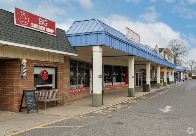
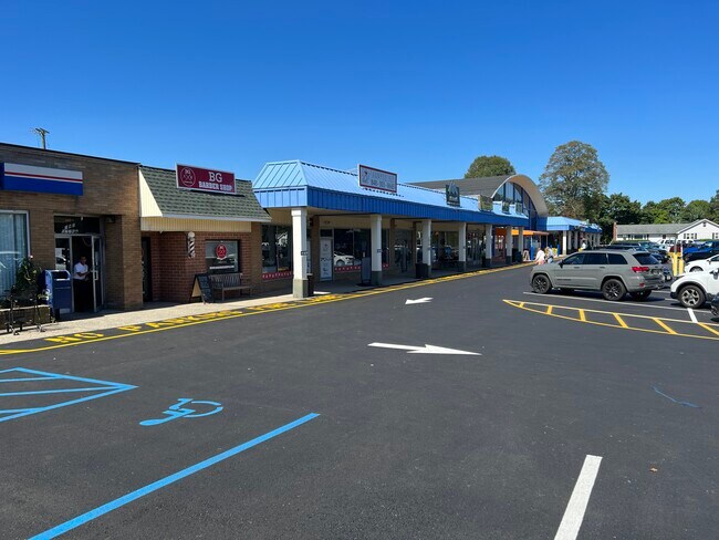
Property Record
175 Locust Ave, West Long Branch, NJ 07764

Property Detail
175 Locust Ave
53-00019-0000-00050
L49
Regionalshoppingcenterormallwithanchorstore
Monmouth
NC
New Jersey
B and X Area of moderate flood hazard, usually the area between the limits of the 100-year and 500-year floods.
50
2024
0.97 AC
2025
Eastern Monmouth
806202
Northern New Jersey
4,084 SF
Lakewood-New Brunswick, NJ
NEARBY LISTINGS FOR SALE OR LEASE
-
-
-
-
-
-
No Photo
-
-
View all West Long Branch listings for lease on LoopNet.com
DEMOGRAPHICS near 175 Locust Ave
1 mile
3 mile
5 mile
2025 Total Population
9,965
79,510
155,687
2030 Population
10,047
80,353
157,263
Pop Growth 2025-2030
+ 0.82%
+ 1.06%
+ 1.01%
Average Age
37
41
42
2025 Total Households
2,990
30,758
62,369
HH Growth 2025-2030
+ 0.74%
+ 0.93%
+ 0.98%
Median Household Inc
$121,188
$91,267
$102,604
Avg Household Size
2.70
2.40
2.40
2025 Avg HH Vehicles
2.00
2.00
2.00
Median Home Value
$755,482
$706,697
$714,695
Median Year Built
1963
1971
1969
Nearby Places
Map Layers
Map Styles
 Street
 Aerial
Layers
 Traffic
 Biking
Places
Listings with unknown addresses are not visible on the map
- Restaurants
- Banks
- Shops
- Fitness
- Groceries
PUBLIC TRANSPORTATION
COMMUTER RAIL
Long Branch (North Jersey Coast Line - NJ Transit Commuter Rail (NJ Transit))
Drive
Walk
Distance
Long Branch (North Jersey Coast Line - NJ Transit Commuter Rail (NJ Transit))
7 min
2.4 mi
Elberon (North Jersey Coast Line - NJ Transit Commuter Rail (NJ Transit))
Drive
Walk
Distance
Elberon (North Jersey Coast Line - NJ Transit Commuter Rail (NJ Transit))
5 min
2.4 mi
AIRPORT
Newark Liberty International
Drive
Walk
Distance
Newark Liberty International
58 min
47.2 mi
Freight Ports
New York Container Terminal
Drive
Walk
Distance
New York Container Terminal
52 min
39.3 mi
SALE & LEASE HISTORY
LISTING DATE
SALE/LEASE

Sep 25, 2016
For Lease
Mar 27, 2018
For Sale
Jun 28, 2019
For Sale
Feb 17, 2022
For Lease
Apr 13, 2018
For Sale
Nearby Properties
Address
Land Use
TOTAL SIZE
Lot Size
Zoning
Address
Land Use
TOTAL SIZE
Lot Size
Zoning
13.75 AC
M
Address
Land Use
TOTAL SIZE
Lot Size
Zoning
221.56 AC
CONREC
Address
Land Use
TOTAL SIZE
Lot Size
Zoning
75.16 AC
MF08
Address
Land Use
TOTAL SIZE
Lot Size
Zoning
7,819 SF
28.41 AC
R-1
Address
Land Use
TOTAL SIZE
Lot Size
Zoning
110,803 SF
51.49 AC
I
Address
Land Use
TOTAL SIZE
Lot Size
Zoning
279,346 SF
3.59 AC
P/VC
Address
Land Use
TOTAL SIZE
Lot Size
Zoning
267,887 SF
13.45 AC
HC
Address
Land Use
TOTAL SIZE
Lot Size
Zoning
35.50 AC
MF08
Address
Land Use
TOTAL SIZE
Lot Size
Zoning
136.40 AC
B2
Address
Land Use
TOTAL SIZE
Lot Size
Zoning
22,877 SF
10.35 AC
IC
Address
Land Use
TOTAL SIZE
Lot Size
Zoning
194,784 SF
2.88 AC
P/VC
Address
Land Use
TOTAL SIZE
Lot Size
Zoning
2,446 SF
21.62 AC
R-5
Address
Land Use
TOTAL SIZE
Lot Size
Zoning
293,262 SF
28.40 AC
HC
Address
Land Use
TOTAL SIZE
Lot Size
Zoning
1,100 SF
37.83 AC
MF08
Address
Land Use
TOTAL SIZE
Lot Size
Zoning
24.45 AC
MF08
Address
Land Use
TOTAL SIZE
Lot Size
Zoning
314,569 SF
22.05 AC
R-4
Address
Land Use
TOTAL SIZE
Lot Size
Zoning
79,391 SF
9.17 AC
C-4
Address
Land Use
TOTAL SIZE
Lot Size
Zoning
9,672 SF
29.80 AC
S-2
Address
Land Use
TOTAL SIZE
Lot Size
Zoning
194,812 SF
55.01 AC
MF15
Address
Land Use
TOTAL SIZE
Lot Size
Zoning
2.19 AC
BG
Address
Land Use
TOTAL SIZE
Lot Size
Zoning
16.49 AC
R-2
Address
Land Use
TOTAL SIZE
Lot Size
Zoning
137,294 SF
2.79 AC
BS
Address
Land Use
TOTAL SIZE
Lot Size
Zoning
27 AC
MF08
Address
Land Use
TOTAL SIZE
Lot Size
Zoning
201,455 SF
79.34 AC
SF40
Address
Land Use
TOTAL SIZE
Lot Size
Zoning
342,256 SF
20.62 AC
MF08
Address
Land Use
TOTAL SIZE
Lot Size
Zoning
153,160 SF
10.12 AC
OB01
Address
Land Use
TOTAL SIZE
Lot Size
Zoning
139,960 SF
3.93 AC
C-4
Address
Land Use
TOTAL SIZE
Lot Size
Zoning
14.23 AC
R-4
Address
Land Use
TOTAL SIZE
Lot Size
Zoning
77.36 AC
B2
Address
Land Use
TOTAL SIZE
Lot Size
Zoning
1,178 SF
21.78 AC
MF08
The World's #1 Commercial Real Estate Marketplace
Connect with us
© 2026 CoStar Group
The information above has been obtained from sources believed reliable. While we do not doubt its accuracy we have not verified it and make no guarantee, warranty or representation about it. It is your responsibility to independently confirm its accuracy and completeness. Any projections, opinions, assumptions, or estimates used are for example only and do not represent the current or future performance of the property. The value of this transaction to you depends on tax and other factors which should be evaluated by your tax, financial, and legal advisors. You and your advisors should conduct a careful, independent investigation of the property to determine to your satisfaction the suitability of the property for your needs.