Property Record
5171 Dixie Hwy, Waterford, MI 48329
NEARBY LISTINGS FOR SALE OR LEASE
Property Detail
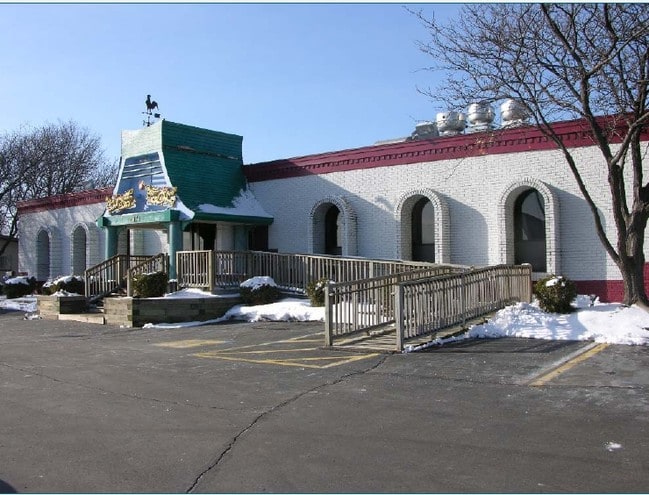
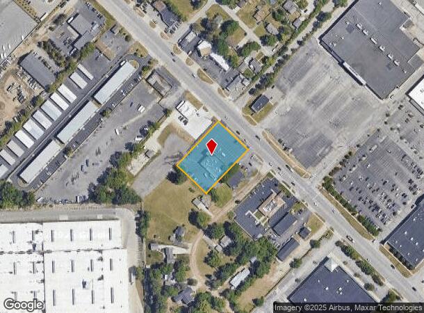
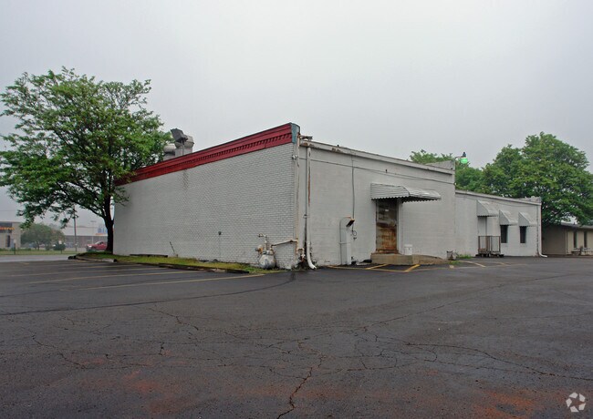
5171 Dixie Hwy
Detroit-Warren-Dearborn, MI
Supervisors
13-04-476-017
T3N, R9E, SEC 4 SUPERVISOR'S PLAT NO 6 LOTS 19 & 20
Restaurantbuilding
Oakland
X
Michigan
26125C0334F
19-20
2024
0.99 AC
2024
Lakes Area
144100
Detroit
6,119 SF
DEMOGRAPHICS near 5171 Dixie Hwy
1 Mile
3 Mile
5 Mile
2024 Total Population
4,673
49,262
116,480
2029 Population
4,613
48,590
115,478
Pop Growth 2024-2029
(1.28%)
(1.36%)
(0.86%)
Average Age
42
43
42
2024 Total Households
1,965
20,920
48,815
HH Growth 2024-2029
(1.37%)
(1.45%)
(0.92%)
Median Household Inc
$74,041
$77,566
$74,795
Avg Household Size
2.30
2.30
2.30
2024 Avg HH Vehicles
2.00
2.00
2.00
Median Home Value
$227,625
$240,268
$249,138
Median Year Built
1966
1970
1974
Nearby Places
Map Layers
Map Styles
 Street
 Aerial
- Restaurants
- Banks
- Shops
- Fitness
- Groceries
PUBLIC TRANSPORTATION
COMMUTER RAIL
DRIVE
WALK
Distance
14 min
6.9 mi
AIRPORT
Bishop International
DRIVE
WALK
Distance
Bishop International
47 min
30.0 mi
Detroit Metro Wayne County
DRIVE
WALK
Distance
Detroit Metro Wayne County
63 min
44.1 mi
Windsor International
DRIVE
WALK
Distance
Windsor International
71 min
46.1 mi
SALE & LEASE HISTORY
LISTING DATE
SALE/LEASE

Nov 29, 2016
For Sale
Nearby Properties
Address
Land Use
TOTAL SIZE
Lot Size
Zoning
Address
Land Use
TOTAL SIZE
Lot Size
Zoning
1,075,040 SF
90.26 AC
II
Address
Land Use
TOTAL SIZE
Lot Size
Zoning
138,009 SF
8.03 AC
PUD
Address
Land Use
TOTAL SIZE
Lot Size
Zoning
388,304 SF
69.09 AC
R2
Address
Land Use
TOTAL SIZE
Lot Size
Zoning
327,435 SF
39.93 AC
R2
Address
Land Use
TOTAL SIZE
Lot Size
Zoning
208,006 SF
1.24 AC
R2
Address
Land Use
TOTAL SIZE
Lot Size
Zoning
16,640 SF
13.07 AC
ME
Address
Land Use
TOTAL SIZE
Lot Size
Zoning
415,169 SF
27.93 AC
II
Address
Land Use
TOTAL SIZE
Lot Size
Zoning
86,192 SF
19.27 AC
Address
Land Use
TOTAL SIZE
Lot Size
Zoning
68,725 SF
4.96 AC
PUD
Address
Land Use
TOTAL SIZE
Lot Size
Zoning
249,200 SF
48.39 AC
R2
Address
Land Use
TOTAL SIZE
Lot Size
Zoning
327,288 SF
19.85 AC
R2
Address
Land Use
TOTAL SIZE
Lot Size
Zoning
126,844 SF
3.20 AC
ME
Address
Land Use
TOTAL SIZE
Lot Size
Zoning
78,261 SF
7.80 AC
PUD
Address
Land Use
TOTAL SIZE
Lot Size
Zoning
105,874 SF
13.07 AC
BI
Address
Land Use
TOTAL SIZE
Lot Size
Zoning
128,290 SF
9.26 AC
BI
Address
Land Use
TOTAL SIZE
Lot Size
Zoning
235,395 SF
37.19 AC
Address
Land Use
TOTAL SIZE
Lot Size
Zoning
205,961 SF
16.57 AC
II
Address
Land Use
TOTAL SIZE
Lot Size
Zoning
63,331 SF
10.03 AC
R2
Address
Land Use
TOTAL SIZE
Lot Size
Zoning
44.10 AC
PUD
Address
Land Use
TOTAL SIZE
Lot Size
Zoning
91,921 SF
2.51 AC
BI
Address
Land Use
TOTAL SIZE
Lot Size
Zoning
120,673 SF
9.40 AC
IOP
Address
Land Use
TOTAL SIZE
Lot Size
Zoning
71,456 SF
Address
Land Use
TOTAL SIZE
Lot Size
Zoning
9,768 SF
25.89 AC
PUD
Address
Land Use
TOTAL SIZE
Lot Size
Zoning
104,296 SF
11.10 AC
BI
Address
Land Use
TOTAL SIZE
Lot Size
Zoning
87,130 SF
9.01 AC
C-3
Address
Land Use
TOTAL SIZE
Lot Size
Zoning
Address
Land Use
TOTAL SIZE
Lot Size
Zoning
19,504 SF
3.16 AC
ML
Address
Land Use
TOTAL SIZE
Lot Size
Zoning
327,288 SF
29.09 AC
REC
Address
Land Use
TOTAL SIZE
Lot Size
Zoning
151,736 SF
26.03 AC
C-2
Address
Land Use
TOTAL SIZE
Lot Size
Zoning
68,971 SF
12 AC
AI
The World's #1 Commercial Real Estate Marketplace
Connect with us
© 2025 CoStar Group
The information above has been obtained from sources believed reliable. While we do not doubt its accuracy we have not verified it and make no guarantee, warranty or representation about it. It is your responsibility to independently confirm its accuracy and completeness. Any projections, opinions, assumptions, or estimates used are for example only and do not represent the current or future performance of the property. The value of this transaction to you depends on tax and other factors which should be evaluated by your tax, financial, and legal advisors. You and your advisors should conduct a careful, independent investigation of the property to determine to your satisfaction the suitability of the property for your needs.