Property Record
3615 Victoria Ave, Oxnard, CA 93035
NEARBY LISTINGS FOR SALE OR LEASE
Property Detail
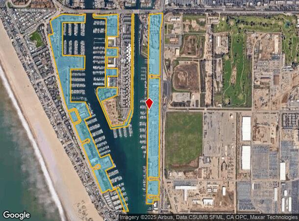
3615 Victoria Ave
Oxnard-Thousand Oaks-Ventura, CA
Patterson Ranch Sub
206-0-280-495
PR APN 2060280475
Countyproperty
Ventura
AE
California
06111C0911F
109.24 AC
0
Oxnard/Port Hueneme
2025
Los Angeles
003618
DEMOGRAPHICS near 3615 Victoria Ave
1 Mile
3 Mile
5 Mile
2024 Total Population
14,872
109,689
212,073
2029 Population
15,055
108,750
209,577
Pop Growth 2024-2029
+ 1.23%
(0.86%)
(1.18%)
Average Age
45
38
37
2024 Total Households
6,226
32,208
58,322
HH Growth 2024-2029
+ 1.61%
(0.43%)
(0.94%)
Median Household Inc
$92,954
$79,487
$82,676
Avg Household Size
2.40
3.20
3.50
2024 Avg HH Vehicles
2.00
2.00
2.00
Median Home Value
$784,698
$617,079
$606,135
Median Year Built
1979
1972
1974
Nearby Places
Map Layers
Map Styles
 Street
 Aerial
- Restaurants
- Banks
- Shops
- Fitness
- Groceries
PUBLIC TRANSPORTATION
COMMUTER RAIL
Oxnard (Ventura County Line - Southern California Regional Rail Authority (Metrolink))
DRIVE
WALK
Distance
Oxnard (Ventura County Line - Southern California Regional Rail Authority (Metrolink))
9 min
4.8 mi
East Ventura Metrolink Station (Metrolink Ventura County Line - Metrolink Trains)
DRIVE
WALK
Distance
East Ventura Metrolink Station (Metrolink Ventura County Line - Metrolink Trains)
10 min
6.4 mi
Freight Ports
The Port of Hueneme
DRIVE
WALK
Distance
The Port of Hueneme
8 min
4.0 mi
Nearby Properties
Address
Land Use
TOTAL SIZE
Lot Size
Zoning
Address
Land Use
TOTAL SIZE
Lot Size
Zoning
241,298 SF
8 AC
R3C
Address
Land Use
TOTAL SIZE
Lot Size
Zoning
90,086 SF
10.48 AC
CDI
Address
Land Use
TOTAL SIZE
Lot Size
Zoning
166,920 SF
7.15 AC
R3PD
Address
Land Use
TOTAL SIZE
Lot Size
Zoning
129,018 SF
5.09 AC
R3PD
Address
Land Use
TOTAL SIZE
Lot Size
Zoning
20,349 SF
9.65 AC
C2
Address
Land Use
TOTAL SIZE
Lot Size
Zoning
81,233 SF
3.29 AC
R3PD
Address
Land Use
TOTAL SIZE
Lot Size
Zoning
79,117 SF
3.25 AC
R3PD
Address
Land Use
TOTAL SIZE
Lot Size
Zoning
Address
Land Use
TOTAL SIZE
Lot Size
Zoning
94,375 SF
7.94 AC
Address
Land Use
TOTAL SIZE
Lot Size
Zoning
14,931 SF
14.08 AC
Address
Land Use
TOTAL SIZE
Lot Size
Zoning
70,600 SF
3.75 AC
R3PD
Address
Land Use
TOTAL SIZE
Lot Size
Zoning
98,276 SF
14 AC
R3
Address
Land Use
TOTAL SIZE
Lot Size
Zoning
56,230 SF
1.19 AC
Address
Land Use
TOTAL SIZE
Lot Size
Zoning
71,845 SF
3.01 AC
COPD
Address
Land Use
TOTAL SIZE
Lot Size
Zoning
52,060 SF
4.61 AC
C2PD
Address
Land Use
TOTAL SIZE
Lot Size
Zoning
86,627 SF
6.59 AC
CMPD
Address
Land Use
TOTAL SIZE
Lot Size
Zoning
57,224 SF
3.17 AC
R1
Address
Land Use
TOTAL SIZE
Lot Size
Zoning
1,316 SF
3.86 AC
Address
Land Use
TOTAL SIZE
Lot Size
Zoning
65,046 SF
2.20 AC
CBD
Address
Land Use
TOTAL SIZE
Lot Size
Zoning
100,612 SF
4.98 AC
R3
Address
Land Use
TOTAL SIZE
Lot Size
Zoning
66,390 SF
7.09 AC
CDI
Address
Land Use
TOTAL SIZE
Lot Size
Zoning
33,756 SF
1.19 AC
C2PD
Address
Land Use
TOTAL SIZE
Lot Size
Zoning
31,631 SF
2.45 AC
Address
Land Use
TOTAL SIZE
Lot Size
Zoning
40,179 SF
5.83 AC
Address
Land Use
TOTAL SIZE
Lot Size
Zoning
122,040 SF
7.52 AC
R2PD
Address
Land Use
TOTAL SIZE
Lot Size
Zoning
122,512 SF
3.51 AC
Address
Land Use
TOTAL SIZE
Lot Size
Zoning
37,500 SF
1.37 AC
Address
Land Use
TOTAL SIZE
Lot Size
Zoning
33,609 SF
2.60 AC
Address
Land Use
TOTAL SIZE
Lot Size
Zoning
40,977 SF
4.14 AC
R1PD
Address
Land Use
TOTAL SIZE
Lot Size
Zoning
77,645 SF
2.99 AC
R4PD
The World's #1 Commercial Real Estate Marketplace
Connect with us
© 2025 CoStar Group
The information above has been obtained from sources believed reliable. While we do not doubt its accuracy we have not verified it and make no guarantee, warranty or representation about it. It is your responsibility to independently confirm its accuracy and completeness. Any projections, opinions, assumptions, or estimates used are for example only and do not represent the current or future performance of the property. The value of this transaction to you depends on tax and other factors which should be evaluated by your tax, financial, and legal advisors. You and your advisors should conduct a careful, independent investigation of the property to determine to your satisfaction the suitability of the property for your needs.