This feature is unavailable at the moment.
We apologize, but the feature you are trying to access is currently unavailable. We are aware of this issue and our team is working hard to resolve the matter.
Please check back in a few minutes. We apologize for the inconvenience.
- LoopNet Team
S. Hamburg
Los Banos, CA 93635
+/-668.60 Acre Hamburg Ranch · Land For Sale · 668.60 AC

Investment Highlights
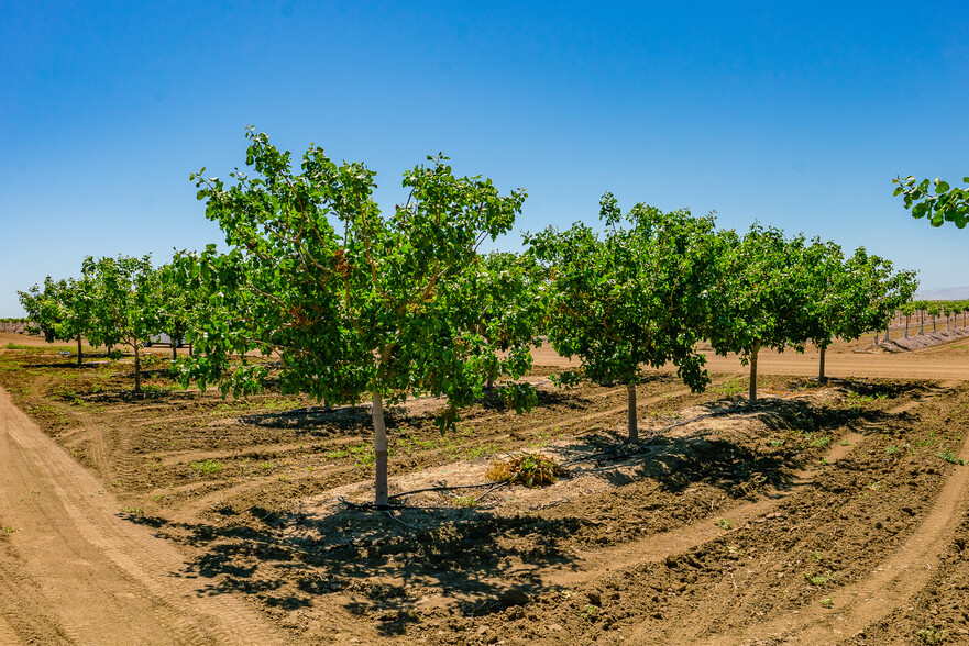
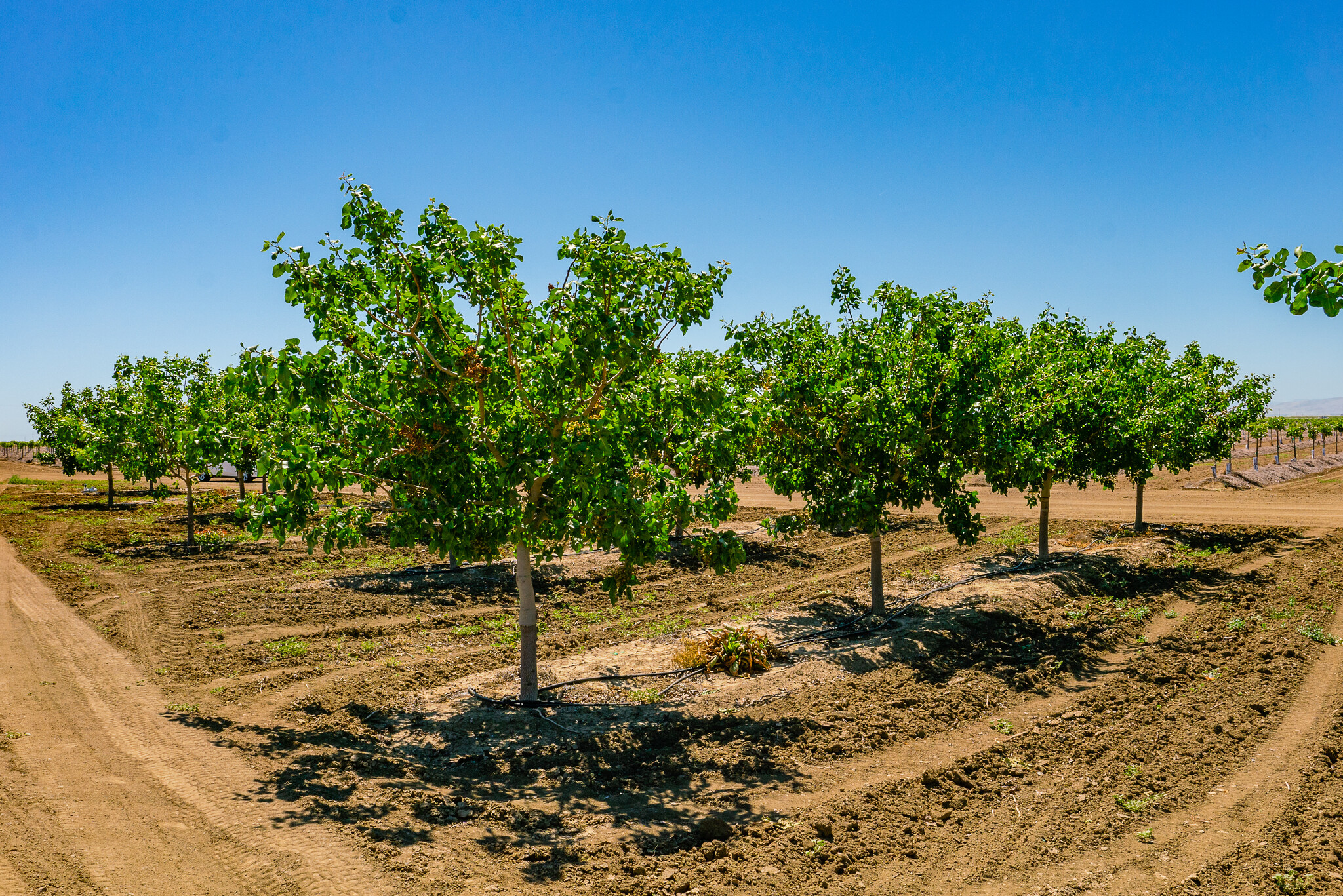
- +/-304 Acres of Pistachios and +/-162 Acres of Almonds.
- Multiple on-site wells.
- +/-162 Acres of Open Land.
PROPERTY FACTS
| Property Type | Land | Total Lot Size | 668.60 AC |
| Property Subtype | Agricultural | Cross Streets | Delta-Mendota Canal |
| Property Type | Land |
| Property Subtype | Agricultural |
| Total Lot Size | 668.60 AC |
| Cross Streets | Delta-Mendota Canal |
Description
+/-668.60 Acres – Pistachios, Almonds, & Open Land – Los Banos, CA Location: The property is located between the Delta Mendota and Outside Canals, +/-1 mile north of Eagle Field Road, +/-4 miles east of Mercy Springs Road and about +/-9 miles southeast of Los Banos in Merced County, CA. Size: +/-668.60 Assessed Acres Legal: Merced County APNs: 088-180-051, 088-190-018, 090-130-028, 090-140-048, and 090-140-049. Plantings: +/-185.35 Acres of Kerman Pistachios planted in 2015. 16' x 20' spacing. +/-99.10 Acres of Kerman Pistachios planted in 2017. 16' x 20' spacing. +/-20.30 Acres of Golden Hills Pistachios planted in 2015. 16' x 20' spacing. +/- 162 Acres of young Almonds planted in 2019 or 2020. See Planting Map for more information. Open Land: +/-163.2 Acres of open land that has been previously planted to row crops. +/-37.95 Acres of roads, drains, etc. +/-0.7 Acre fenced equipment yard. Zoning: Property is zoned A-2, Exclusive Agricultural (160-Acre minimum parcel size). Soil: +/-79.4% Deldota clay, partially drained. +/-16.4% Chateau clay, partially drained. +/-4.1% Dosamigos clay, partially drained. Ground Water: Multiple on-site wells. See “Water Map” and “Well Map” for well location and information. GSA: The majority of the subject property is located in the Central Delta-Mendota Region Multi- Agency Groundwater Sustainability Agency; San Joaquin Valley Delta-Mendota sub-basin. The northwest 24 acres is located in the San Joaquin River Exchange Contractors Groundwater Sustainability Agency; San Joaquin Valley Delta-Mendota sub-basin. Surface Water: SLWD: The majority of the subject property (644.30 acres) is located in the San Luis Water District (SLWD), which is part of the Central Valley Project (CVP), a coalition of various irrigation districts within the San Joaquin Valley. The United States Bureau of Reclamation (USBR) oversees the operation of the CVP. SLWD has a total contract entitlement with the USBR’s Central Valley Project of approximately 125,000 acre feet with the SLWD entitlement is reported at approximately 2.1 acre feet per acre. A 32 year history of allocations is available with allocations ranging from 100% in 2017 to 0% in 2021 with the last five year average at 49% allocation. The 2019 SLWD assessment charge was $29.41 per acre and water delivery charges were $237.07 per acre foot. The water delivery charge represents actual cost of water (from USBR), which was $137.72 per acre foot, plus all other applicable district charges, i.e. administration, operating & maintenance, etc. CCID: The northwest 24 acres is in the Central California Irrigation District. The total allocation for 2021 is 72.90 acre feet and the average yearly consumption based on a 7 year history is approximately 17.9 acre feet. Although a majority of the property is in SLWD, most of the deliveries for SLWD were made through CCID. Railroad Water is distributed by CCID from the Delta Mendota Canal based on 597 acres, the total allocation for 2021 is 504 acre feet. which is distributed in blocks of three 3-month periods throughout the year. The average yearly water consumption based on a 9 year history is approximately 214 acre feet. Water acquisition from secondary sources include other districts, transfers of entitlement from other lands within federal water districts and pumping credits from landowners who have wells that can pump into the CVP system. The cost of secondary water varies significantly with dry years commanding the highest price for secondary water. Irrigation Systems: Pistachios have low volume drip lines. Almonds have micro-sprinklers. Open northeast +/-100 acres prepared for Pistachio planting including underground PVC system, underground drainage system, and graded for planting berms. A concrete lateral runs along the southern boundary, parallel to the Delta-Mendota Canal, which is used for distribution and transferring water within the various fields. Filter Stations: STATION #1: Eight (8) Arkal sand media pot filters, set over concrete slab, and an inline Morrill screen filter. A booster pump is also used (Cornell pump & 75HP Baldor motor (SN C1205141397)). There is also a Yaskawa iQ Pump 1,000 variable frequency drive. These variable drives automatically adjusts pump operating conditions as the process variables change while still maintaining optimum pump performance and protection. The site also has an injection pump for amendments and a chlorinator with injection pump. STATION #2: Six (6) new Flow Guard stainless steel sand media pot filters, set over concrete slab. These filters are not yet connected or in use. STATION #3: The filters are set within cyclone fencing; hence, inspection was limited. Two (2) Arkal sand media pot filters, set over concrete slab, and an inline screen filter. There is also a small booster pump. Drainage The property is located within the Grasslands Drainage Area and serviced by the Panoche Drainage District. A majority of the property is improved with tile drains with three concrete culverts at the east boundary; each culvert has a lift pump set at approximately 8 feet below grade. Consultant: The current owner has very limited history regarding this property. Pro-rata water deliveries are based on water district allocations and only provide a theoretical amount of water that may or may not have been delivered to the property. Likewise, regarding the excess drainage water; any prospective Buyer will need to independently confirm the drainage district’s willingness to take future drainage water. Therefore, all prospective Buyers are strongly encouraged to engage a water consultant before making a purchase decision. Water Information- The following are available upon request: Pump test reports Railroad CCID Hamburg Water History San Luis Water District Summary of Agricultural Allocations
Links
PROPERTY TAXES
| Parcel Numbers |
Multiple
|
Improvements Assessment | $4,551,750 |
| Land Assessment | $11,324,754 | Total Assessment | $15,876,504 |
PROPERTY TAXES
- 090-140-048
- 090-140-049
- 090-130-028
- 088-190-018
- 088-180-051
zoning
| Zoning Code | A-2 |
| A-2 |
Learn More About Investing in Land
Listing ID: 23210533
Date on Market: 5/26/2021
Last Updated:
Address: S. Hamburg, Los Banos, CA 93635

