Property Record
1555 Highland Ave, Cheshire, CT 06410
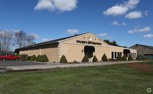


Property Detail
1555 Highland Ave
Storebuilding
Naugatuck Vly
I-1
Connecticut
B and X Area of moderate flood hazard, usually the area between the limits of the 100-year and 500-year floods.
1 AC
2025
Cheshire
2025
Westchester/So Connecticut
343101
New Haven, CT
10,400 SF
CHES-000019-000022
NEARBY LISTINGS FOR SALE OR LEASE
DEMOGRAPHICS near 1555 Highland Ave
1 mile
3 mile
5 mile
2025 Total Population
837
30,440
109,132
2030 Population
862
31,137
110,959
Pop Growth 2025-2030
+ 2.99%
+ 2.29%
+ 1.67%
Average Age
42
43
42
2025 Total Households
214
11,124
42,076
HH Growth 2025-2030
+ 4.21%
+ 2.41%
+ 1.68%
Median Household Inc
$158,823
$119,170
$95,690
Avg Household Size
2.70
2.60
2.50
2025 Avg HH Vehicles
2.00
2.00
2.00
Median Home Value
$487,878
$388,574
$353,395
Median Year Built
1985
1970
1967
Nearby Places
Map Layers
Map Styles
 Street
 Aerial
Transit
 Traffic
 Biking
Places
Listings with unknown addresses are not visible on the map
- Restaurants
- Banks
- Shops
- Fitness
- Groceries
PUBLIC TRANSPORTATION
COMMUTER RAIL
Drive
Walk
Distance
9 min
6.4 mi
AIRPORT
Tweed/New Haven
Drive
Walk
Distance
Tweed/New Haven
35 min
21.4 mi
Bradley International
Drive
Walk
Distance
Bradley International
55 min
37.6 mi
Freight Ports
Port of New Haven
Drive
Walk
Distance
Port of New Haven
29 min
18.8 mi
Nearby Properties
Address
Land Use
TOTAL SIZE
Lot Size
Zoning
Address
Land Use
TOTAL SIZE
Lot Size
Zoning
1,664 SF
166.95 AC
I-2
Address
Land Use
TOTAL SIZE
Lot Size
Zoning
313,293 SF
53.21 AC
I-1
Address
Land Use
TOTAL SIZE
Lot Size
Zoning
30.10 AC
ICSDD
Address
Land Use
TOTAL SIZE
Lot Size
Zoning
5,600 SF
59 AC
R-40
Address
Land Use
TOTAL SIZE
Lot Size
Zoning
531,397 SF
82.40 AC
I-2
Address
Land Use
TOTAL SIZE
Lot Size
Zoning
24.80 AC
R-20A
Address
Land Use
TOTAL SIZE
Lot Size
Zoning
243,820 SF
39.42 AC
I-2
Address
Land Use
TOTAL SIZE
Lot Size
Zoning
12,250 SF
101.84 AC
R-40
Address
Land Use
TOTAL SIZE
Lot Size
Zoning
116,196 SF
9.45 AC
R-20
Address
Land Use
TOTAL SIZE
Lot Size
Zoning
73,961 SF
27.36 AC
I-2
Address
Land Use
TOTAL SIZE
Lot Size
Zoning
86,019 SF
7.51 AC
B
Address
Land Use
TOTAL SIZE
Lot Size
Zoning
130,912 SF
11 AC
R-12
Address
Land Use
TOTAL SIZE
Lot Size
Zoning
14,307 SF
13.39 AC
R-20/2
Address
Land Use
TOTAL SIZE
Lot Size
Zoning
281,623 SF
39.24 AC
I-2
Address
Land Use
TOTAL SIZE
Lot Size
Zoning
12,960 SF
12.25 AC
R-20
Address
Land Use
TOTAL SIZE
Lot Size
Zoning
172,891 SF
75 AC
I-2
Address
Land Use
TOTAL SIZE
Lot Size
Zoning
241,500 SF
16.93 AC
I-1
Address
Land Use
TOTAL SIZE
Lot Size
Zoning
10,876 SF
5.73 AC
AHD
Address
Land Use
TOTAL SIZE
Lot Size
Zoning
62,955 SF
2.76 AC
C-2
Address
Land Use
TOTAL SIZE
Lot Size
Zoning
154,702 SF
33.86 AC
I-2
Address
Land Use
TOTAL SIZE
Lot Size
Zoning
14,200 SF
19.20 AC
I-2
Address
Land Use
TOTAL SIZE
Lot Size
Zoning
101,250 SF
16.91 AC
B
Address
Land Use
TOTAL SIZE
Lot Size
Zoning
35,463 SF
2.03 AC
R-20
Address
Land Use
TOTAL SIZE
Lot Size
Zoning
48,960 SF
5.94 AC
R-20
Address
Land Use
TOTAL SIZE
Lot Size
Zoning
57,572 SF
9.87 AC
I-1
Address
Land Use
TOTAL SIZE
Lot Size
Zoning
143,115 SF
13.14 AC
I-2
Address
Land Use
TOTAL SIZE
Lot Size
Zoning
72,224 SF
9.09 AC
I-2
Address
Land Use
TOTAL SIZE
Lot Size
Zoning
118,206 SF
13.20 AC
I-2
Address
Land Use
TOTAL SIZE
Lot Size
Zoning
25,200 SF
5.80 AC
I-2
Address
Land Use
TOTAL SIZE
Lot Size
Zoning
23,590 SF
12.30 AC
R-20
The World's #1 Commercial Real Estate Marketplace
Connect with us
© 2026 CoStar Group
The information above has been obtained from sources believed reliable. While we do not doubt its accuracy we have not verified it and make no guarantee, warranty or representation about it. It is your responsibility to independently confirm its accuracy and completeness. Any projections, opinions, assumptions, or estimates used are for example only and do not represent the current or future performance of the property. The value of this transaction to you depends on tax and other factors which should be evaluated by your tax, financial, and legal advisors. You and your advisors should conduct a careful, independent investigation of the property to determine to your satisfaction the suitability of the property for your needs.