Property Record
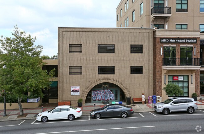
111 S Monroe St, Tallahassee, FL 32301


NEARBY LISTINGS FOR SALE OR LEASE
Property Detail
111 S Monroe St
Tallahassee, FL
111 South Monroe
21-36-25-080-134.0
SECTION 36 T1N R1W 111 SOUTH MONROE PB 22/26 LOT 2
Officebuilding
Leon
X
Florida
12073C0284F
2
0
0.17 AC
2025
Downtown Tallahassee
000200
Tallahassee
23,030 SF
DEMOGRAPHICS near 111 S Monroe St
1 Mile
3 Mile
5 Mile
2024 Total Population
12,833
96,709
176,726
2029 Population
13,293
100,682
185,717
Pop Growth 2024-2029
+ 3.58%
+ 4.11%
+ 5.09%
Average Age
31
33
34
2024 Total Households
5,887
43,075
76,635
HH Growth 2024-2029
+ 4.43%
+ 4.39%
+ 5.29%
Median Household Inc
$37,018
$40,233
$46,070
Avg Household Size
1.70
2.00
2.10
2024 Avg HH Vehicles
2.00
2.00
2.00
Median Home Value
$321,287
$203,526
$202,331
Median Year Built
1975
1979
1985
Nearby Places
Map Layers
Map Styles
 Street
 Aerial
- Restaurants
- Banks
- Shops
- Fitness
- Groceries
PUBLIC TRANSPORTATION
AIRPORT
Tallahassee International
DRIVE
WALK
Distance
Tallahassee International
15 min
6.9 mi
SALE & LEASE HISTORY
LISTING DATE
SALE/LEASE

Oct 03, 2016
For Lease
Nearby Properties
Address
Land Use
TOTAL SIZE
Lot Size
Zoning
Address
Land Use
TOTAL SIZE
Lot Size
Zoning
1,635,322 SF
29.76 AC
UT
Address
Land Use
TOTAL SIZE
Lot Size
Zoning
6,686,582 SF
86.50 AC
UT
Address
Land Use
TOTAL SIZE
Lot Size
Zoning
4,577,528 SF
108.47 AC
UT
Address
Land Use
TOTAL SIZE
Lot Size
Zoning
3,647,358 SF
49.17 AC
UT
Address
Land Use
TOTAL SIZE
Lot Size
Zoning
3,882,850 SF
22.64 AC
CM
Address
Land Use
TOTAL SIZE
Lot Size
Zoning
2,330,342 SF
69.26 AC
UT
Address
Land Use
TOTAL SIZE
Lot Size
Zoning
807,298 SF
145.81 AC
UT
Address
Land Use
TOTAL SIZE
Lot Size
Zoning
2,312,757 SF
10.87 AC
CCPD
Address
Land Use
TOTAL SIZE
Lot Size
Zoning
479,864 SF
19.01 AC
DI
Address
Land Use
TOTAL SIZE
Lot Size
Zoning
1,545,007 SF
44.85 AC
UT
Address
Land Use
TOTAL SIZE
Lot Size
Zoning
859,455 SF
3.79 AC
CU45
Address
Land Use
TOTAL SIZE
Lot Size
Zoning
367,978 SF
2.52 AC
RO
Address
Land Use
TOTAL SIZE
Lot Size
Zoning
704,857 SF
4.95 AC
UT
Address
Land Use
TOTAL SIZE
Lot Size
Zoning
806,710 SF
2.96 AC
CCPD
Address
Land Use
TOTAL SIZE
Lot Size
Zoning
664,514 SF
2.49 AC
UT
Address
Land Use
TOTAL SIZE
Lot Size
Zoning
369,383 SF
4.51 AC
UT
Address
Land Use
TOTAL SIZE
Lot Size
Zoning
899,528 SF
3.34 AC
CCPD
Address
Land Use
TOTAL SIZE
Lot Size
Zoning
758,762 SF
20.82 AC
UT
Address
Land Use
TOTAL SIZE
Lot Size
Zoning
307,884 SF
2.97 AC
CCPD
Address
Land Use
TOTAL SIZE
Lot Size
Zoning
200,705 SF
31.57 AC
Address
Land Use
TOTAL SIZE
Lot Size
Zoning
616,484 SF
30.15 AC
UT
Address
Land Use
TOTAL SIZE
Lot Size
Zoning
428,190 SF
2.24 AC
CCPD
Address
Land Use
TOTAL SIZE
Lot Size
Zoning
452,530 SF
10.30 AC
UV
Address
Land Use
TOTAL SIZE
Lot Size
Zoning
445,676 SF
23.50 AC
PUD
Address
Land Use
TOTAL SIZE
Lot Size
Zoning
756,294 SF
20.19 AC
OR3
Address
Land Use
TOTAL SIZE
Lot Size
Zoning
249,612 SF
1.67 AC
CCPD
Address
Land Use
TOTAL SIZE
Lot Size
Zoning
456,149 SF
22.50 AC
OR3
Address
Land Use
TOTAL SIZE
Lot Size
Zoning
652,729 SF
1.71 AC
UT
Address
Land Use
TOTAL SIZE
Lot Size
Zoning
721,205 SF
6.19 AC
UT
Address
Land Use
TOTAL SIZE
Lot Size
Zoning
414,216 SF
2.23 AC
CU45
The World's #1 Commercial Real Estate Marketplace
Connect with us
© 2025 CoStar Group
The information above has been obtained from sources believed reliable. While we do not doubt its accuracy we have not verified it and make no guarantee, warranty or representation about it. It is your responsibility to independently confirm its accuracy and completeness. Any projections, opinions, assumptions, or estimates used are for example only and do not represent the current or future performance of the property. The value of this transaction to you depends on tax and other factors which should be evaluated by your tax, financial, and legal advisors. You and your advisors should conduct a careful, independent investigation of the property to determine to your satisfaction the suitability of the property for your needs.