No Photo
Property Record
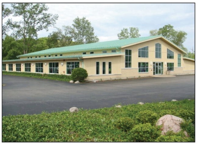
600 S Il Route 59, Ingleside, IL 60041


Property Detail
600 S Il Route 59
Chicago-Naperville-Elgin, IL-IN
NW NE;COM SWCOR,N725,E//TO SLN 200,SE ALG LN IF EXTND X SL N 1206E OF SWCOR 807.6 FOR POB, SE ALG LAST DESC LN 261.64 MOL TO NW LN RT59, NE ALG SD ROW CHD DIST 203.83, NW 287.
05-15-200-016
LAKE
Commercialbuilding
Illinois
AE The base floodplain where base flood elevations are provided. AE Zones are now used on new format FIRMs instead of A1-A30 Zones.
1.25 AC
2024
Central Northwest
2025
Chicago
860903
NEARBY LISTINGS FOR SALE OR LEASE
DEMOGRAPHICS near 600 S Il Route 59
1 mile
3 mile
5 mile
2025 Total Population
5,743
37,332
107,856
2030 Population
5,876
38,024
109,429
Pop Growth 2025-2030
+ 2.32%
+ 1.85%
+ 1.46%
Average Age
41
41
40
2025 Total Households
2,378
14,799
39,284
HH Growth 2025-2030
+ 2.23%
+ 1.89%
+ 1.61%
Median Household Inc
$67,448
$94,363
$95,450
Avg Household Size
2.30
2.50
2.70
2025 Avg HH Vehicles
2.00
2.00
2.00
Median Home Value
$241,946
$248,670
$255,789
Median Year Built
1973
1977
1984
Nearby Places
Map Layers
Map Styles
 Street
 Aerial
Layers
 Traffic
 Biking
Places
Listings with unknown addresses are not visible on the map
- Restaurants
- Banks
- Shops
- Fitness
- Groceries
PUBLIC TRANSPORTATION
TRANSIT/SUBWAY
Ingleside Station (Milwaukee District North Line - Northeast Illinois Regional Commuter Railroad (Metra))
Drive
Walk
Distance
Ingleside Station (Milwaukee District North Line - Northeast Illinois Regional Commuter Railroad (Metra))
2 min
14 min
0.7 mi
COMMUTER RAIL
Ingleside Station (Milwaukee District North Line - Northeast Illinois Regional Commuter Railroad (Metra))
Drive
Walk
Distance
Ingleside Station (Milwaukee District North Line - Northeast Illinois Regional Commuter Railroad (Metra))
2 min
14 min
0.7 mi
Fox Lake Station (Milwaukee District North Line - Northeast Illinois Regional Commuter Railroad (Metra))
Drive
Walk
Distance
Fox Lake Station (Milwaukee District North Line - Northeast Illinois Regional Commuter Railroad (Metra))
5 min
2.2 mi
AIRPORT
Chicago O'Hare International
Drive
Walk
Distance
Chicago O'Hare International
55 min
39.9 mi
Freight Ports
Port Milwaukee
Drive
Walk
Distance
Port Milwaukee
72 min
55.3 mi
Nearby Properties
Address
Land Use
TOTAL SIZE
Lot Size
Zoning
Address
Land Use
TOTAL SIZE
Lot Size
Zoning
6.18 AC
Address
Land Use
TOTAL SIZE
Lot Size
Zoning
10.91 AC
Address
Land Use
TOTAL SIZE
Lot Size
Zoning
6.54 AC
Address
Land Use
TOTAL SIZE
Lot Size
Zoning
12.56 AC
Address
Land Use
TOTAL SIZE
Lot Size
Zoning
11.05 AC
Address
Land Use
TOTAL SIZE
Lot Size
Zoning
Address
Land Use
TOTAL SIZE
Lot Size
Zoning
4.04 AC
Address
Land Use
TOTAL SIZE
Lot Size
Zoning
2.34 AC
Address
Land Use
TOTAL SIZE
Lot Size
Zoning
Address
Land Use
TOTAL SIZE
Lot Size
Zoning
3.43 AC
Address
Land Use
TOTAL SIZE
Lot Size
Zoning
4.28 AC
Address
Land Use
TOTAL SIZE
Lot Size
Zoning
4.40 AC
Address
Land Use
TOTAL SIZE
Lot Size
Zoning
Address
Land Use
TOTAL SIZE
Lot Size
Zoning
10.02 AC
Address
Land Use
TOTAL SIZE
Lot Size
Zoning
21.50 AC
Address
Land Use
TOTAL SIZE
Lot Size
Zoning
Address
Land Use
TOTAL SIZE
Lot Size
Zoning
1.95 AC
Address
Land Use
TOTAL SIZE
Lot Size
Zoning
10.22 AC
Address
Land Use
TOTAL SIZE
Lot Size
Zoning
Address
Land Use
TOTAL SIZE
Lot Size
Zoning
0.38 AC
Address
Land Use
TOTAL SIZE
Lot Size
Zoning
1.39 AC
Address
Land Use
TOTAL SIZE
Lot Size
Zoning
2.16 AC
Address
Land Use
TOTAL SIZE
Lot Size
Zoning
24.25 AC
Address
Land Use
TOTAL SIZE
Lot Size
Zoning
37,010 SF
2.90 AC
Address
Land Use
TOTAL SIZE
Lot Size
Zoning
0.40 AC
Address
Land Use
TOTAL SIZE
Lot Size
Zoning
3.36 AC
Address
Land Use
TOTAL SIZE
Lot Size
Zoning
365,600 SF
5.57 AC
Address
Land Use
TOTAL SIZE
Lot Size
Zoning
Address
Land Use
TOTAL SIZE
Lot Size
Zoning
195,600 SF
3.09 AC
Address
Land Use
TOTAL SIZE
Lot Size
Zoning
4.99 AC
The World's #1 Commercial Real Estate Marketplace
Connect with us
© 2026 CoStar Group
The information above has been obtained from sources believed reliable. While we do not doubt its accuracy we have not verified it and make no guarantee, warranty or representation about it. It is your responsibility to independently confirm its accuracy and completeness. Any projections, opinions, assumptions, or estimates used are for example only and do not represent the current or future performance of the property. The value of this transaction to you depends on tax and other factors which should be evaluated by your tax, financial, and legal advisors. You and your advisors should conduct a careful, independent investigation of the property to determine to your satisfaction the suitability of the property for your needs.