Property Record
191 State Route 15, Lafayette, NJ 07848


Property Detail
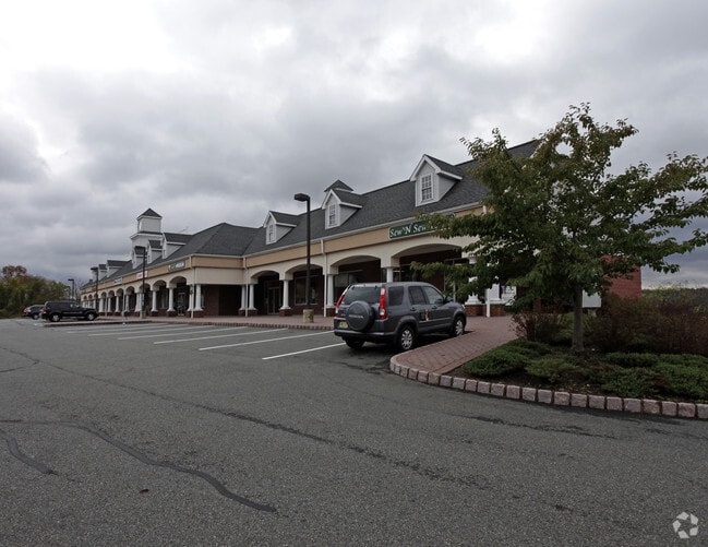
191 State Route 15
13-00017-0000-00002-01
ADDITIONAL LOTS: P/O 17,1.02 ESMNT
Regionalshoppingcenterormallwithanchorstore
Sussex
B-2
New Jersey
AE The base floodplain where base flood elevations are provided. AE Zones are now used on new format FIRMs instead of A1-A30 Zones.
2.1
2024
8.68 AC
2025
Sussex County
372400
Northern New Jersey
14,600 SF
Newark, NJ
NEARBY LISTINGS FOR SALE OR LEASE
-
-
View all Lafayette listings for sale on LoopNet.com
DEMOGRAPHICS near 191 State Route 15
1 mile
3 mile
5 mile
2025 Total Population
400
4,429
19,942
2030 Population
397
4,439
20,258
Pop Growth 2025-2030
(0.75%)
+ 0.23%
+ 1.58%
Average Age
45
45
43
2025 Total Households
150
1,748
7,741
HH Growth 2025-2030
(0.67%)
+ 0.51%
+ 1.63%
Median Household Inc
$113,068
$109,757
$106,597
Avg Household Size
2.70
2.50
2.50
2025 Avg HH Vehicles
3.00
2.00
2.00
Median Home Value
$485,937
$399,999
$407,181
Median Year Built
1975
1978
1974
Nearby Places
Map Layers
Map Styles
 Street
 Aerial
Layers
 Traffic
 Biking
Places
Listings with unknown addresses are not visible on the map
- Restaurants
- Banks
- Shops
- Fitness
- Groceries
Nearby Properties
Address
Land Use
TOTAL SIZE
Lot Size
Zoning
Address
Land Use
TOTAL SIZE
Lot Size
Zoning
156,719 SF
48.98 AC
OSGU
Address
Land Use
TOTAL SIZE
Lot Size
Zoning
1,762 SF
21.87 AC
AR
Address
Land Use
TOTAL SIZE
Lot Size
Zoning
14.14 AC
AR
Address
Land Use
TOTAL SIZE
Lot Size
Zoning
58,605 SF
28.29 AC
OSGU
Address
Land Use
TOTAL SIZE
Lot Size
Zoning
29,156 SF
121.97 AC
L-1
Address
Land Use
TOTAL SIZE
Lot Size
Zoning
65,064 SF
7.17 AC
L-1
Address
Land Use
TOTAL SIZE
Lot Size
Zoning
31,620 SF
8.18 AC
HCMF
Address
Land Use
TOTAL SIZE
Lot Size
Zoning
29.26 AC
HCR3
Address
Land Use
TOTAL SIZE
Lot Size
Zoning
30,790 SF
31 AC
R-2
Address
Land Use
TOTAL SIZE
Lot Size
Zoning
14 AC
R-3
Address
Land Use
TOTAL SIZE
Lot Size
Zoning
59,919 SF
21.22 AC
R-2
Address
Land Use
TOTAL SIZE
Lot Size
Zoning
10.16 AC
HCRD
Address
Land Use
TOTAL SIZE
Lot Size
Zoning
11,765 SF
9.45 AC
HCMF
Address
Land Use
TOTAL SIZE
Lot Size
Zoning
864 SF
19.72 AC
R-2
Address
Land Use
TOTAL SIZE
Lot Size
Zoning
18,954 SF
7.56 AC
HCMF
Address
Land Use
TOTAL SIZE
Lot Size
Zoning
15,000 SF
2.03 AC
HCMF
Address
Land Use
TOTAL SIZE
Lot Size
Zoning
112.54 AC
AR
Address
Land Use
TOTAL SIZE
Lot Size
Zoning
10.87 AC
L-I
Address
Land Use
TOTAL SIZE
Lot Size
Zoning
2.85 AC
L-I
Address
Land Use
TOTAL SIZE
Lot Size
Zoning
12,440 SF
6.55 AC
HCMF
Address
Land Use
TOTAL SIZE
Lot Size
Zoning
4.35 AC
L-I
Address
Land Use
TOTAL SIZE
Lot Size
Zoning
23.28 AC
HCMF
Address
Land Use
TOTAL SIZE
Lot Size
Zoning
17,524 SF
160.18 AC
R-2
Address
Land Use
TOTAL SIZE
Lot Size
Zoning
1,396 SF
1.65 AC
R-2
Address
Land Use
TOTAL SIZE
Lot Size
Zoning
3.79 AC
HC
Address
Land Use
TOTAL SIZE
Lot Size
Zoning
1,248 SF
0.70 AC
C-1
Address
Land Use
TOTAL SIZE
Lot Size
Zoning
12.33 AC
HC
Address
Land Use
TOTAL SIZE
Lot Size
Zoning
4.08 AC
AR
Address
Land Use
TOTAL SIZE
Lot Size
Zoning
199.30 AC
AR
Address
Land Use
TOTAL SIZE
Lot Size
Zoning
6,000 SF
7.09 AC
R-3
The World's #1 Commercial Real Estate Marketplace
Connect with us
© 2026 CoStar Group
The information above has been obtained from sources believed reliable. While we do not doubt its accuracy we have not verified it and make no guarantee, warranty or representation about it. It is your responsibility to independently confirm its accuracy and completeness. Any projections, opinions, assumptions, or estimates used are for example only and do not represent the current or future performance of the property. The value of this transaction to you depends on tax and other factors which should be evaluated by your tax, financial, and legal advisors. You and your advisors should conduct a careful, independent investigation of the property to determine to your satisfaction the suitability of the property for your needs.