Property Record
170 E Main St, Hendersonville, TN 37075


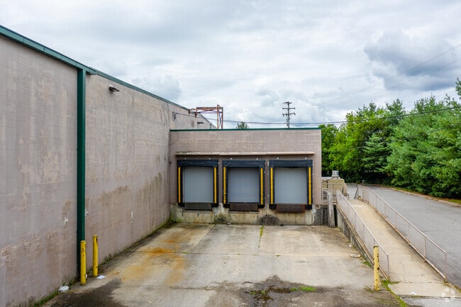
Property Detail
170 E Main St
159I-D-033.00
PLAT: 13 PAGE: 50 BLOCK: LOT: 1 SUBD: MARTINS OAK SEC 3, P.B.27 PG.186
Departmentstore
Sumner
C-PU
Tennessee
AE The base floodplain where base flood elevations are provided. AE Zones are now used on new format FIRMs instead of A1-A30 Zones.
1
2025
5.26 AC
2025
Hendersonville-Gallatin
021205
Nashville
65,750 SF
Nashville-Davidson--Murfreesboro--Franklin, TN
NEARBY LISTINGS FOR SALE OR LEASE
DEMOGRAPHICS near 170 E Main St
1 mile
3 mile
5 mile
2025 Total Population
5,829
47,400
95,321
2030 Population
6,181
49,959
101,039
Pop Growth 2025-2030
+ 6.04%
+ 5.40%
+ 6.00%
Average Age
42
41
41
2025 Total Households
2,388
18,940
37,370
HH Growth 2025-2030
+ 6.20%
+ 5.55%
+ 6.07%
Median Household Inc
$85,889
$90,563
$96,685
Avg Household Size
2.40
2.50
2.50
2025 Avg HH Vehicles
2.00
2.00
2.00
Median Home Value
$386,681
$416,356
$468,415
Median Year Built
1983
1987
1990
Nearby Places
Map Layers
Map Styles
 Street
 Aerial
Layers
 Traffic
 Biking
Places
Listings with unknown addresses are not visible on the map
- Restaurants
- Banks
- Shops
- Fitness
- Groceries
SALE & LEASE HISTORY
LISTING DATE
SALE/LEASE

Sep 25, 2016
For Lease
Sep 25, 2016
For Lease
Nearby Properties
Address
Land Use
TOTAL SIZE
Lot Size
Zoning
Address
Land Use
TOTAL SIZE
Lot Size
Zoning
25,212 SF
31.56 AC
Address
Land Use
TOTAL SIZE
Lot Size
Zoning
86,086 SF
8 AC
OPS
Address
Land Use
TOTAL SIZE
Lot Size
Zoning
154,761 SF
8.74 AC
GCS
Address
Land Use
TOTAL SIZE
Lot Size
Zoning
46,650 SF
17.41 AC
MRO
Address
Land Use
TOTAL SIZE
Lot Size
Zoning
56,782 SF
11.37 AC
Address
Land Use
TOTAL SIZE
Lot Size
Zoning
31,919 SF
14.69 AC
Address
Land Use
TOTAL SIZE
Lot Size
Zoning
84,210 SF
8.05 AC
GCS
Address
Land Use
TOTAL SIZE
Lot Size
Zoning
25,200 SF
20.36 AC
RM2
Address
Land Use
TOTAL SIZE
Lot Size
Zoning
8,336 SF
18.34 AC
GCS
Address
Land Use
TOTAL SIZE
Lot Size
Zoning
29,068 SF
13.30 AC
TCR
Address
Land Use
TOTAL SIZE
Lot Size
Zoning
47,319 SF
7.52 AC
Address
Land Use
TOTAL SIZE
Lot Size
Zoning
169,864 SF
5.29 AC
GCS
Address
Land Use
TOTAL SIZE
Lot Size
Zoning
32,481 SF
9.42 AC
GCS
Address
Land Use
TOTAL SIZE
Lot Size
Zoning
105,942 SF
14.80 AC
GCS
Address
Land Use
TOTAL SIZE
Lot Size
Zoning
77,028 SF
12.78 AC
GCS
Address
Land Use
TOTAL SIZE
Lot Size
Zoning
15,456 SF
23.18 AC
Address
Land Use
TOTAL SIZE
Lot Size
Zoning
20,896 SF
17.79 AC
Address
Land Use
TOTAL SIZE
Lot Size
Zoning
18,342 SF
8.40 AC
RM1
Address
Land Use
TOTAL SIZE
Lot Size
Zoning
218,472 SF
27.08 AC
GCS
Address
Land Use
TOTAL SIZE
Lot Size
Zoning
11,274 SF
15.30 AC
Address
Land Use
TOTAL SIZE
Lot Size
Zoning
142,403 SF
18.78 AC
NCS
Address
Land Use
TOTAL SIZE
Lot Size
Zoning
15,105 SF
13.35 AC
Address
Land Use
TOTAL SIZE
Lot Size
Zoning
27,038 SF
4.05 AC
Address
Land Use
TOTAL SIZE
Lot Size
Zoning
161,880 SF
23.90 AC
GCS
Address
Land Use
TOTAL SIZE
Lot Size
Zoning
105,542 SF
9.09 AC
GCS
Address
Land Use
TOTAL SIZE
Lot Size
Zoning
21,213 SF
6.56 AC
Address
Land Use
TOTAL SIZE
Lot Size
Zoning
31,728 SF
13.59 AC
GCS
Address
Land Use
TOTAL SIZE
Lot Size
Zoning
27,148 SF
8 AC
Address
Land Use
TOTAL SIZE
Lot Size
Zoning
18,762 SF
13.02 AC
Address
Land Use
TOTAL SIZE
Lot Size
Zoning
154,556 SF
16.26 AC
The World's #1 Commercial Real Estate Marketplace
Connect with us
© 2026 CoStar Group
The information above has been obtained from sources believed reliable. While we do not doubt its accuracy we have not verified it and make no guarantee, warranty or representation about it. It is your responsibility to independently confirm its accuracy and completeness. Any projections, opinions, assumptions, or estimates used are for example only and do not represent the current or future performance of the property. The value of this transaction to you depends on tax and other factors which should be evaluated by your tax, financial, and legal advisors. You and your advisors should conduct a careful, independent investigation of the property to determine to your satisfaction the suitability of the property for your needs.