Property Record
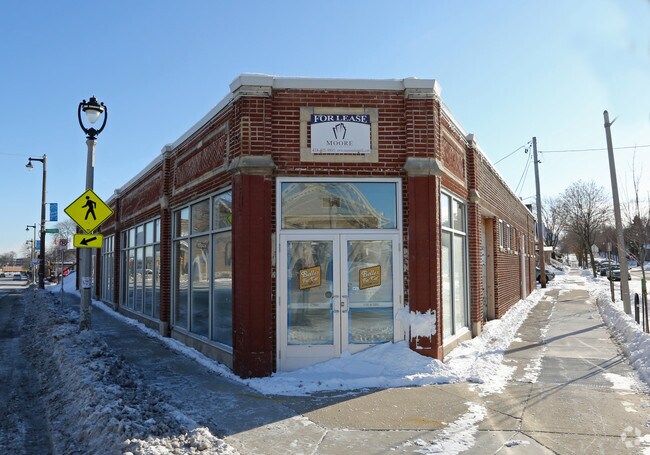
2737 S Kinnickinnic Ave, Milwaukee, WI 53207


NEARBY LISTINGS FOR SALE OR LEASE
Property Detail
2737 S Kinnickinnic Ave
Milwaukee-Waukesha-West Allis, WI
Manns Second Subd
504-1017-000-8
MANNS SECOND SUBD IN SE 1/4 SEC 9-6-22 BLOCK 9 ALL EXC S 40 (LOTS 6-7 & W 29.62 LOT 5) & EXC ST BID #44
Storemultistory
Milwaukee
X
Wisconsin
55079C0157E
6-7,5
2024
0.20 AC
2024
Milwaukee SE
018300
Milwaukee/Madison
5,595 SF
DEMOGRAPHICS near 2737 S Kinnickinnic Ave
1 Mile
3 Mile
5 Mile
2024 Total Population
16,659
126,016
305,707
2029 Population
16,301
123,075
299,079
Pop Growth 2024-2029
(2.15%)
(2.33%)
(2.17%)
Average Age
39
36
36
2024 Total Households
8,350
50,074
131,970
HH Growth 2024-2029
(2.25%)
(2.30%)
(2.08%)
Median Household Inc
$75,520
$53,443
$51,262
Avg Household Size
2.00
2.40
2.20
2024 Avg HH Vehicles
2.00
2.00
1.00
Median Home Value
$242,372
$172,332
$180,974
Median Year Built
1946
1947
1950
Nearby Places
Map Layers
Map Styles
 Street
 Aerial
- Restaurants
- Banks
- Shops
- Fitness
- Groceries
PUBLIC TRANSPORTATION
AIRPORT
General Mitchell International
DRIVE
WALK
Distance
General Mitchell International
15 min
4.7 mi
Nearby Properties
Address
Land Use
TOTAL SIZE
Lot Size
Zoning
Address
Land Use
TOTAL SIZE
Lot Size
Zoning
41.05 AC
IO2
Address
Land Use
TOTAL SIZE
Lot Size
Zoning
523,726 SF
0.79 AC
C9B(B)
Address
Land Use
TOTAL SIZE
Lot Size
Zoning
362,007 SF
1.02 AC
C9F(A)
Address
Land Use
TOTAL SIZE
Lot Size
Zoning
173,610 SF
1.70 AC
IM
Address
Land Use
TOTAL SIZE
Lot Size
Zoning
319,559 SF
6.29 AC
PD
Address
Land Use
TOTAL SIZE
Lot Size
Zoning
179 AC
IH
Address
Land Use
TOTAL SIZE
Lot Size
Zoning
Address
Land Use
TOTAL SIZE
Lot Size
Zoning
11.09 AC
Address
Land Use
TOTAL SIZE
Lot Size
Zoning
204,809 SF
1.04 AC
IM
Address
Land Use
TOTAL SIZE
Lot Size
Zoning
245,485 SF
6.30 AC
IM
Address
Land Use
TOTAL SIZE
Lot Size
Zoning
0.86 AC
C9F(A)
Address
Land Use
TOTAL SIZE
Lot Size
Zoning
166,554 SF
0.66 AC
C9F(A)
Address
Land Use
TOTAL SIZE
Lot Size
Zoning
12.02 AC
IO2
Address
Land Use
TOTAL SIZE
Lot Size
Zoning
15.43 AC
PD
Address
Land Use
TOTAL SIZE
Lot Size
Zoning
48.34 AC
IO1
Address
Land Use
TOTAL SIZE
Lot Size
Zoning
122,695 SF
0.39 AC
C9G
Address
Land Use
TOTAL SIZE
Lot Size
Zoning
2.85 AC
C9G
Address
Land Use
TOTAL SIZE
Lot Size
Zoning
110,000 SF
7.59 AC
TL
Address
Land Use
TOTAL SIZE
Lot Size
Zoning
2,610 SF
1.04 AC
IM
Address
Land Use
TOTAL SIZE
Lot Size
Zoning
444,549 SF
2.09 AC
C9F(A)
Address
Land Use
TOTAL SIZE
Lot Size
Zoning
86.13 AC
IH
Address
Land Use
TOTAL SIZE
Lot Size
Zoning
11.38 AC
TL
Address
Land Use
TOTAL SIZE
Lot Size
Zoning
120,000 SF
1.10 AC
IM
Address
Land Use
TOTAL SIZE
Lot Size
Zoning
222,100 SF
1.29 AC
PD
Address
Land Use
TOTAL SIZE
Lot Size
Zoning
197,354 SF
18 AC
CS
Address
Land Use
TOTAL SIZE
Lot Size
Zoning
0.43 AC
RT3
Address
Land Use
TOTAL SIZE
Lot Size
Zoning
183,291 SF
11.48 AC
IM
Address
Land Use
TOTAL SIZE
Lot Size
Zoning
95,788 SF
1.04 AC
IM
Address
Land Use
TOTAL SIZE
Lot Size
Zoning
112,438 SF
0.59 AC
C9F(A)
Address
Land Use
TOTAL SIZE
Lot Size
Zoning
The World's #1 Commercial Real Estate Marketplace
Connect with us
© 2025 CoStar Group
The information above has been obtained from sources believed reliable. While we do not doubt its accuracy we have not verified it and make no guarantee, warranty or representation about it. It is your responsibility to independently confirm its accuracy and completeness. Any projections, opinions, assumptions, or estimates used are for example only and do not represent the current or future performance of the property. The value of this transaction to you depends on tax and other factors which should be evaluated by your tax, financial, and legal advisors. You and your advisors should conduct a careful, independent investigation of the property to determine to your satisfaction the suitability of the property for your needs.