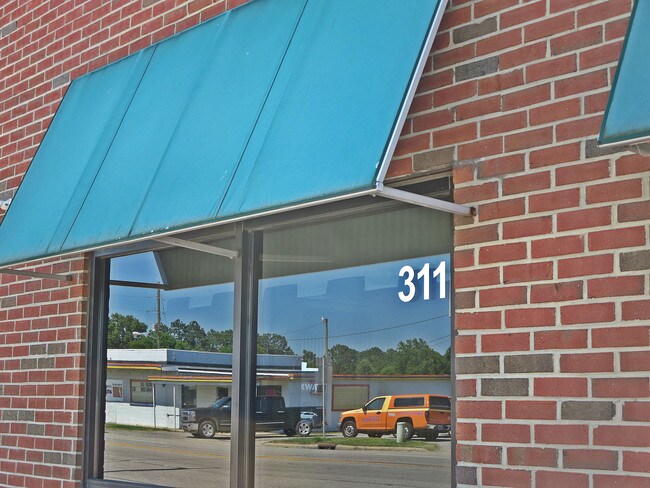
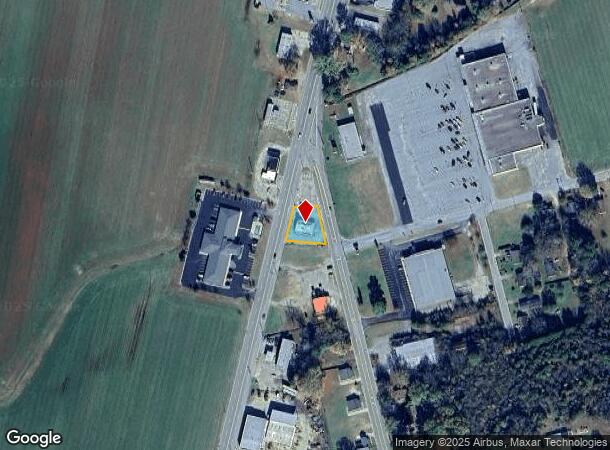
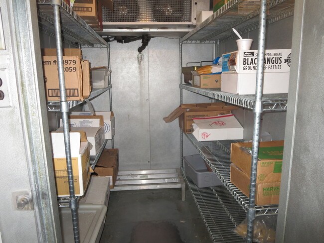
Property Record
311 Main St, Scotland Neck, NC 27874
NEARBY LISTINGS FOR SALE OR LEASE
Property Detail
311 Main St
Restaurantdrivein
S MAIN ST
X
Halifax
3720486600J
North Carolina
2024
0.28 AC
2025
Other Market Areas
931102
Roanoke Rapids, NC
2,026 SF
11-00514
DEMOGRAPHICS near 311 Main St
1 Mile
3 Mile
5 Mile
2024 Total Population
1,470
3,223
3,809
2029 Population
1,478
3,196
3,765
Pop Growth 2024-2029
+ 0.54%
(0.84%)
(1.16%)
Average Age
47
46
46
2024 Total Households
649
1,408
1,659
HH Growth 2024-2029
+ 0.62%
(0.71%)
(1.02%)
Median Household Inc
$19,687
$24,511
$26,210
Avg Household Size
2.10
2.20
2.20
2024 Avg HH Vehicles
1.00
2.00
2.00
Median Home Value
$62,761
$76,659
$79,507
Median Year Built
1965
1970
1970
Nearby Places
Map Layers
Map Styles
 Street
 Aerial
- Restaurants
- Banks
- Shops
- Fitness
- Groceries
PUBLIC TRANSPORTATION
AIRPORT
Pitt-Greenville
DRIVE
WALK
Distance
Pitt-Greenville
60 min
40.4 mi
SALE & LEASE HISTORY
LISTING DATE
SALE/LEASE

Sep 23, 2016
For Sale
May 18, 2017
For Sale
Aug 08, 2019
For Sale
Nearby Properties
Address
Land Use
TOTAL SIZE
Lot Size
Zoning
Address
Land Use
TOTAL SIZE
Lot Size
Zoning
37,640 SF
12.15 AC
SNR
Address
Land Use
TOTAL SIZE
Lot Size
Zoning
32,044 SF
20.54 AC
SNRA
Address
Land Use
TOTAL SIZE
Lot Size
Zoning
14,400 SF
17 AC
SNR
Address
Land Use
TOTAL SIZE
Lot Size
Zoning
26,968 SF
12.50 AC
CORA
Address
Land Use
TOTAL SIZE
Lot Size
Zoning
26,664 SF
10 AC
SNR
Address
Land Use
TOTAL SIZE
Lot Size
Zoning
3,420 SF
20 AC
SNI1
Address
Land Use
TOTAL SIZE
Lot Size
Zoning
26,850 SF
7.48 AC
SNRM
Address
Land Use
TOTAL SIZE
Lot Size
Zoning
14,066 SF
4.59 AC
SNB1
Address
Land Use
TOTAL SIZE
Lot Size
Zoning
1,650 SF
10.65 AC
SNR
Address
Land Use
TOTAL SIZE
Lot Size
Zoning
18,560 SF
10 AC
SNR
Address
Land Use
TOTAL SIZE
Lot Size
Zoning
5,474 SF
0.76 AC
SNR2
Address
Land Use
TOTAL SIZE
Lot Size
Zoning
14,490 SF
0.60 AC
SNR2
Address
Land Use
TOTAL SIZE
Lot Size
Zoning
15,144 SF
2.85 AC
SNR
Address
Land Use
TOTAL SIZE
Lot Size
Zoning
16,916 SF
0.65 AC
SNR2
Address
Land Use
TOTAL SIZE
Lot Size
Zoning
12,000 SF
12.48 AC
SNI1
Address
Land Use
TOTAL SIZE
Lot Size
Zoning
9,838 SF
0.92 AC
SNR1
Address
Land Use
TOTAL SIZE
Lot Size
Zoning
16,802 SF
1.93 AC
SNB2
Address
Land Use
TOTAL SIZE
Lot Size
Zoning
7,200 SF
2.20 AC
SNB2
Address
Land Use
TOTAL SIZE
Lot Size
Zoning
20,000 SF
2.67 AC
SNB2
Address
Land Use
TOTAL SIZE
Lot Size
Zoning
7,298 SF
0.67 AC
SNB1
Address
Land Use
TOTAL SIZE
Lot Size
Zoning
6,952 SF
8.59 AC
CORA
Address
Land Use
TOTAL SIZE
Lot Size
Zoning
9,266 SF
0.37 AC
SNB1
Address
Land Use
TOTAL SIZE
Lot Size
Zoning
4,684 SF
5.60 AC
CORA
Address
Land Use
TOTAL SIZE
Lot Size
Zoning
63,360 SF
8 AC
SNI1
Address
Land Use
TOTAL SIZE
Lot Size
Zoning
56,954 SF
5.06 AC
SNI2
Address
Land Use
TOTAL SIZE
Lot Size
Zoning
3,196 SF
1.61 AC
SNR
Address
Land Use
TOTAL SIZE
Lot Size
Zoning
1.07 AC
SNR
Address
Land Use
TOTAL SIZE
Lot Size
Zoning
4,320 SF
2.09 AC
CORA
Address
Land Use
TOTAL SIZE
Lot Size
Zoning
10,000 SF
12.88 AC
SNI2
Address
Land Use
TOTAL SIZE
Lot Size
Zoning
5,900 SF
0.92 AC
SNB1
The World's #1 Commercial Real Estate Marketplace
Connect with us
© 2025 CoStar Group
The information above has been obtained from sources believed reliable. While we do not doubt its accuracy we have not verified it and make no guarantee, warranty or representation about it. It is your responsibility to independently confirm its accuracy and completeness. Any projections, opinions, assumptions, or estimates used are for example only and do not represent the current or future performance of the property. The value of this transaction to you depends on tax and other factors which should be evaluated by your tax, financial, and legal advisors. You and your advisors should conduct a careful, independent investigation of the property to determine to your satisfaction the suitability of the property for your needs.