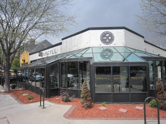
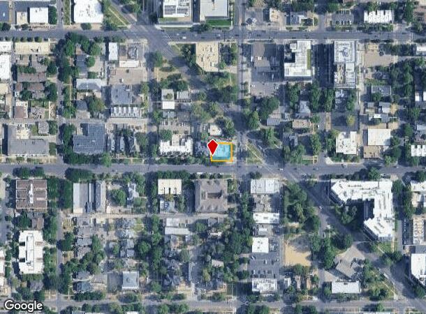
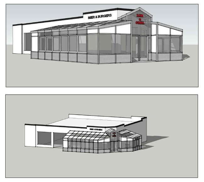
Property Record
1033 E 17Th Ave, Denver, CO 80218

NEARBY LISTINGS FOR SALE OR LEASE
Property Detail
1033 E 17Th Ave
Denver-Aurora-Lakewood, CO
Park Avenue Add
2354-10-007
PARK AVENUE ADD B17 L18 & 19 & S/2 OF L17 EXC W 60FT
Restaurantbuilding
Denver
X
Colorado
0800460201H
18
2024
0.15 AC
2024
Downtown
002602
Denver
8,832 SF
DEMOGRAPHICS near 1033 E 17Th Ave
1 Mile
3 Mile
5 Mile
2024 Total Population
48,983
237,322
492,927
2029 Population
49,821
242,104
499,923
Pop Growth 2024-2029
+ 1.71%
+ 2.01%
+ 1.42%
Average Age
38
38
38
2024 Total Households
30,389
127,326
232,846
HH Growth 2024-2029
+ 1.64%
+ 2.05%
+ 1.49%
Median Household Inc
$71,428
$88,126
$84,311
Avg Household Size
1.50
1.80
2.00
2024 Avg HH Vehicles
1.00
1.00
1.00
Median Home Value
$653,514
$731,484
$660,984
Median Year Built
1965
1973
1967
Nearby Places
Map Layers
Map Styles
 Street
 Aerial
- Restaurants
- Banks
- Shops
- Fitness
- Groceries
PUBLIC TRANSPORTATION
TRANSIT/SUBWAY
25th-Welton (D Line - Denver Regional Transportation District Light Rail (TheRide))
DRIVE
WALK
Distance
25th-Welton (D Line - Denver Regional Transportation District Light Rail (TheRide))
3 min
16 min
0.9 mi
20th-Welton (D Line - Denver Regional Transportation District Light Rail (TheRide))
DRIVE
WALK
Distance
20th-Welton (D Line - Denver Regional Transportation District Light Rail (TheRide))
4 min
16 min
0.9 mi
27th-Welton (D Line - Denver Regional Transportation District Light Rail (TheRide))
DRIVE
WALK
Distance
27th-Welton (D Line - Denver Regional Transportation District Light Rail (TheRide))
4 min
18 min
0.9 mi
18th-California (D Line - Denver Regional Transportation District Light Rail (TheRide), F Line - Denver Regional Transportation District Light Rail (TheRide), H Line - Denver Regional Transportation District Light Rail (TheRide))
DRIVE
WALK
Distance
18th-California (D Line - Denver Regional Transportation District Light Rail (TheRide), F Line - Denver Regional Transportation District Light Rail (TheRide), H Line - Denver Regional Transportation District Light Rail (TheRide))
4 min
19 min
1.0 mi
29th-Welton (D Line - Denver Regional Transportation District Light Rail (TheRide))
DRIVE
WALK
Distance
29th-Welton (D Line - Denver Regional Transportation District Light Rail (TheRide))
3 min
19 min
1.0 mi
AIRPORT
Denver International
DRIVE
WALK
Distance
Denver International
38 min
25.7 mi
Freight Ports
Port of Shreveport
DRIVE
WALK
Distance
Port of Shreveport
1 min
812.8 mi
SALE & LEASE HISTORY
LISTING DATE
SALE/LEASE

Dec 07, 2016
For Lease
Nearby Properties
Address
Land Use
TOTAL SIZE
Lot Size
Zoning
Address
Land Use
TOTAL SIZE
Lot Size
Zoning
1,882,179 SF
21.15 AC
D-TD
Address
Land Use
TOTAL SIZE
Lot Size
Zoning
1,721,086 SF
21.34 AC
C-MU-30
Address
Land Use
TOTAL SIZE
Lot Size
Zoning
857,233 SF
10.26 AC
CMP-H
Address
Land Use
TOTAL SIZE
Lot Size
Zoning
794,383 SF
0.90 AC
D-TD
Address
Land Use
TOTAL SIZE
Lot Size
Zoning
1,542,612 SF
1.56 AC
D-C
Address
Land Use
TOTAL SIZE
Lot Size
Zoning
856,519 SF
10.04 AC
B-3
Address
Land Use
TOTAL SIZE
Lot Size
Zoning
1,567,575 SF
1.40 AC
D-C
Address
Land Use
TOTAL SIZE
Lot Size
Zoning
1,096,923 SF
16.14 AC
CMP-H
Address
Land Use
TOTAL SIZE
Lot Size
Zoning
1,312,939 SF
1.15 AC
D-C
Address
Land Use
TOTAL SIZE
Lot Size
Zoning
1,048,471 SF
2.44 AC
PUD
Address
Land Use
TOTAL SIZE
Lot Size
Zoning
545,292 SF
1.15 AC
D-C
Address
Land Use
TOTAL SIZE
Lot Size
Zoning
656,257 SF
3.05 AC
D-CV
Address
Land Use
TOTAL SIZE
Lot Size
Zoning
614,750 SF
0.23 AC
D-C
Address
Land Use
TOTAL SIZE
Lot Size
Zoning
611,828 SF
0.94 AC
PUD
Address
Land Use
TOTAL SIZE
Lot Size
Zoning
150,202 SF
13.24 AC
T-MU-30
Address
Land Use
TOTAL SIZE
Lot Size
Zoning
337,495 SF
0.57 AC
D-C
Address
Land Use
TOTAL SIZE
Lot Size
Zoning
858,528 SF
2.53 AC
D-C
Address
Land Use
TOTAL SIZE
Lot Size
Zoning
755,793 SF
2.44 AC
D-C
Address
Land Use
TOTAL SIZE
Lot Size
Zoning
677,832 SF
2.42 AC
D-C
Address
Land Use
TOTAL SIZE
Lot Size
Zoning
298,387 SF
0.88 AC
PUD
Address
Land Use
TOTAL SIZE
Lot Size
Zoning
724,981 SF
1.26 AC
D-C
Address
Land Use
TOTAL SIZE
Lot Size
Zoning
405,974 SF
1.78 AC
PUD
Address
Land Use
TOTAL SIZE
Lot Size
Zoning
1,018,386 SF
2.46 AC
D-C
Address
Land Use
TOTAL SIZE
Lot Size
Zoning
290,821 SF
1.16 AC
PUD
Address
Land Use
TOTAL SIZE
Lot Size
Zoning
604,358 SF
2.45 AC
D-C
Address
Land Use
TOTAL SIZE
Lot Size
Zoning
716,151 SF
2.45 AC
D-C
Address
Land Use
TOTAL SIZE
Lot Size
Zoning
618,768 SF
1.23 AC
D-C
Address
Land Use
TOTAL SIZE
Lot Size
Zoning
778,340 SF
0.61 AC
D-C
Address
Land Use
TOTAL SIZE
Lot Size
Zoning
334,746 SF
1.25 AC
D-LD
Address
Land Use
TOTAL SIZE
Lot Size
Zoning
764,724 SF
1 AC
D-C
The World's #1 Commercial Real Estate Marketplace
Connect with us
© 2025 CoStar Group
The information above has been obtained from sources believed reliable. While we do not doubt its accuracy we have not verified it and make no guarantee, warranty or representation about it. It is your responsibility to independently confirm its accuracy and completeness. Any projections, opinions, assumptions, or estimates used are for example only and do not represent the current or future performance of the property. The value of this transaction to you depends on tax and other factors which should be evaluated by your tax, financial, and legal advisors. You and your advisors should conduct a careful, independent investigation of the property to determine to your satisfaction the suitability of the property for your needs.