This feature is unavailable at the moment.
We apologize, but the feature you are trying to access is currently unavailable. We are aware of this issue and our team is working hard to resolve the matter.
Please check back in a few minutes. We apologize for the inconvenience.
- LoopNet Team
CR 25
Weirsdale, FL 32195
Signalized Dollar General Adjacent Parcel FL · Land For Sale · 0.82 AC

Investment Highlights
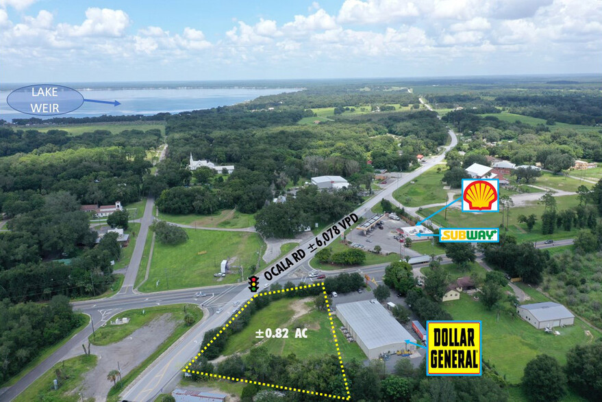
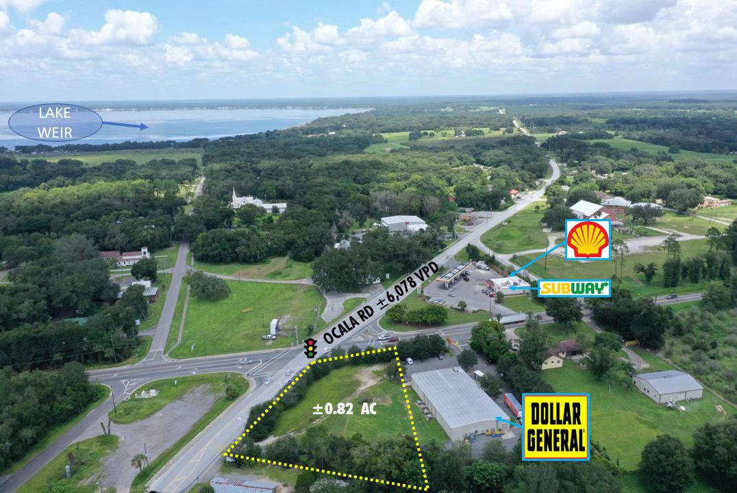
- Signalized hard corner parcel adjacent to Dollar General with direct frontage and excellent visibility to ±6,078 vehicles per day
- Dense demographics with 5-mile population of ±51,544 and annual household income of ±$58,546
- Absolute $1 Auction - NO RESERVE
- Flexible M-2 (Heavy Industrial) zoning
- Tremendous 15.2% growth from 2010-2020 and future double-digit growth anticipated (5-mile radius)
PROPERTY FACTS
Description
CBRE and RealINSIGHT Marketplace are pleased to present a ±0.82-acre land parcel located adjacent to 13842 SE Highway 42 in Weirsdale, Florida (the “Property”) equidistant between Leesburg and Ocala. This Property offers an exceptional investment opportunity via development and FIRST BID MEETS RESERVE! The Property is a ±0.82-acre parcel located immediately adjacent to Dollar General. The Property offers frontage and visibility on Ocala Road and benefits from traffic counts of ±6,078 vehicles per day. The Property is zoned M-2, Heavy Industrial and is intended for those activities that are not compatible with other zoning districts with retail commercial sales allowed. Strategically positioned in north central Florida, the Property is part of the Ocala MSA relatively equidistant between Leesburg to the south and Ocala to the north, each city approximately 20 miles from the Property. Weirsdale is centered around the intersection of State Road 25 and State Road 42 with the Property anchoring the south east corner of this central intersection. The Property’s 2020 demographics within a 5-mile radius has a population of ±51,544, an average household income of ±$58,546. The Property is located within a high growth area with population growth of 15.20% from 2010-2020 and an anticipated 10.5% growth expected from 2020-2025 within 5-miles of the Property. This opportunity gives potential investors the ability to acquire a ±0.82 AC parcel development site at a significant discount with huge value-add enhancement potential.
Links
PROPERTY TAXES
| Parcel Number | 49708-001-00 | Improvements Assessment | $0 |
| Land Assessment | $0 | Total Assessment | $42,495 |
PROPERTY TAXES
zoning
| Zoning Code | M2 |
| M2 |
Learn More About Investing in Land
Listing ID: 20937978
Date on Market: 9/13/2020
Last Updated:
Address: CR 25, Weirsdale, FL 32195
The Land Property at CR 25, Weirsdale, FL 32195 is no longer being advertised on LoopNet.com. Contact the broker for information on availability.
Land PROPERTIES IN NEARBY NEIGHBORHOODS
Nearby Listings
- 9235 SE 154th St, Summerfield FL
- 41015 County Road 25, Weirsdale FL
- SE 109th Terrace Road, Summerfield FL
- US Hwy 441 & 156th Pl, Summerfield FL
- 9494 SE Highway 42, Summerfield FL
- 00 US 441 Hwy, Summerfield FL
- 1165 Highway 466, Lady Lake FL
- S US Hwy 441, Summerfield FL
- 451 Rolling Acres Rd, Lady Lake FL
- 17697 S Highway 25, Weirsdale FL
- 1175 Hwy-466, Lady Lake FL
- 8924 E County Road 466, Lady Lake FL
- 216 US-441, Lady Lake FL
- SE 172nd Rd, Summerfield FL
- 4035 CR 25 Rd, Lady Lake FL

