This feature is unavailable at the moment.
We apologize, but the feature you are trying to access is currently unavailable. We are aware of this issue and our team is working hard to resolve the matter.
Please check back in a few minutes. We apologize for the inconvenience.
- LoopNet Team
Kittyhawk Dr
Blanchard, OK 73010
02070(06) · Land For Sale · 1.68 AC

PROPERTY FACTS
| Property Type | Land | Cross Streets | FOUR LAKES DR |
| Property Subtype | Residential | Parcel Number | 0136-00-007-002-0-000-00 |
| Total Lot Size | 1.68 AC |
| Property Type | Land |
| Property Subtype | Residential |
| Total Lot Size | 1.68 AC |
| Cross Streets | FOUR LAKES DR |
| Parcel Number | 0136-00-007-002-0-000-00 |
Description
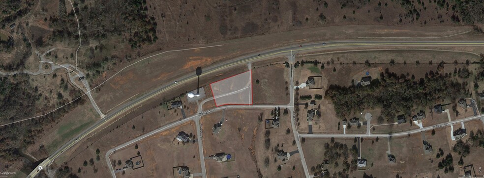
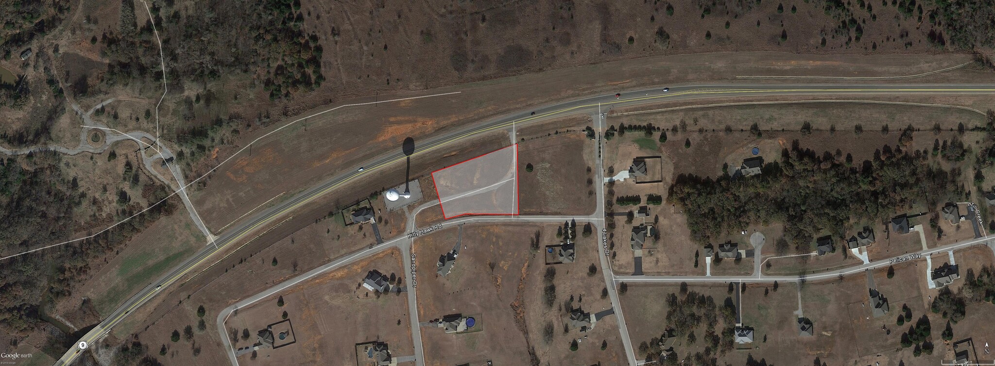
A strip, piece or parcel of land lying in part of Lots 2 & 3, Block 7 of Four Lakes Phase II, a subdivision of the S½ Section 35, T8N, R5W, according to the recorded plat thereof, in Grady County, Oklahoma. Said parcel of land being described by metes and bounds as follows: Beginning at the SE corner of said Lot 2, thence S 89°46’01” W along the South line of said Lot 2 a distance of 95.28 feet, thence S 85°26’00” W along said South line a distance of 149.45 feet to the SE corner of said Lot 3, thence S 71°11’00” W along the South line of said Lot 3 a distance of 95.90 feet, thence N 15°01’26” W a distance of 171.10 feet to a point on the present South right-of-way line of US Highway No. 62, thence N 70°43’50” E along said right-of-way line a distance of 401.67 feet to a point on the East line of said Lot 2, thence S 00°02’50” E along said East line a distance of 254.59 feet to point of beginning. Containing 73,162 Sq. Ft. or 1.68 acres, more or less. Grantor, reserves and excepts unto itself, its successors and assigns ALL RIGHTS OF INGRESS AND EGRESS from said 1.68 acres, more or less to the lands or rights-of-way covered by the abutting U.S. Highway No. 62 facility along the Northerly side of the above described property. Grantor, reserves and excepts, unto itself, its successors and assigns a PERPETUAL UTILITY EASEMENT upon, over, below, and across the Northerly 20.00 feet of the above described 1.68 acres, more or less, and being further described by metes and bounds as follows: Commencing at the SW corner of said Lot 3, thence N 71°11’00” E along the South line of said Lot 3 a distance of 150.00 feet, thence N 15°01’26” W a distance of 151.04 feet to the point of beginning, thence continuing N 15°01’26” W a distance of 20.06 feet to a point on the present South right-of-way line of U.S. Highway No. 62, thence N 70°43’50” E along said right-of-way line a distance of 401.67 feet to a point on the East line of said Lot 2, thence S 00°02’50” E along said East line a distance of 21.19 feet, thence S 70°43’50” W a distance of 396.18 feet to said point of beginning. This perpetual utility easement is granted for the sole purpose of enabling the Grantor, its officers, agents, employees, contractors, permitees, and assigns to go upon, survey, locate, construct, build and maintain utility facilities, and all necessary or convenient appurtenances thereto, and includes the permanent right of ingress and egress by the State of Oklahoma, its officers, agents, employees, contractors, permitees, and assigns.
Links
zoning
| Zoning Code | Residential |
| Residential |
Learn More About Investing in Land
Listing ID: 18433454
Date on Market: 2/6/2020
Last Updated:
Address: Kittyhawk Dr, Blanchard, OK 73010
The Land Property at Kittyhawk Dr, Blanchard, OK 73010 is no longer being advertised on LoopNet.com. Contact the broker for information on availability.
Land PROPERTIES IN NEARBY NEIGHBORHOODS
Nearby Listings

