State Route 7
Spanaway, WA 98387
Puget Sound Sand and Gravel Prospect Site · Land For Sale
·
280.00 AC

INVESTMENT HIGHLIGHTS
- Excellent access to I-5, Olympia, Tacoma and Seattle
- Proximity to WA Dept of Transportation Puget Sound Gateway Program
- 280 acre property along SR 7 near Spanaway with estimated 12.6 million tons of reserve
PROPERTY FACTS
| Property Type | Land |
| Property Subtype | Residential |
| Proposed Use | Mixed Use |
| Total Lot Size | 280.00 AC |
DESCRIPTION
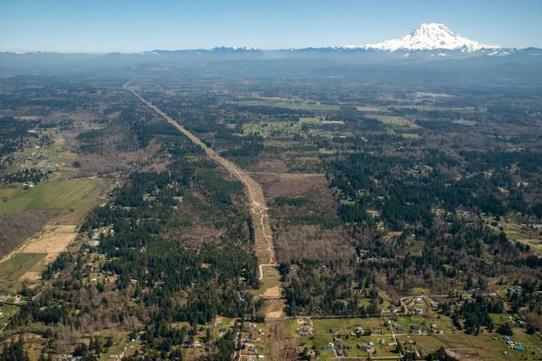
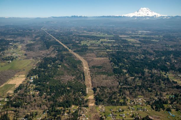
This 323± acre property is located along Mountain Highway (State Route 7), 16 miles southeast of Tacoma and 7 miles south of Spanaway. The property is being offered in its entirety and in two parcels of 280 acres (contains estimated 12.6 million tons or reserve as sand and gravel prospect) , and 43 acres (located on east side of State Route 7 and has residential potential based on zoning). There is excellent access to I-5 corridor, and strategic proximity to Washington Department of Transportation $1.9 billion Puget Sound Gateway Program. Puget Sound Gateway Program was funded primarily by the 2015 Connecting Washington Transportation Reserve package. It is a two-phase program to be completed from 2024 to 2028 which will connect Tacoma and Port of Seattle manufacturing and industrial centers. Phase One is completion of SR 167 from Puyallup to I-5, and Port of Tacoma. Phase Two is completion of SR 509 which will extend a new southern access point to Sea-Tac International Airport, and provide an alternate route to I-5 and SR 99. Both projects are located within a thirty-mile radius of the 323± acre property, offering a competitive location for providing aggregate. In addition, Puget Sound Regional Council in 2018 projected that, by 2050, the population will increase by 1.8 million, which should create continued demand for sand and gravel. In 2016, Bennett Consulting conducted subsurface exploration for a prior owner. Appreciable quantities of sand and gravel on 109± acres of the property are indicated. Proven and probable reserve was estimated at 2,759,000 tons of rock on 35± acres, and an additional 9,876,000 tons of possible reserve on 74± acres. Bennett Consulting projected a twenty-year life, with production to start at 100,000 tons, and annual full production of 600,000 tons by year six. Cumulative production of 7.6 million tons would be obtained by year 15. The property could also be used as backfill site as part of a segmental reclamation program to take advantage of proximity to new construction along the I-5 corridor. Additional reserves might be identified with additional exploration of the site. The complete 2016 Geologic Report with estimated gravel resource valuation is available on Data Site. Prospects will have access to Data Site by signing a Confidentiality Agreement. Property has no entitlements, and is being sold As Is. The new owner will be responsible for obtaining a Conditional Use Permit from Pierce County, and a Mining Permit from Washington Department of Natural Resources. Please see Data Site for additional detail on requirements from Pierce County. The 323± acre property was originally owned by Washington Department of Natural Resources. It was part of an exchange with Western Pacific Timber in 2008, and was acquired by the Seller in 2015. It is currently managed as timberland. 273± acres are considered commercial timberland, with 132± acres having primarily 3 to 12 year-old Douglas-fir and red alder, and 144± acres having 22 to 30 year-old Douglas-fir. Two powerlines bisect the tract, and riparian areas along Muck Creek total 50± acres. There are 2,200± feet of frontage along State Route 7 in the northwest section. 43± acres are north of the highway, and the balance of the 280± acre block contains the potential sand and gravel reserve. RR-10 zoning has a minimum parcel size of 10 acres for a residence. There are homes near the northwest and northeast sections of the tract. The property is being offered in its entirety and in two parcels: the 280± acre main block which has the sand and gravel prospect and the 43± acre tract north of State Route 7 which may have residential potential. The entire property is designated as forestland. 2020 taxes are $950. Individual sales of the parcels will require lot line adjustment.
LINKS
ZONING
| Zoning Code | RR-10 and RSR-10 (Rural Residential and Rural Sensitive Resource) |
Listing ID: 19771017
Date on Market: 6/3/2020
Last Updated:
Address: State Route 7, Spanaway, WA 98387
The Land Property at State Route 7, Spanaway, WA 98387 is no longer being advertised on LoopNet.com. Contact the broker for information on availability.
LAND PROPERTIES IN NEARBY NEIGHBORHOODS
- Lakeview Tacoma Residential Land & Home Lots
- South Hill Residential Land & Home Lots
- South Lakes Residential Land & Home Lots
- Pacific Residential Land & Home Lots
- Northeast Lakewood Residential Land & Home Lots
- Midland Residential Land & Home Lots
- South End Residential Land & Home Lots
- Eastside Residential Land & Home Lots
- Downtown Puyallup Residential Land & Home Lots
- McChord Residential Land & Home Lots


