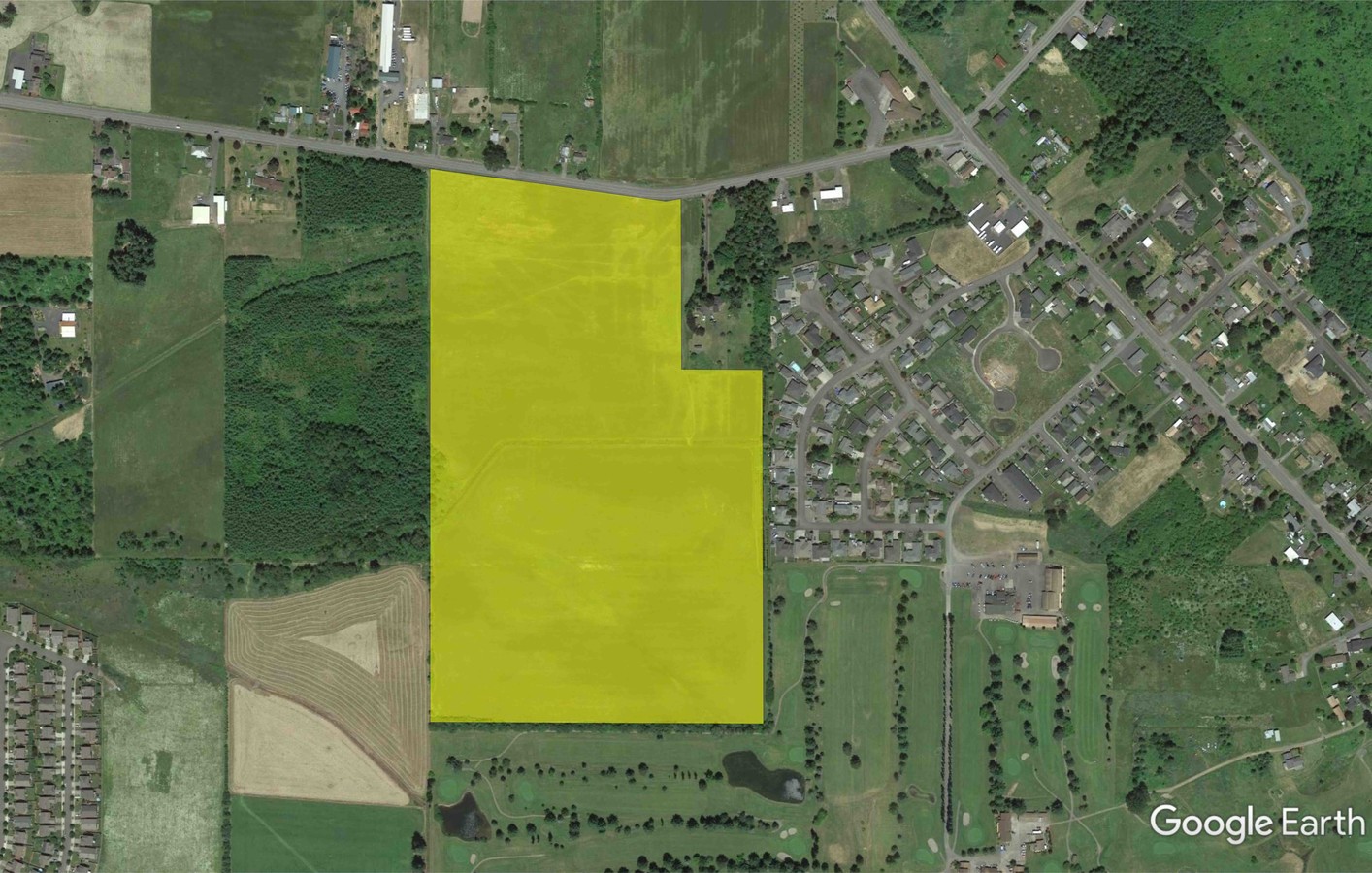
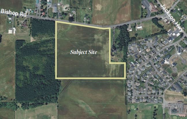
Property Record
Bishop Rd, Chehalis, WA 98532
NEARBY LISTINGS FOR SALE OR LEASE
Property Detail
Bishop Rd
Residentialacreage
Lewis
X
Washington
5301021782C
Washington State Area
0
Other Market Areas
2024
Centralia, WA
971000
017857-003-006
DEMOGRAPHICS near Bishop Rd
1 Mile
3 Mile
5 Mile
2024 Total Population
1,767
7,561
19,555
2029 Population
1,975
8,405
21,731
Pop Growth 2024-2029
+ 11.77%
+ 11.16%
+ 11.13%
Average Age
43
42
41
2024 Total Households
646
2,822
7,307
HH Growth 2024-2029
+ 11.76%
+ 11.27%
+ 11.26%
Median Household Inc
$75,281
$76,075
$73,566
Avg Household Size
2.70
2.70
2.60
2024 Avg HH Vehicles
3.00
2.00
2.00
Median Home Value
$366,826
$358,859
$342,986
Median Year Built
1993
1991
1981
Nearby Places
- Restaurants
- Banks
- Shops
- Fitness
- Groceries
SALE & LEASE HISTORY
LISTING DATE
SALE/LEASE

Sep 25, 2016
For Lease
Sep 24, 2016
For Sale
Jan 29, 2018
For Sale
Aug 17, 2023
For Sale
Apr 16, 2021
For Sale
Nearby Properties
Address
Land Use
TOTAL SIZE
Lot Size
Zoning
Address
Land Use
TOTAL SIZE
Lot Size
Zoning
317,972 SF
47.34 AC
IL
Address
Land Use
TOTAL SIZE
Lot Size
Zoning
114,778 SF
42.22 AC
RUGA
Address
Land Use
TOTAL SIZE
Lot Size
Zoning
2,704 SF
8.28 AC
IL
Address
Land Use
TOTAL SIZE
Lot Size
Zoning
739,659 SF
37.76 AC
IL
Address
Land Use
TOTAL SIZE
Lot Size
Zoning
3,012 SF
11.23 AC
R4
Address
Land Use
TOTAL SIZE
Lot Size
Zoning
172,800 SF
13.97 AC
IL
Address
Land Use
TOTAL SIZE
Lot Size
Zoning
118,034 SF
5.90 AC
IL
Address
Land Use
TOTAL SIZE
Lot Size
Zoning
6,004 SF
30.82 AC
C1
Address
Land Use
TOTAL SIZE
Lot Size
Zoning
1,755 SF
10.34 AC
IL
Address
Land Use
TOTAL SIZE
Lot Size
Zoning
2,464 SF
1 AC
CG
Address
Land Use
TOTAL SIZE
Lot Size
Zoning
62,352 SF
17.32 AC
IL
Address
Land Use
TOTAL SIZE
Lot Size
Zoning
83,978 SF
6.63 AC
Address
Land Use
TOTAL SIZE
Lot Size
Zoning
93,000 SF
6.54 AC
IL
Address
Land Use
TOTAL SIZE
Lot Size
Zoning
37,709 SF
5 AC
C1
Address
Land Use
TOTAL SIZE
Lot Size
Zoning
4.32 AC
RUGA
Address
Land Use
TOTAL SIZE
Lot Size
Zoning
1.29 AC
C
Address
Land Use
TOTAL SIZE
Lot Size
Zoning
9,802 SF
10.38 AC
Address
Land Use
TOTAL SIZE
Lot Size
Zoning
1,056 SF
12.90 AC
EPFS
Address
Land Use
TOTAL SIZE
Lot Size
Zoning
8,669 SF
10.78 AC
Address
Land Use
TOTAL SIZE
Lot Size
Zoning
1,915 SF
2 AC
RUGA
Address
Land Use
TOTAL SIZE
Lot Size
Zoning
2,045 SF
1 AC
CG
Address
Land Use
TOTAL SIZE
Lot Size
Zoning
2,336 SF
2.69 AC
RUGA
Address
Land Use
TOTAL SIZE
Lot Size
Zoning
54,669 SF
2.33 AC
CG
Address
Land Use
TOTAL SIZE
Lot Size
Zoning
24,942 SF
5 AC
CG
Address
Land Use
TOTAL SIZE
Lot Size
Zoning
44,454 SF
4.01 AC
IL
Address
Land Use
TOTAL SIZE
Lot Size
Zoning
9.04 AC
C
Address
Land Use
TOTAL SIZE
Lot Size
Zoning
54,304 SF
7.74 AC
IL
Address
Land Use
TOTAL SIZE
Lot Size
Zoning
5,880 SF
24.71 AC
IL
Address
Land Use
TOTAL SIZE
Lot Size
Zoning
37,388 SF
2.37 AC
IL
The World's #1 Commercial Real Estate Marketplace
Connect with us
© 2025 CoStar Group
The information above has been obtained from sources believed reliable. While we do not doubt its accuracy we have not verified it and make no guarantee, warranty or representation about it. It is your responsibility to independently confirm its accuracy and completeness. Any projections, opinions, assumptions, or estimates used are for example only and do not represent the current or future performance of the property. The value of this transaction to you depends on tax and other factors which should be evaluated by your tax, financial, and legal advisors. You and your advisors should conduct a careful, independent investigation of the property to determine to your satisfaction the suitability of the property for your needs.