Property Record
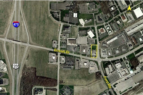
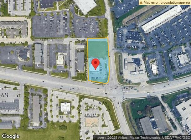
501 W Dussel Dr, Maumee, OH 43537
NEARBY LISTINGS FOR SALE OR LEASE
Property Detail
501 W Dussel Dr
Toledo, OH
Arrowhead Plat 4 Pt Of
36-40882
ARROWHEAD PLAT 4 PT OF LOT 61 & PT OF LOT 65 INARROWHEAD PLAT 5 IRR
Regionalshoppingcenterormallwithanchorstore
Lucas
X
Ohio
39173C0010D
61,65
2023
1.06 AC
2023
South/Southwest
007104
Toledo
6,246 SF
DEMOGRAPHICS near 501 W Dussel Dr
1 Mile
3 Mile
5 Mile
2024 Total Population
2,637
50,294
129,026
2029 Population
2,641
49,414
127,737
Pop Growth 2024-2029
+ 0.15%
(1.75%)
(1.00%)
Average Age
39
42
41
2024 Total Households
1,222
22,192
55,816
HH Growth 2024-2029
(0.08%)
(1.80%)
(1.06%)
Median Household Inc
$52,079
$69,679
$66,347
Avg Household Size
2.10
2.20
2.20
2024 Avg HH Vehicles
2.00
2.00
2.00
Median Home Value
$212,391
$195,597
$192,927
Median Year Built
1982
1978
1978
Nearby Places
- Restaurants
- Banks
- Shops
- Fitness
- Groceries
SALE & LEASE HISTORY
LISTING DATE
SALE/LEASE

Sep 24, 2016
For Sale
Nearby Properties
Address
Land Use
TOTAL SIZE
Lot Size
Zoning
Address
Land Use
TOTAL SIZE
Lot Size
Zoning
541,518 SF
21.30 AC
16-R1
Address
Land Use
TOTAL SIZE
Lot Size
Zoning
275,990 SF
49.65 AC
16-CM
Address
Land Use
TOTAL SIZE
Lot Size
Zoning
67,264 SF
6.95 AC
16-CM
Address
Land Use
TOTAL SIZE
Lot Size
Zoning
186,190 SF
14 AC
19-C2
Address
Land Use
TOTAL SIZE
Lot Size
Zoning
196,149 SF
18.69 AC
10-RD6
Address
Land Use
TOTAL SIZE
Lot Size
Zoning
35.94 AC
17-C3
Address
Land Use
TOTAL SIZE
Lot Size
Zoning
3.56 AC
Address
Land Use
TOTAL SIZE
Lot Size
Zoning
231,756 SF
31.37 AC
16-M1
Address
Land Use
TOTAL SIZE
Lot Size
Zoning
569,612 SF
51.49 AC
16-M2
Address
Land Use
TOTAL SIZE
Lot Size
Zoning
269,263 SF
55.93 AC
16-R2
Address
Land Use
TOTAL SIZE
Lot Size
Zoning
211,140 SF
28.92 AC
10-IC
Address
Land Use
TOTAL SIZE
Lot Size
Zoning
139,741 SF
30.48 AC
19-RA3
Address
Land Use
TOTAL SIZE
Lot Size
Zoning
212,672 SF
15.98 AC
17-R1
Address
Land Use
TOTAL SIZE
Lot Size
Zoning
352,382 SF
62.93 AC
16-M1
Address
Land Use
TOTAL SIZE
Lot Size
Zoning
200,639 SF
16.39 AC
24-SUP
Address
Land Use
TOTAL SIZE
Lot Size
Zoning
138,607 SF
21.30 AC
10-RS12
Address
Land Use
TOTAL SIZE
Lot Size
Zoning
178,915 SF
13 AC
19-R3
Address
Land Use
TOTAL SIZE
Lot Size
Zoning
111,195 SF
13.64 AC
19-C2
Address
Land Use
TOTAL SIZE
Lot Size
Zoning
156,420 SF
12 AC
19-R3
Address
Land Use
TOTAL SIZE
Lot Size
Zoning
214,986 SF
17.55 AC
19-R1
Address
Land Use
TOTAL SIZE
Lot Size
Zoning
78,166 SF
2.08 AC
16-CM
Address
Land Use
TOTAL SIZE
Lot Size
Zoning
120,077 SF
9.53 AC
24-B3
Address
Land Use
TOTAL SIZE
Lot Size
Zoning
606,883 SF
119.87 AC
16-M2
Address
Land Use
TOTAL SIZE
Lot Size
Zoning
212,664 SF
21.43 AC
24-B3
Address
Land Use
TOTAL SIZE
Lot Size
Zoning
200,978 SF
13.15 AC
10-RD6
Address
Land Use
TOTAL SIZE
Lot Size
Zoning
238,148 SF
19.37 AC
24-B3
Address
Land Use
TOTAL SIZE
Lot Size
Zoning
108,406 SF
7.55 AC
24-SUP
Address
Land Use
TOTAL SIZE
Lot Size
Zoning
160,811 SF
10.83 AC
10-MX
Address
Land Use
TOTAL SIZE
Lot Size
Zoning
88,152 SF
11 AC
19-C2
Address
Land Use
TOTAL SIZE
Lot Size
Zoning
131,201 SF
10 AC
10-CUP
The World's #1 Commercial Real Estate Marketplace
Connect with us
© 2025 CoStar Group
The information above has been obtained from sources believed reliable. While we do not doubt its accuracy we have not verified it and make no guarantee, warranty or representation about it. It is your responsibility to independently confirm its accuracy and completeness. Any projections, opinions, assumptions, or estimates used are for example only and do not represent the current or future performance of the property. The value of this transaction to you depends on tax and other factors which should be evaluated by your tax, financial, and legal advisors. You and your advisors should conduct a careful, independent investigation of the property to determine to your satisfaction the suitability of the property for your needs.