Property Record
34 West St, Newnan, GA 30263

NEARBY LISTINGS FOR SALE OR LEASE
-
-
View all Newnan listings for sale on LoopNet.com
Property Detail
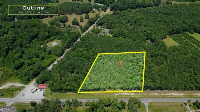
34 West St
Atlanta-Sandy Springs-Roswell, GA
Coweta
010-3174-005
Georgia
Residentialnec
5.03 AC
X
Fayette/Coweta County
13077C0205D
Atlanta
DEMOGRAPHICS near 34 West St
1 Mile
3 Mile
5 Mile
2024 Total Population
381
1,892
3,844
2029 Population
410
2,052
4,180
Pop Growth 2024-2029
+ 7.61%
+ 8.46%
+ 8.74%
Average Age
41
41
42
2024 Total Households
140
694
1,414
HH Growth 2024-2029
+ 7.86%
+ 8.65%
+ 8.84%
Median Household Inc
$56,666
$62,222
$66,241
Avg Household Size
2.70
2.70
2.70
2024 Avg HH Vehicles
2.00
2.00
2.00
Median Home Value
$193,749
$198,550
$212,617
Median Year Built
1987
1988
1989
Nearby Places
Map Layers
Map Styles
 Street
 Aerial
- Restaurants
- Banks
- Shops
- Fitness
- Groceries
SALE & LEASE HISTORY
LISTING DATE
SALE/LEASE

Jul 24, 2024
For Sale
Nearby Properties
Address
Land Use
TOTAL SIZE
Lot Size
Zoning
Address
Land Use
TOTAL SIZE
Lot Size
Zoning
10,550 SF
11.45 AC
001
Address
Land Use
TOTAL SIZE
Lot Size
Zoning
662.13 AC
RESIDENTIA
Address
Land Use
TOTAL SIZE
Lot Size
Zoning
334.43 AC
RESIDENTIA
Address
Land Use
TOTAL SIZE
Lot Size
Zoning
9,424 SF
2 AC
RFA
Address
Land Use
TOTAL SIZE
Lot Size
Zoning
614.80 AC
RFA
Address
Land Use
TOTAL SIZE
Lot Size
Zoning
712.85 AC
RESIDENTIA
Address
Land Use
TOTAL SIZE
Lot Size
Zoning
5,118 SF
12.50 AC
RFA
Address
Land Use
TOTAL SIZE
Lot Size
Zoning
773.72 AC
RESIDENTIA
Address
Land Use
TOTAL SIZE
Lot Size
Zoning
157.53 AC
RESIDENTIA
Address
Land Use
TOTAL SIZE
Lot Size
Zoning
3,500 SF
139.11 AC
001
Address
Land Use
TOTAL SIZE
Lot Size
Zoning
215.37 AC
RFA
Address
Land Use
TOTAL SIZE
Lot Size
Zoning
216.25 AC
RESIDENTIA
Address
Land Use
TOTAL SIZE
Lot Size
Zoning
5,040 SF
189.75 AC
004
Address
Land Use
TOTAL SIZE
Lot Size
Zoning
250 AC
RESIDENTIA
Address
Land Use
TOTAL SIZE
Lot Size
Zoning
110.19 AC
RFA
Address
Land Use
TOTAL SIZE
Lot Size
Zoning
150 AC
RURAL
Address
Land Use
TOTAL SIZE
Lot Size
Zoning
150 AC
RESIDENTIA
Address
Land Use
TOTAL SIZE
Lot Size
Zoning
1,536 SF
100.43 AC
RESIDENTIA
Address
Land Use
TOTAL SIZE
Lot Size
Zoning
89.20 AC
RFA
Address
Land Use
TOTAL SIZE
Lot Size
Zoning
113 AC
001
Address
Land Use
TOTAL SIZE
Lot Size
Zoning
2,444 SF
5.24 AC
RFA
Address
Land Use
TOTAL SIZE
Lot Size
Zoning
4,300 SF
4.99 AC
RFA
Address
Land Use
TOTAL SIZE
Lot Size
Zoning
101.29 AC
INDUSTRIAL
Address
Land Use
TOTAL SIZE
Lot Size
Zoning
200 AC
RESIDENTIA
Address
Land Use
TOTAL SIZE
Lot Size
Zoning
19.50 AC
RURAL
Address
Land Use
TOTAL SIZE
Lot Size
Zoning
167.91 AC
RFA
Address
Land Use
TOTAL SIZE
Lot Size
Zoning
82.64 AC
RFA
Address
Land Use
TOTAL SIZE
Lot Size
Zoning
1,403 SF
44 AC
RFA
Address
Land Use
TOTAL SIZE
Lot Size
Zoning
49,966 SF
45.32 AC
004
Address
Land Use
TOTAL SIZE
Lot Size
Zoning
116.29 AC
RFA
The World's #1 Commercial Real Estate Marketplace
Connect with us
© 2026 CoStar Group
The information above has been obtained from sources believed reliable. While we do not doubt its accuracy we have not verified it and make no guarantee, warranty or representation about it. It is your responsibility to independently confirm its accuracy and completeness. Any projections, opinions, assumptions, or estimates used are for example only and do not represent the current or future performance of the property. The value of this transaction to you depends on tax and other factors which should be evaluated by your tax, financial, and legal advisors. You and your advisors should conduct a careful, independent investigation of the property to determine to your satisfaction the suitability of the property for your needs.