Property Record
0 N Main St, Jacksonville, FL 32218
NEARBY LISTINGS FOR SALE OR LEASE
Property Detail
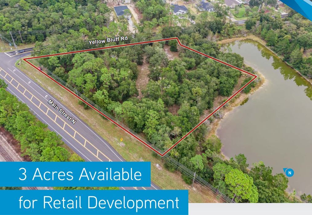
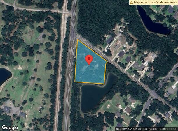
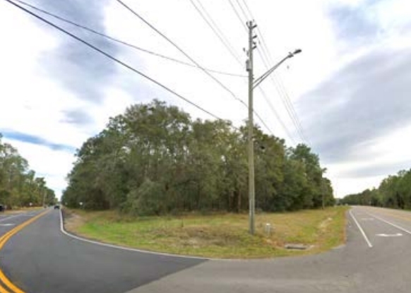
0 N Main St
Jacksonville, FL
Section Land
106125-0000
51-2N-27E 3.0 WILLIAM HENDRICKS GRANT PT RECD O/R 21311-790 BEING PARCEL A
Commercialacreage
Duval
X
Florida
12031C0065J
3 AC
2023
Northeast Jacksonville
2024
Jacksonville (Florida)
010308
DEMOGRAPHICS near 0 N Main St
1 Mile
3 Mile
5 Mile
2024 Total Population
1,577
8,477
32,923
2029 Population
1,668
8,878
36,345
Pop Growth 2024-2029
+ 5.77%
+ 4.73%
+ 10.39%
Average Age
36
38
39
2024 Total Households
547
2,834
11,701
HH Growth 2024-2029
+ 5.85%
+ 4.80%
+ 10.94%
Median Household Inc
$101,519
$87,838
$79,364
Avg Household Size
2.80
2.80
2.70
2024 Avg HH Vehicles
2.00
2.00
2.00
Median Home Value
$272,438
$274,294
$267,816
Median Year Built
2010
2007
2005
Nearby Places
- Restaurants
- Banks
- Shops
- Fitness
- Groceries
PUBLIC TRANSPORTATION
AIRPORT
Jacksonville International
DRIVE
WALK
Distance
Jacksonville International
15 min
7.5 mi
Freight Ports
Jacksonville Port
DRIVE
WALK
Distance
Jacksonville Port
25 min
17.8 mi
SALE & LEASE HISTORY
LISTING DATE
SALE/LEASE

Sep 26, 2017
For Sale
May 04, 2018
For Sale
Jun 26, 2017
For Sale
Dec 21, 2020
For Sale
Nearby Properties
Address
Land Use
TOTAL SIZE
Lot Size
Zoning
Address
Land Use
TOTAL SIZE
Lot Size
Zoning
197,526 SF
11.98 AC
PUD
Address
Land Use
TOTAL SIZE
Lot Size
Zoning
9,750 SF
71.20 AC
IL
Address
Land Use
TOTAL SIZE
Lot Size
Zoning
5,816 SF
26.61 AC
PUD
Address
Land Use
TOTAL SIZE
Lot Size
Zoning
35,256 SF
34.79 AC
PUD
Address
Land Use
TOTAL SIZE
Lot Size
Zoning
30,727 SF
13.71 AC
CCG-1
Address
Land Use
TOTAL SIZE
Lot Size
Zoning
6,862 SF
39.36 AC
PUD
Address
Land Use
TOTAL SIZE
Lot Size
Zoning
101,126 SF
32.74 AC
CCG-2
Address
Land Use
TOTAL SIZE
Lot Size
Zoning
9,750 SF
32.90 AC
IL
Address
Land Use
TOTAL SIZE
Lot Size
Zoning
7,376 SF
1.22 AC
CCG-1
Address
Land Use
TOTAL SIZE
Lot Size
Zoning
16,020 SF
17.22 AC
RR-ACRE
Address
Land Use
TOTAL SIZE
Lot Size
Zoning
2,828 SF
11.23 AC
PUD
Address
Land Use
TOTAL SIZE
Lot Size
Zoning
2,880 SF
2.70 AC
CCG-2
Address
Land Use
TOTAL SIZE
Lot Size
Zoning
14,416 SF
17.78 AC
RLD-100A
Address
Land Use
TOTAL SIZE
Lot Size
Zoning
1,452 SF
5.65 AC
CRO
Address
Land Use
TOTAL SIZE
Lot Size
Zoning
6,688 SF
1.12 AC
IL
Address
Land Use
TOTAL SIZE
Lot Size
Zoning
10.02 AC
RR-ACRE
Address
Land Use
TOTAL SIZE
Lot Size
Zoning
18,912 SF
16.64 AC
RLD-120
Address
Land Use
TOTAL SIZE
Lot Size
Zoning
516 SF
5 AC
PUD
Address
Land Use
TOTAL SIZE
Lot Size
Zoning
5,713 SF
26.24 AC
PUD
Address
Land Use
TOTAL SIZE
Lot Size
Zoning
4,500 SF
0.62 AC
CCG-2
Address
Land Use
TOTAL SIZE
Lot Size
Zoning
4.46 AC
RMD-D
Address
Land Use
TOTAL SIZE
Lot Size
Zoning
6,000 SF
1.20 AC
PUD
Address
Land Use
TOTAL SIZE
Lot Size
Zoning
4.69 AC
RLD-100A
Address
Land Use
TOTAL SIZE
Lot Size
Zoning
6,095 SF
0.90 AC
PUD
Address
Land Use
TOTAL SIZE
Lot Size
Zoning
7,001 SF
1.87 AC
RLD-100A
Address
Land Use
TOTAL SIZE
Lot Size
Zoning
6,568 SF
4.02 AC
RLD-120
Address
Land Use
TOTAL SIZE
Lot Size
Zoning
5,232 SF
36.10 AC
AGR
Address
Land Use
TOTAL SIZE
Lot Size
Zoning
3,988 SF
2.42 AC
RLD-120
Address
Land Use
TOTAL SIZE
Lot Size
Zoning
14.11 AC
RR-ACRE
Address
Land Use
TOTAL SIZE
Lot Size
Zoning
3,083 SF
2.70 AC
RLD-120
The World's #1 Commercial Real Estate Marketplace
Connect with us
© 2025 CoStar Group
The information above has been obtained from sources believed reliable. While we do not doubt its accuracy we have not verified it and make no guarantee, warranty or representation about it. It is your responsibility to independently confirm its accuracy and completeness. Any projections, opinions, assumptions, or estimates used are for example only and do not represent the current or future performance of the property. The value of this transaction to you depends on tax and other factors which should be evaluated by your tax, financial, and legal advisors. You and your advisors should conduct a careful, independent investigation of the property to determine to your satisfaction the suitability of the property for your needs.