Property Record
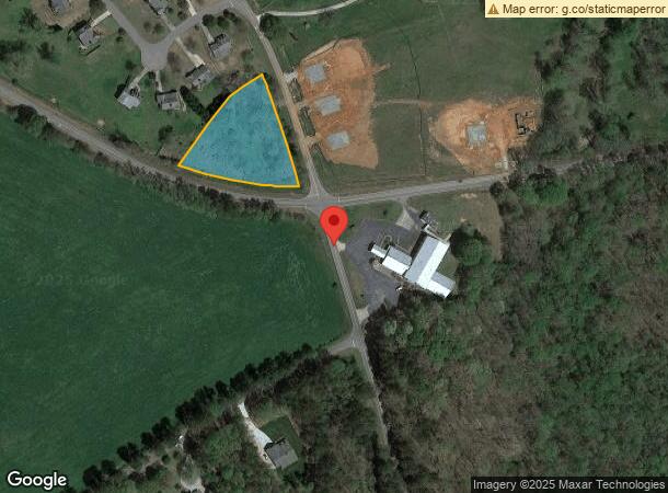
6 Pleasant Hill Church Rd Ne, Winder, GA 30680

NEARBY LISTINGS FOR SALE OR LEASE
Property Detail
6 Pleasant Hill Church Rd Ne
Atlanta-Sandy Springs-Roswell, GA
Jackson Park
XX105-053
HWY 82
Conveniencestore
Barrow
X
Georgia
13013C0135D
0
2024
1.60 AC
2024
Barrow County
180401
Atlanta
3,500 SF
DEMOGRAPHICS near 6 Pleasant Hill Church Rd Ne
1 Mile
3 Mile
5 Mile
2024 Total Population
752
11,711
36,942
2029 Population
879
13,721
43,403
Pop Growth 2024-2029
+ 16.89%
+ 17.16%
+ 17.49%
Average Age
37
38
38
2024 Total Households
258
4,045
13,012
HH Growth 2024-2029
+ 17.05%
+ 17.35%
+ 17.63%
Median Household Inc
$68,716
$68,089
$64,706
Avg Household Size
2.90
2.90
2.80
2024 Avg HH Vehicles
2.00
2.00
2.00
Median Home Value
$187,850
$216,615
$212,212
Median Year Built
2004
2003
2002
Nearby Places
- Restaurants
- Banks
- Shops
- Fitness
- Groceries
SALE & LEASE HISTORY
LISTING DATE
SALE/LEASE

Sep 24, 2016
For Sale
Nearby Properties
Address
Land Use
TOTAL SIZE
Lot Size
Zoning
Address
Land Use
TOTAL SIZE
Lot Size
Zoning
398,490 SF
56.70 AC
M-1
Address
Land Use
TOTAL SIZE
Lot Size
Zoning
6,928 SF
358.90 AC
AC
Address
Land Use
TOTAL SIZE
Lot Size
Zoning
27,337 SF
60 AC
M-2
Address
Land Use
TOTAL SIZE
Lot Size
Zoning
20,132 SF
56.30 AC
M-2
Address
Land Use
TOTAL SIZE
Lot Size
Zoning
6,960 SF
46.90 AC
M-2
Address
Land Use
TOTAL SIZE
Lot Size
Zoning
41,916 SF
16.10 AC
LI
Address
Land Use
TOTAL SIZE
Lot Size
Zoning
40,950 SF
32.90 AC
M-2
Address
Land Use
TOTAL SIZE
Lot Size
Zoning
2,800 SF
5.30 AC
O-I
Address
Land Use
TOTAL SIZE
Lot Size
Zoning
10,125 SF
63.60 AC
M-2
Address
Land Use
TOTAL SIZE
Lot Size
Zoning
24,222 SF
3.80 AC
O-I
Address
Land Use
TOTAL SIZE
Lot Size
Zoning
7,500 SF
3 AC
LI
Address
Land Use
TOTAL SIZE
Lot Size
Zoning
9,125 SF
7.40 AC
C-1
Address
Land Use
TOTAL SIZE
Lot Size
Zoning
984 SF
2.10 AC
HB
Address
Land Use
TOTAL SIZE
Lot Size
Zoning
26,400 SF
13.40 AC
M-1
Address
Land Use
TOTAL SIZE
Lot Size
Zoning
64,733 SF
1.60 AC
CB
Address
Land Use
TOTAL SIZE
Lot Size
Zoning
3,200 SF
3.40 AC
M-1
Address
Land Use
TOTAL SIZE
Lot Size
Zoning
2,788 SF
15.20 AC
B1
Address
Land Use
TOTAL SIZE
Lot Size
Zoning
18,865 SF
0.50 AC
HR
Address
Land Use
TOTAL SIZE
Lot Size
Zoning
10,000 SF
2.60 AC
LI
Address
Land Use
TOTAL SIZE
Lot Size
Zoning
9,000 SF
3 AC
M-1
Address
Land Use
TOTAL SIZE
Lot Size
Zoning
19,902 SF
1.67 AC
AC
Address
Land Use
TOTAL SIZE
Lot Size
Zoning
18,000 SF
1.90 AC
Address
Land Use
TOTAL SIZE
Lot Size
Zoning
4,738 SF
9.80 AC
AG
Address
Land Use
TOTAL SIZE
Lot Size
Zoning
6,000 SF
24.20 AC
R-1
Address
Land Use
TOTAL SIZE
Lot Size
Zoning
10,800 SF
5 AC
LI
Address
Land Use
TOTAL SIZE
Lot Size
Zoning
35,220 SF
5.40 AC
LI
Address
Land Use
TOTAL SIZE
Lot Size
Zoning
17,090 SF
4.80 AC
AG
Address
Land Use
TOTAL SIZE
Lot Size
Zoning
4,500 SF
18.70 AC
M-1
Address
Land Use
TOTAL SIZE
Lot Size
Zoning
4,180 SF
2 AC
MFR
Address
Land Use
TOTAL SIZE
Lot Size
Zoning
95 AC
PUD
The World's #1 Commercial Real Estate Marketplace
Connect with us
© 2025 CoStar Group
The information above has been obtained from sources believed reliable. While we do not doubt its accuracy we have not verified it and make no guarantee, warranty or representation about it. It is your responsibility to independently confirm its accuracy and completeness. Any projections, opinions, assumptions, or estimates used are for example only and do not represent the current or future performance of the property. The value of this transaction to you depends on tax and other factors which should be evaluated by your tax, financial, and legal advisors. You and your advisors should conduct a careful, independent investigation of the property to determine to your satisfaction the suitability of the property for your needs.