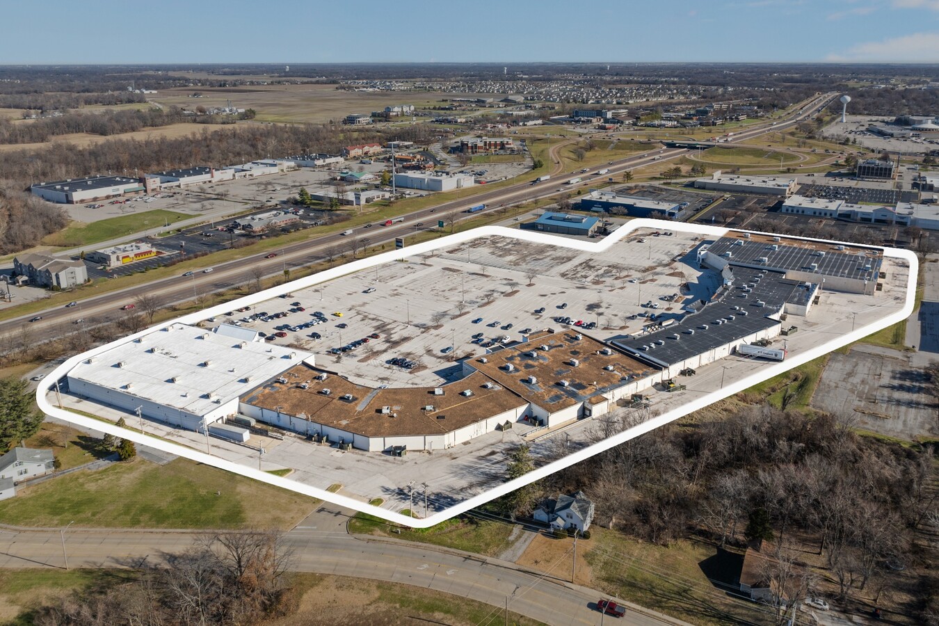
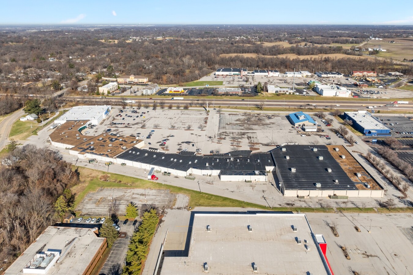
Property Record
17 Plaza Dr, Fairview Heights, IL 62208
Current Lease Availabilities
NEARBY LISTINGS FOR SALE OR LEASE
Property Detail
17 Plaza Dr
St. Louis
Caseyville Twp Sec 2
St. Louis, MO-IL
CASEYVILLE TWP SEC 28 LOT/SEC-28-SUBL/TWP-2N-BLK/RG-8W PT LOTS 2B, 3, 4, & 7 A02772427 TRACT 2B
03-28.0-200-046
St. Clair
Commercialnec
Illinois
2023
2b
2023
8.42 AC
503416
Metro East Illinois
102,687 SF
DEMOGRAPHICS near 17 Plaza Dr
1 Mile
3 Mile
5 Mile
2024 Total Population
3,014
30,123
107,137
2029 Population
2,886
28,980
103,915
Pop Growth 2024-2029
(4.25%)
(3.79%)
(3.01%)
Average Age
42
41
41
2024 Total Households
1,393
12,407
44,364
HH Growth 2024-2029
(4.16%)
(3.80%)
(3.01%)
Median Household Inc
$58,656
$86,022
$73,591
Avg Household Size
2.10
2.40
2.40
2024 Avg HH Vehicles
2.00
2.00
2.00
Median Home Value
$135,181
$185,172
$169,918
Median Year Built
1970
1986
1977
Nearby Places
- Restaurants
- Banks
- Shops
- Fitness
- Groceries
PUBLIC TRANSPORTATION
COMMUTER RAIL
Fairview Heights (Lambert Airport Shiloh-Scott - St. Louis MetroLink (MetroLink), Shrewsbury-Lansdowne I-44 Emerson Park - St. Louis MetroLink (MetroLink))
DRIVE
WALK
Distance
Fairview Heights (Lambert Airport Shiloh-Scott - St. Louis MetroLink (MetroLink), Shrewsbury-Lansdowne I-44 Emerson Park - St. Louis MetroLink (MetroLink))
8 min
3.8 mi
Memorial Hospital (Lambert Airport Shiloh-Scott - St. Louis MetroLink (MetroLink))
DRIVE
WALK
Distance
Memorial Hospital (Lambert Airport Shiloh-Scott - St. Louis MetroLink (MetroLink))
9 min
3.9 mi
AIRPORT
Scott AFB/Midamerica St Louis
DRIVE
WALK
Distance
Scott AFB/Midamerica St Louis
25 min
13.5 mi
St Louis Lambert International
DRIVE
WALK
Distance
St Louis Lambert International
38 min
26.4 mi
Freight Ports
Port Milwaukee
DRIVE
WALK
Distance
Port Milwaukee
413 min
363.2 mi
Nearby Properties
Address
Land Use
TOTAL SIZE
Lot Size
Zoning
Address
Land Use
TOTAL SIZE
Lot Size
Zoning
Address
Land Use
TOTAL SIZE
Lot Size
Zoning
2,484 SF
16.76 AC
Address
Land Use
TOTAL SIZE
Lot Size
Zoning
13,440 SF
14.07 AC
Address
Land Use
TOTAL SIZE
Lot Size
Zoning
207,910 SF
13.42 AC
Address
Land Use
TOTAL SIZE
Lot Size
Zoning
143,464 SF
10.78 AC
Address
Land Use
TOTAL SIZE
Lot Size
Zoning
5,772 SF
11.48 AC
Address
Land Use
TOTAL SIZE
Lot Size
Zoning
140,850 SF
16.71 AC
Address
Land Use
TOTAL SIZE
Lot Size
Zoning
142,369 SF
12.01 AC
Address
Land Use
TOTAL SIZE
Lot Size
Zoning
1,863 SF
11.46 AC
Address
Land Use
TOTAL SIZE
Lot Size
Zoning
127,251 SF
12.15 AC
Address
Land Use
TOTAL SIZE
Lot Size
Zoning
13,486 SF
12.67 AC
Address
Land Use
TOTAL SIZE
Lot Size
Zoning
113,880 SF
10.22 AC
Address
Land Use
TOTAL SIZE
Lot Size
Zoning
7,004 SF
9.59 AC
Address
Land Use
TOTAL SIZE
Lot Size
Zoning
7.82 AC
Address
Land Use
TOTAL SIZE
Lot Size
Zoning
15,888 SF
20.30 AC
Address
Land Use
TOTAL SIZE
Lot Size
Zoning
74,479 SF
5.96 AC
Address
Land Use
TOTAL SIZE
Lot Size
Zoning
Address
Land Use
TOTAL SIZE
Lot Size
Zoning
64,752 SF
5.57 AC
Address
Land Use
TOTAL SIZE
Lot Size
Zoning
10,014 SF
3.18 AC
Address
Land Use
TOTAL SIZE
Lot Size
Zoning
127,613 SF
10 AC
Address
Land Use
TOTAL SIZE
Lot Size
Zoning
45,378 SF
0.92 AC
Address
Land Use
TOTAL SIZE
Lot Size
Zoning
16,682 SF
2.48 AC
Address
Land Use
TOTAL SIZE
Lot Size
Zoning
6,974 SF
6.14 AC
Address
Land Use
TOTAL SIZE
Lot Size
Zoning
5,656 SF
8.65 AC
Address
Land Use
TOTAL SIZE
Lot Size
Zoning
11,005 SF
7.71 AC
Address
Land Use
TOTAL SIZE
Lot Size
Zoning
4,674 SF
9.31 AC
Address
Land Use
TOTAL SIZE
Lot Size
Zoning
49,386 SF
2.54 AC
Address
Land Use
TOTAL SIZE
Lot Size
Zoning
8,075 SF
5.56 AC
Address
Land Use
TOTAL SIZE
Lot Size
Zoning
17,705 SF
1.38 AC
Address
Land Use
TOTAL SIZE
Lot Size
Zoning
45,742 SF
8.57 AC
The World's #1 Commercial Real Estate Marketplace
Connect with us
© 2025 CoStar Group
The information above has been obtained from sources believed reliable. While we do not doubt its accuracy we have not verified it and make no guarantee, warranty or representation about it. It is your responsibility to independently confirm its accuracy and completeness. Any projections, opinions, assumptions, or estimates used are for example only and do not represent the current or future performance of the property. The value of this transaction to you depends on tax and other factors which should be evaluated by your tax, financial, and legal advisors. You and your advisors should conduct a careful, independent investigation of the property to determine to your satisfaction the suitability of the property for your needs.