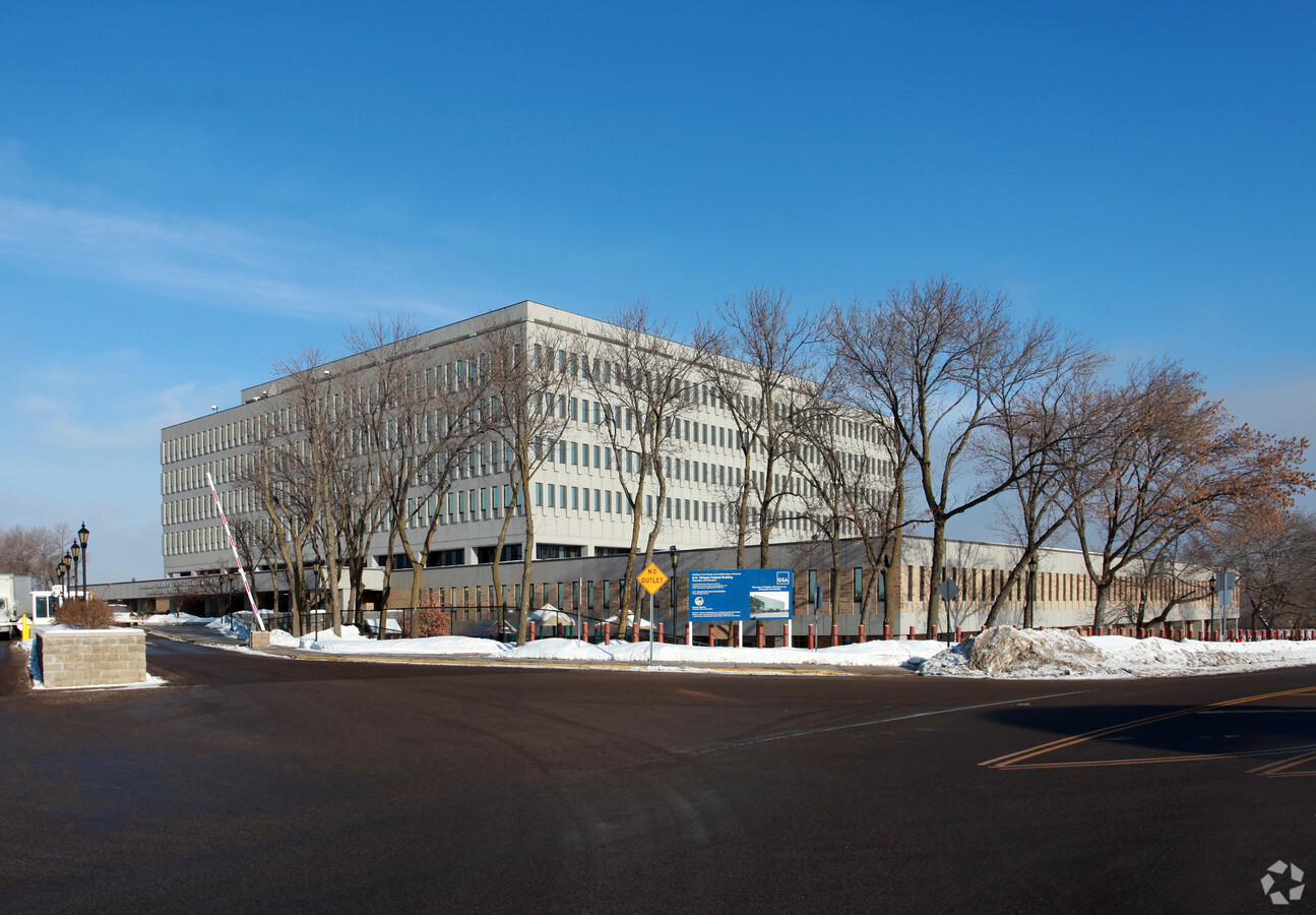
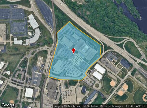
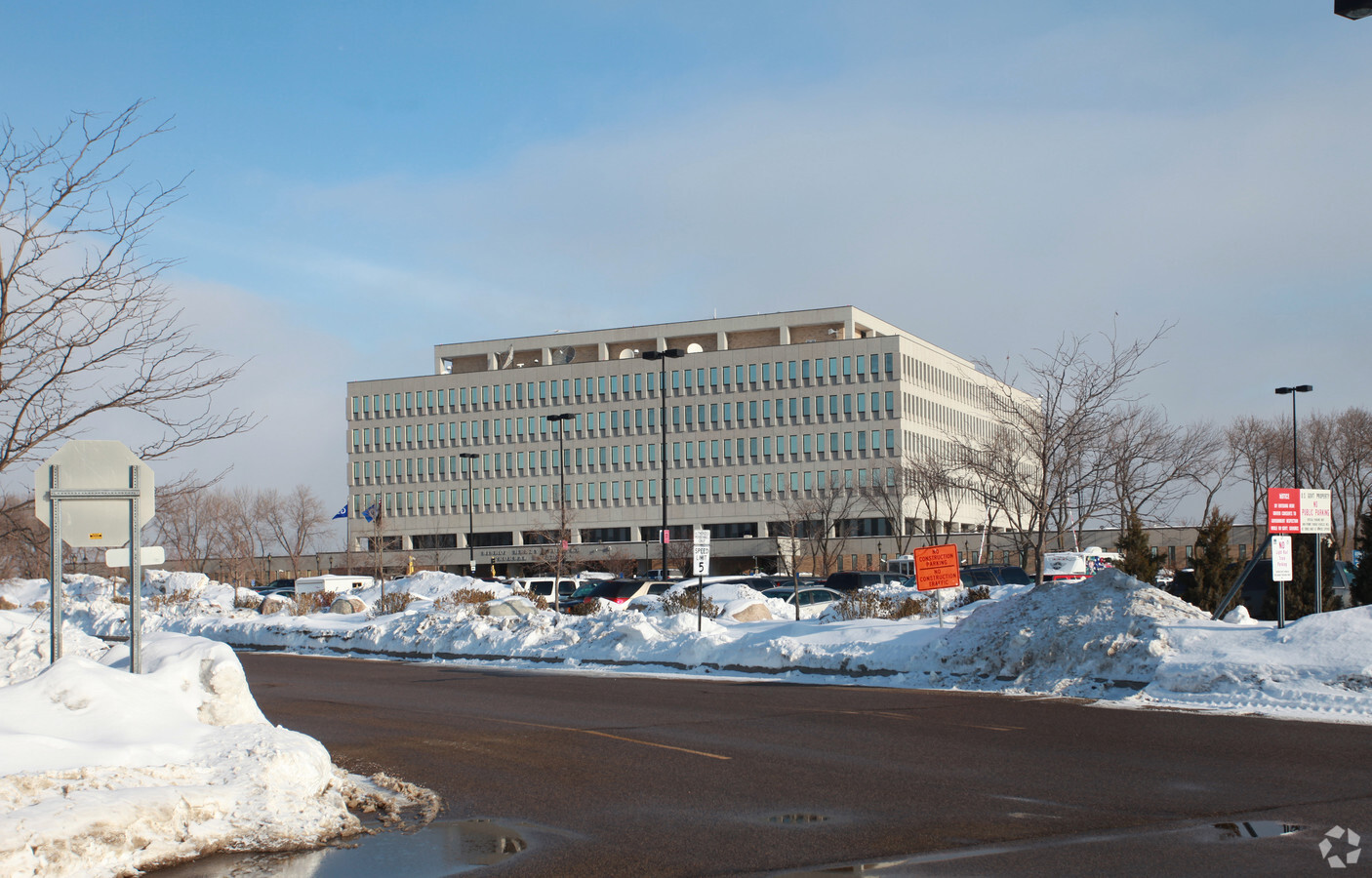
Property Record
1 Federal Dr, Fort Snelling, MN 55111
NEARBY LISTINGS FOR SALE OR LEASE
Property Detail
1 Federal Dr
Minneapolis-St. Paul-Bloomington, MN-WI
Unplatted 20 028 23
20-028-23-43-0009
A UNPLATTED 20 028 23 FORT SNELLING RESERVATION EMBRACED WITHIN SECTION 20, TOWNSHIP 28, RANGE 23; SEE DOC NOS 7278536 AND 9494189 FOR ADDITIONAL INFORMATION FOR THIS T IRREGULAR
Commercialnec
Hennepin
X
Minnesota
27053C0389F
24.60 AC
2023
I-494 Corridor
2023
Minneapolis/St Paul
9800001
DEMOGRAPHICS near 1 Federal Dr
1 Mile
3 Mile
5 Mile
2024 Total Population
3,936
70,998
285,114
2029 Population
3,854
69,873
280,893
Pop Growth 2024-2029
(2.08%)
(1.58%)
(1.48%)
Average Age
43
41
39
2024 Total Households
1,883
31,600
120,820
HH Growth 2024-2029
(2.44%)
(1.67%)
(1.59%)
Median Household Inc
$84,800
$86,234
$81,433
Avg Household Size
2.00
2.10
2.20
2024 Avg HH Vehicles
2.00
2.00
2.00
Median Home Value
$300,388
$352,061
$333,834
Median Year Built
1955
1953
1950
Nearby Places
- Restaurants
- Banks
- Shops
- Fitness
- Groceries
PUBLIC TRANSPORTATION
TRANSIT/SUBWAY
Fort Snelling Station (Hiawatha Line - Minneapolis-Saint Paul Metro Transit Light Rail)
DRIVE
WALK
Distance
Fort Snelling Station (Hiawatha Line - Minneapolis-Saint Paul Metro Transit Light Rail)
1 min
4 min
0.2 mi
COMMUTER RAIL
St. Paul-Minneapolis (Empire Builder - Amtrak)
DRIVE
WALK
Distance
St. Paul-Minneapolis (Empire Builder - Amtrak)
12 min
7.7 mi
Target Field Station (Northstar Corridor - Northstar Commuter Rail)
DRIVE
WALK
Distance
Target Field Station (Northstar Corridor - Northstar Commuter Rail)
18 min
8.2 mi
AIRPORT
Minneapolis-St Paul International/Wold-Chamberlain
DRIVE
WALK
Distance
Minneapolis-St Paul International/Wold-Chamberlain
7 min
3.1 mi
Freight Ports
Port Milwaukee
DRIVE
WALK
Distance
Port Milwaukee
372 min
336.4 mi
Nearby Properties
Address
Land Use
TOTAL SIZE
Lot Size
Zoning
Address
Land Use
TOTAL SIZE
Lot Size
Zoning
504,049 SF
75.43 AC
Address
Land Use
TOTAL SIZE
Lot Size
Zoning
4.26 AC
Address
Land Use
TOTAL SIZE
Lot Size
Zoning
3.86 AC
Address
Land Use
TOTAL SIZE
Lot Size
Zoning
2.65 AC
Address
Land Use
TOTAL SIZE
Lot Size
Zoning
267,530 SF
28.60 AC
Address
Land Use
TOTAL SIZE
Lot Size
Zoning
429,720 SF
6.02 AC
Address
Land Use
TOTAL SIZE
Lot Size
Zoning
378,880 SF
3.42 AC
Address
Land Use
TOTAL SIZE
Lot Size
Zoning
173.22 AC
Address
Land Use
TOTAL SIZE
Lot Size
Zoning
387,902 SF
14.81 AC
Address
Land Use
TOTAL SIZE
Lot Size
Zoning
Address
Land Use
TOTAL SIZE
Lot Size
Zoning
Address
Land Use
TOTAL SIZE
Lot Size
Zoning
33,246 SF
5.16 AC
Address
Land Use
TOTAL SIZE
Lot Size
Zoning
437,524 SF
6.11 AC
Address
Land Use
TOTAL SIZE
Lot Size
Zoning
Address
Land Use
TOTAL SIZE
Lot Size
Zoning
Address
Land Use
TOTAL SIZE
Lot Size
Zoning
233,588 SF
2.22 AC
Address
Land Use
TOTAL SIZE
Lot Size
Zoning
288,834 SF
1.72 AC
Address
Land Use
TOTAL SIZE
Lot Size
Zoning
165,618 SF
12.37 AC
Address
Land Use
TOTAL SIZE
Lot Size
Zoning
Address
Land Use
TOTAL SIZE
Lot Size
Zoning
116,318 SF
0.83 AC
Address
Land Use
TOTAL SIZE
Lot Size
Zoning
2.49 AC
Address
Land Use
TOTAL SIZE
Lot Size
Zoning
47,397 SF
6.78 AC
Address
Land Use
TOTAL SIZE
Lot Size
Zoning
266,623 SF
2.61 AC
R5
Address
Land Use
TOTAL SIZE
Lot Size
Zoning
471,035 SF
16.28 AC
Address
Land Use
TOTAL SIZE
Lot Size
Zoning
207,621 SF
1.65 AC
Address
Land Use
TOTAL SIZE
Lot Size
Zoning
185,066 SF
1.26 AC
C3A
Address
Land Use
TOTAL SIZE
Lot Size
Zoning
Address
Land Use
TOTAL SIZE
Lot Size
Zoning
Address
Land Use
TOTAL SIZE
Lot Size
Zoning
34,152 SF
6.11 AC
Address
Land Use
TOTAL SIZE
Lot Size
Zoning
2.18 AC
The World's #1 Commercial Real Estate Marketplace
Connect with us
© 2025 CoStar Group
The information above has been obtained from sources believed reliable. While we do not doubt its accuracy we have not verified it and make no guarantee, warranty or representation about it. It is your responsibility to independently confirm its accuracy and completeness. Any projections, opinions, assumptions, or estimates used are for example only and do not represent the current or future performance of the property. The value of this transaction to you depends on tax and other factors which should be evaluated by your tax, financial, and legal advisors. You and your advisors should conduct a careful, independent investigation of the property to determine to your satisfaction the suitability of the property for your needs.