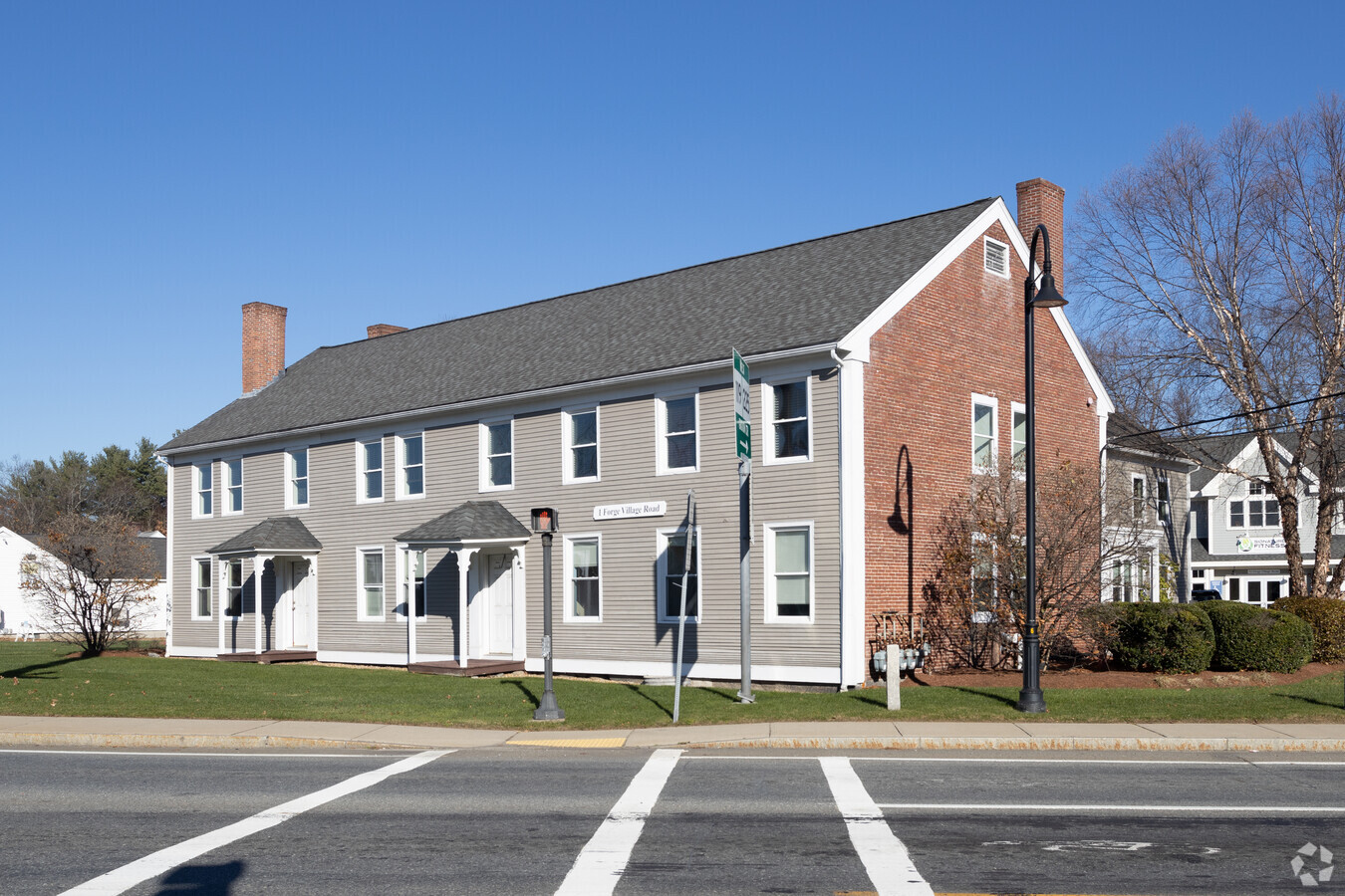
Property Record
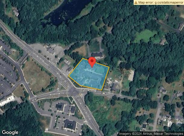
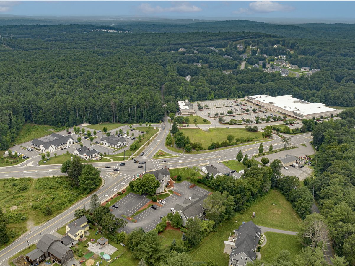
1 Forge Village Rd, Groton, MA 01450
NEARBY LISTINGS FOR SALE OR LEASE
Property Detail
1 Forge Village Rd
GROT-000133-000011
Middlesex
Commercialnec
Massachusetts
X
1.70 AC
25027C0325E
Groton/Townsend
2024
Boston
2024
Boston-Cambridge-Newton, MA-NH
326102
DEMOGRAPHICS near 1 Forge Village Rd
1 Mile
3 Mile
5 Mile
2024 Total Population
1,612
16,109
43,911
2029 Population
1,586
16,037
43,625
Pop Growth 2024-2029
(1.61%)
(0.45%)
(0.65%)
Average Age
42
41
42
2024 Total Households
588
6,003
16,198
HH Growth 2024-2029
(1.70%)
(0.47%)
(0.72%)
Median Household Inc
$199,201
$155,161
$146,189
Avg Household Size
2.70
2.70
2.60
2024 Avg HH Vehicles
2.00
2.00
2.00
Median Home Value
$669,811
$585,213
$603,865
Median Year Built
1978
1982
1981
Nearby Places
- Restaurants
- Banks
- Shops
- Fitness
- Groceries
PUBLIC TRANSPORTATION
COMMUTER RAIL
Ayer (Fitchburg/South Acton Line - Massachusetts Bay Transportation Authority Commuter Rail (Purple Line))
Drive
Walk
Distance
Ayer (Fitchburg/South Acton Line - Massachusetts Bay Transportation Authority Commuter Rail (Purple Line))
11 min
4.6 mi
Littleton/Route 495 (Fitchburg/South Acton Line - Massachusetts Bay Transportation Authority Commuter Rail (Purple Line))
Drive
Walk
Distance
Littleton/Route 495 (Fitchburg/South Acton Line - Massachusetts Bay Transportation Authority Commuter Rail (Purple Line))
12 min
6.0 mi
AIRPORT
Manchester Boston Regional
Drive
Walk
Distance
Manchester Boston Regional
50 min
32.2 mi
Worcester Regional
Drive
Walk
Distance
Worcester Regional
51 min
36.8 mi
Freight Ports
Port of Boston
Drive
Walk
Distance
Port of Boston
57 min
34.8 mi
SALE & LEASE HISTORY
LISTING DATE
SALE/LEASE

Oct 27, 2023
For Lease
Jun 09, 2021
For Lease
Jun 09, 2021
For Sale
Jul 18, 2018
For Lease
Feb 05, 2019
For Lease
Nearby Properties
Address
Land Use
TOTAL SIZE
Lot Size
Zoning
Address
Land Use
TOTAL SIZE
Lot Size
Zoning
448759
51.82 AC
IA
Address
Land Use
TOTAL SIZE
Lot Size
Zoning
480900
69.04 AC
IA
Address
Land Use
TOTAL SIZE
Lot Size
Zoning
279042
37.90 AC
RA
Address
Land Use
TOTAL SIZE
Lot Size
Zoning
374270
62.74 AC
IA
Address
Land Use
TOTAL SIZE
Lot Size
Zoning
51888
57.38 AC
LI
Address
Land Use
TOTAL SIZE
Lot Size
Zoning
171661
5.46 AC
IB
Address
Land Use
TOTAL SIZE
Lot Size
Zoning
125160
29.36 AC
R
Address
Land Use
TOTAL SIZE
Lot Size
Zoning
109556
85.62 AC
RA
Address
Land Use
TOTAL SIZE
Lot Size
Zoning
39860
20 AC
Address
Land Use
TOTAL SIZE
Lot Size
Zoning
125642
5.77 AC
IB
Address
Land Use
TOTAL SIZE
Lot Size
Zoning
105559
35.45 AC
A1
Address
Land Use
TOTAL SIZE
Lot Size
Zoning
343400
20 AC
LI
Address
Land Use
TOTAL SIZE
Lot Size
Zoning
213950
22.71 AC
I
Address
Land Use
TOTAL SIZE
Lot Size
Zoning
16.44 AC
IA
Address
Land Use
TOTAL SIZE
Lot Size
Zoning
293250
60.10 AC
LI
Address
Land Use
TOTAL SIZE
Lot Size
Zoning
63420
40.10 AC
RA
Address
Land Use
TOTAL SIZE
Lot Size
Zoning
6.50 AC
RA
Address
Land Use
TOTAL SIZE
Lot Size
Zoning
672
183.18 AC
IA
Address
Land Use
TOTAL SIZE
Lot Size
Zoning
44417
2.29 AC
RA
Address
Land Use
TOTAL SIZE
Lot Size
Zoning
58738
183.84 AC
RA
Address
Land Use
TOTAL SIZE
Lot Size
Zoning
65680
7.59 AC
IA
Address
Land Use
TOTAL SIZE
Lot Size
Zoning
62860
9.97 AC
IA
Address
Land Use
TOTAL SIZE
Lot Size
Zoning
16.22 AC
IA
Address
Land Use
TOTAL SIZE
Lot Size
Zoning
94159
13.31 AC
I
Address
Land Use
TOTAL SIZE
Lot Size
Zoning
12074
6.39 AC
R
Address
Land Use
TOTAL SIZE
Lot Size
Zoning
57152
20.30 AC
A2
Address
Land Use
TOTAL SIZE
Lot Size
Zoning
96036
9.82 AC
I
Address
Land Use
TOTAL SIZE
Lot Size
Zoning
107452
5.35 AC
I
Address
Land Use
TOTAL SIZE
Lot Size
Zoning
17.25 AC
IA
Address
Land Use
TOTAL SIZE
Lot Size
Zoning
133239
12.12 AC
I
Start a new search to find other properties for sale or lease
Connect with us
© 2024 CoStar Group
The information above has been obtained from sources believed reliable. While we do not doubt its accuracy we have not verified it and make no guarantee, warranty or representation about it. It is your responsibility to independently confirm its accuracy and completeness. Any projections, opinions, assumptions, or estimates used are for example only and do not represent the current or future performance of the property. The value of this transaction to you depends on tax and other factors which should be evaluated by your tax, financial, and legal advisors. You and your advisors should conduct a careful, independent investigation of the property to determine to your satisfaction the suitability of the property for your needs.