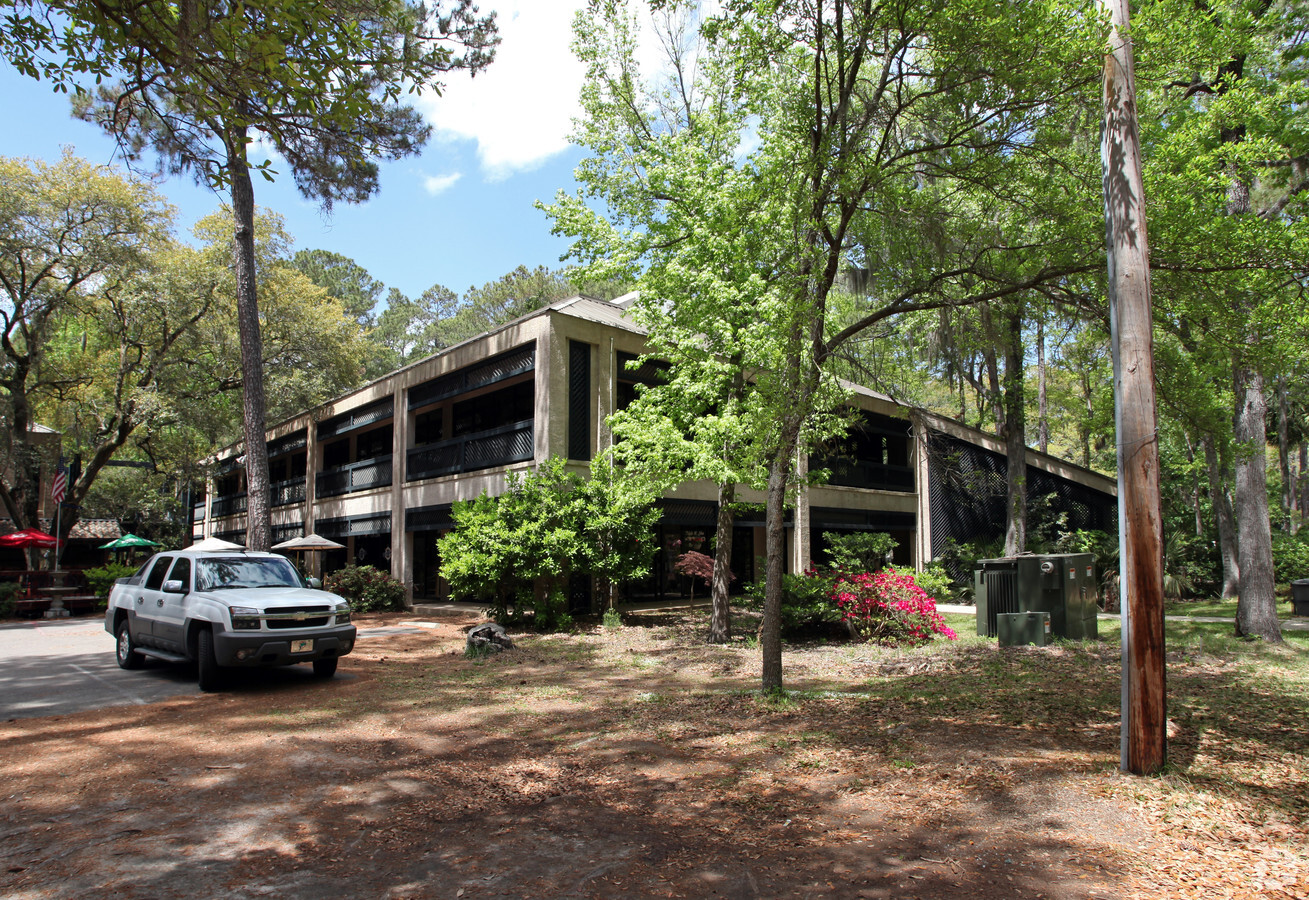
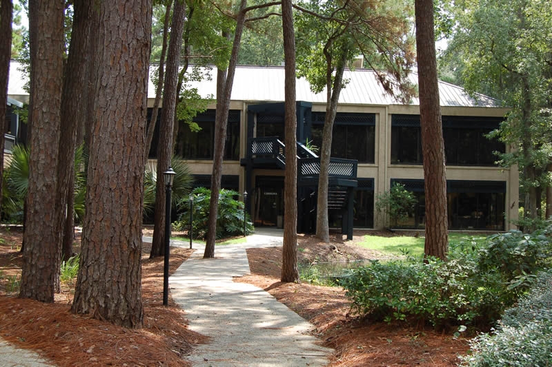
Property Record
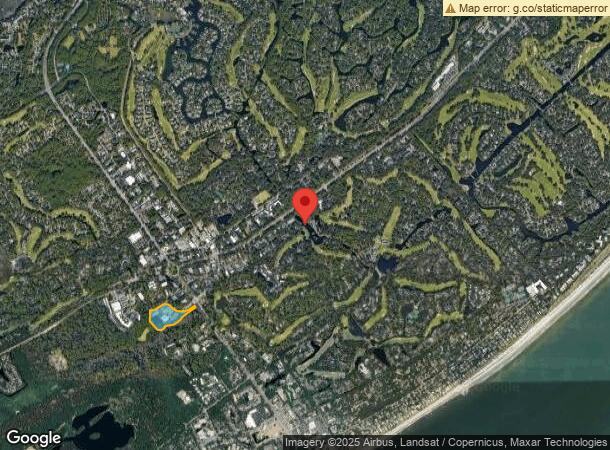
1 Sand Shark Dr, Hilton Head Island, SC 29928

NEARBY LISTINGS FOR SALE OR LEASE
Property Detail
1 Sand Shark Dr
Hilton Head Island-Bluffton-Beaufort, SC
Palmetto Bay Road Area Commer
R552-015-000-0154-0000
PAR 154 OFFICE PARK FKA PAR D SEA PINES OFFICE PARK 08-10-1978 DB02681538 *SPLIT
Officebuilding
Beaufort
2024
South Carolina
2024
9.55 AC
010300
Hilton Head/Beaufort
14,400 SF
Other Market Areas
DEMOGRAPHICS near 1 Sand Shark Dr
1 Mile
3 Mile
5 Mile
2024 Total Population
6,025
23,501
35,758
2029 Population
7,319
27,989
42,289
Pop Growth 2024-2029
+ 21.48%
+ 19.10%
+ 18.26%
Average Age
54
56
55
2024 Total Households
3,249
11,651
17,137
HH Growth 2024-2029
+ 21.27%
+ 18.95%
+ 18.28%
Median Household Inc
$64,389
$82,868
$87,232
Avg Household Size
1.80
1.90
2.00
2024 Avg HH Vehicles
1.00
2.00
2.00
Median Home Value
$388,003
$611,079
$621,491
Median Year Built
1985
1986
1988
Nearby Places
- Restaurants
- Banks
- Shops
- Fitness
- Groceries
PUBLIC TRANSPORTATION
AIRPORT
Hilton Head
DRIVE
WALK
Distance
Hilton Head
11 min
6.6 mi
Savannah/Hilton Head International
DRIVE
WALK
Distance
Savannah/Hilton Head International
67 min
48.0 mi
Freight Ports
Georgia Ports - Savannah
DRIVE
WALK
Distance
Georgia Ports - Savannah
63 min
46.3 mi
Nearby Properties
Address
Land Use
TOTAL SIZE
Lot Size
Zoning
Address
Land Use
TOTAL SIZE
Lot Size
Zoning
381,700 SF
13.78 AC
6615
Address
Land Use
TOTAL SIZE
Lot Size
Zoning
99,058 SF
30.34 AC
6615
Address
Land Use
TOTAL SIZE
Lot Size
Zoning
196,750 SF
13.58 AC
6615
Address
Land Use
TOTAL SIZE
Lot Size
Zoning
272,442 SF
7.80 AC
6615
Address
Land Use
TOTAL SIZE
Lot Size
Zoning
3,400 SF
4.97 AC
Address
Land Use
TOTAL SIZE
Lot Size
Zoning
313,171 SF
4.45 AC
Address
Land Use
TOTAL SIZE
Lot Size
Zoning
80,867 SF
11.29 AC
6615
Address
Land Use
TOTAL SIZE
Lot Size
Zoning
108,590 SF
13.37 AC
6615
Address
Land Use
TOTAL SIZE
Lot Size
Zoning
21,861 SF
159.29 AC
6615
Address
Land Use
TOTAL SIZE
Lot Size
Zoning
4,854 SF
8.63 AC
6615
Address
Land Use
TOTAL SIZE
Lot Size
Zoning
8,480 SF
7.53 AC
6615
Address
Land Use
TOTAL SIZE
Lot Size
Zoning
280 SF
93.12 AC
6615
Address
Land Use
TOTAL SIZE
Lot Size
Zoning
18,901 SF
4.28 AC
6615
Address
Land Use
TOTAL SIZE
Lot Size
Zoning
12,539 SF
238.29 AC
6615
Address
Land Use
TOTAL SIZE
Lot Size
Zoning
92,759 SF
5.45 AC
6615
Address
Land Use
TOTAL SIZE
Lot Size
Zoning
7,242 SF
1.69 AC
6115
Address
Land Use
TOTAL SIZE
Lot Size
Zoning
35,951 SF
3.76 AC
6615
Address
Land Use
TOTAL SIZE
Lot Size
Zoning
64,408 SF
6.91 AC
6615
Address
Land Use
TOTAL SIZE
Lot Size
Zoning
5,500 SF
10.80 AC
6605
Address
Land Use
TOTAL SIZE
Lot Size
Zoning
4,176 SF
8.07 AC
6615
Address
Land Use
TOTAL SIZE
Lot Size
Zoning
26,412 SF
8 AC
6615
Address
Land Use
TOTAL SIZE
Lot Size
Zoning
17,262 SF
4.60 AC
6615
Address
Land Use
TOTAL SIZE
Lot Size
Zoning
29,592 SF
5 AC
6615
Address
Land Use
TOTAL SIZE
Lot Size
Zoning
8,918 SF
184.69 AC
6815
Address
Land Use
TOTAL SIZE
Lot Size
Zoning
20,329 SF
19.67 AC
6615
Address
Land Use
TOTAL SIZE
Lot Size
Zoning
15,393 SF
142.02 AC
6615
Address
Land Use
TOTAL SIZE
Lot Size
Zoning
33,216 SF
1.67 AC
6605
Address
Land Use
TOTAL SIZE
Lot Size
Zoning
43,191 SF
6.39 AC
6615
Address
Land Use
TOTAL SIZE
Lot Size
Zoning
5,000 SF
2.07 AC
6615
The World's #1 Commercial Real Estate Marketplace
Connect with us
© 2025 CoStar Group
The information above has been obtained from sources believed reliable. While we do not doubt its accuracy we have not verified it and make no guarantee, warranty or representation about it. It is your responsibility to independently confirm its accuracy and completeness. Any projections, opinions, assumptions, or estimates used are for example only and do not represent the current or future performance of the property. The value of this transaction to you depends on tax and other factors which should be evaluated by your tax, financial, and legal advisors. You and your advisors should conduct a careful, independent investigation of the property to determine to your satisfaction the suitability of the property for your needs.