Property Record
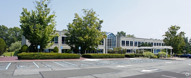
1 Theall Rd, Rye, NY 10580


Property Detail
1 Theall Rd
1400-146-013-00001-000-0006
WESTCHESTER
Officebuilding
New York
B4
6.000
B and X Area of moderate flood hazard, usually the area between the limits of the 100-year and 500-year floods.
7 AC
2025
East I-287 Corridor
2025
Westchester/So Connecticut
007500
New York-Jersey City-White Plains, NY-NJ
1,512 SF
NEARBY LISTINGS FOR SALE OR LEASE
DEMOGRAPHICS near 1 Theall Rd
1 mile
3 mile
5 mile
2025 Total Population
13,401
77,618
175,094
2030 Population
13,602
77,176
176,164
Pop Growth 2025-2030
+ 1.50%
(0.57%)
+ 0.61%
Average Age
41
41
41
2025 Total Households
4,821
26,977
60,550
HH Growth 2025-2030
+ 1.68%
(0.53%)
+ 0.65%
Median Household Inc
$161,640
$139,472
$161,128
Avg Household Size
2.70
2.80
2.70
2025 Avg HH Vehicles
2.00
2.00
2.00
Median Home Value
$1,059,869
$907,168
$940,596
Median Year Built
1962
1957
1956
Nearby Places
Map Layers
Map Styles
 Street
 Aerial
Layers
 Traffic
 Biking
Places
Listings with unknown addresses are not visible on the map
- Restaurants
- Banks
- Shops
- Fitness
- Groceries
PUBLIC TRANSPORTATION
COMMUTER RAIL
Harrison Station (New Haven Line - Metro-North Commuter Railroad Company (Metro-North))
Drive
Walk
Distance
Harrison Station (New Haven Line - Metro-North Commuter Railroad Company (Metro-North))
5 min
1.4 mi
Rye Station (New Haven Line - Metro-North Commuter Railroad Company (Metro-North))
Drive
Walk
Distance
Rye Station (New Haven Line - Metro-North Commuter Railroad Company (Metro-North))
5 min
1.6 mi
AIRPORT
Westchester County
Drive
Walk
Distance
Westchester County
19 min
12.1 mi
LaGuardia
Drive
Walk
Distance
LaGuardia
38 min
22.7 mi
John F Kennedy International
Drive
Walk
Distance
John F Kennedy International
44 min
30.2 mi
Freight Ports
NY - Red Hook Container Terminal
Drive
Walk
Distance
NY - Red Hook Container Terminal
53 min
33.2 mi
Nearby Properties
Address
Land Use
TOTAL SIZE
Lot Size
Zoning
Address
Land Use
TOTAL SIZE
Lot Size
Zoning
5COMMUND
Address
Land Use
TOTAL SIZE
Lot Size
Zoning
Address
Land Use
TOTAL SIZE
Lot Size
Zoning
277,172 SF
29.98 AC
CD COMM
Address
Land Use
TOTAL SIZE
Lot Size
Zoning
0.01 AC
5COMMUND
Address
Land Use
TOTAL SIZE
Lot Size
Zoning
5COMMUND
Address
Land Use
TOTAL SIZE
Lot Size
Zoning
345,927 SF
4.32 AC
MUR WTRFR
Address
Land Use
TOTAL SIZE
Lot Size
Zoning
125,010 SF
4.02 AC
Address
Land Use
TOTAL SIZE
Lot Size
Zoning
556,297 SF
25.31 AC
05 - COMME
Address
Land Use
TOTAL SIZE
Lot Size
Zoning
5COMMUND
Address
Land Use
TOTAL SIZE
Lot Size
Zoning
5COMMUND
Address
Land Use
TOTAL SIZE
Lot Size
Zoning
21.33 AC
Address
Land Use
TOTAL SIZE
Lot Size
Zoning
143,372 SF
24.05 AC
OB-2 OFFC
Address
Land Use
TOTAL SIZE
Lot Size
Zoning
84,747 SF
8.64 AC
C1-P RTAIL
Address
Land Use
TOTAL SIZE
Lot Size
Zoning
188.31 AC
Address
Land Use
TOTAL SIZE
Lot Size
Zoning
135,380 SF
7.32 AC
MUR WTRFR
Address
Land Use
TOTAL SIZE
Lot Size
Zoning
67.51 AC
Address
Land Use
TOTAL SIZE
Lot Size
Zoning
9.30 AC
M2 INDUST
Address
Land Use
TOTAL SIZE
Lot Size
Zoning
1,056 SF
42.50 AC
PB
Address
Land Use
TOTAL SIZE
Lot Size
Zoning
108,367 SF
5.57 AC
AA1
Address
Land Use
TOTAL SIZE
Lot Size
Zoning
122,386 SF
1.39 AC
DW2 WTRFR
Address
Land Use
TOTAL SIZE
Lot Size
Zoning
65,659 SF
7.72 AC
R-6
Address
Land Use
TOTAL SIZE
Lot Size
Zoning
101,657 SF
1.14 AC
C2 COMM
Address
Land Use
TOTAL SIZE
Lot Size
Zoning
171,925 SF
6.21 AC
M2 INDUST
Address
Land Use
TOTAL SIZE
Lot Size
Zoning
6.31 AC
R-5 SFR
Address
Land Use
TOTAL SIZE
Lot Size
Zoning
37,187 SF
2.62 AC
Address
Land Use
TOTAL SIZE
Lot Size
Zoning
75,598 SF
0.54 AC
MUR WTRFR
Address
Land Use
TOTAL SIZE
Lot Size
Zoning
10.10 AC
RA-1
Address
Land Use
TOTAL SIZE
Lot Size
Zoning
109,212 SF
1.80 AC
CD COMM
Address
Land Use
TOTAL SIZE
Lot Size
Zoning
88,900 SF
0.51 AC
MUR WTRFR
Address
Land Use
TOTAL SIZE
Lot Size
Zoning
5COMMUND
The World's #1 Commercial Real Estate Marketplace
Connect with us
© 2026 CoStar Group
The information above has been obtained from sources believed reliable. While we do not doubt its accuracy we have not verified it and make no guarantee, warranty or representation about it. It is your responsibility to independently confirm its accuracy and completeness. Any projections, opinions, assumptions, or estimates used are for example only and do not represent the current or future performance of the property. The value of this transaction to you depends on tax and other factors which should be evaluated by your tax, financial, and legal advisors. You and your advisors should conduct a careful, independent investigation of the property to determine to your satisfaction the suitability of the property for your needs.