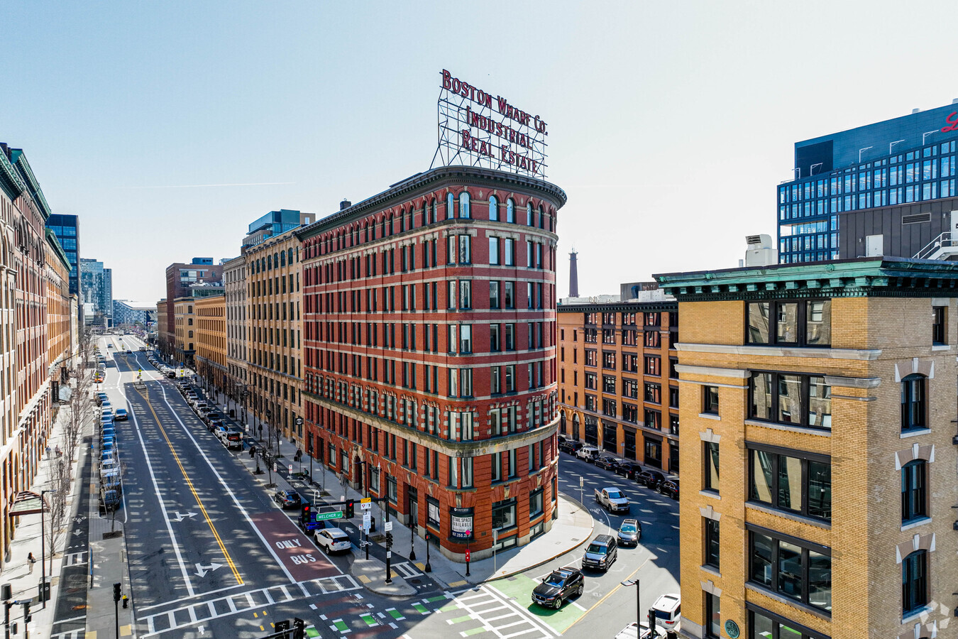
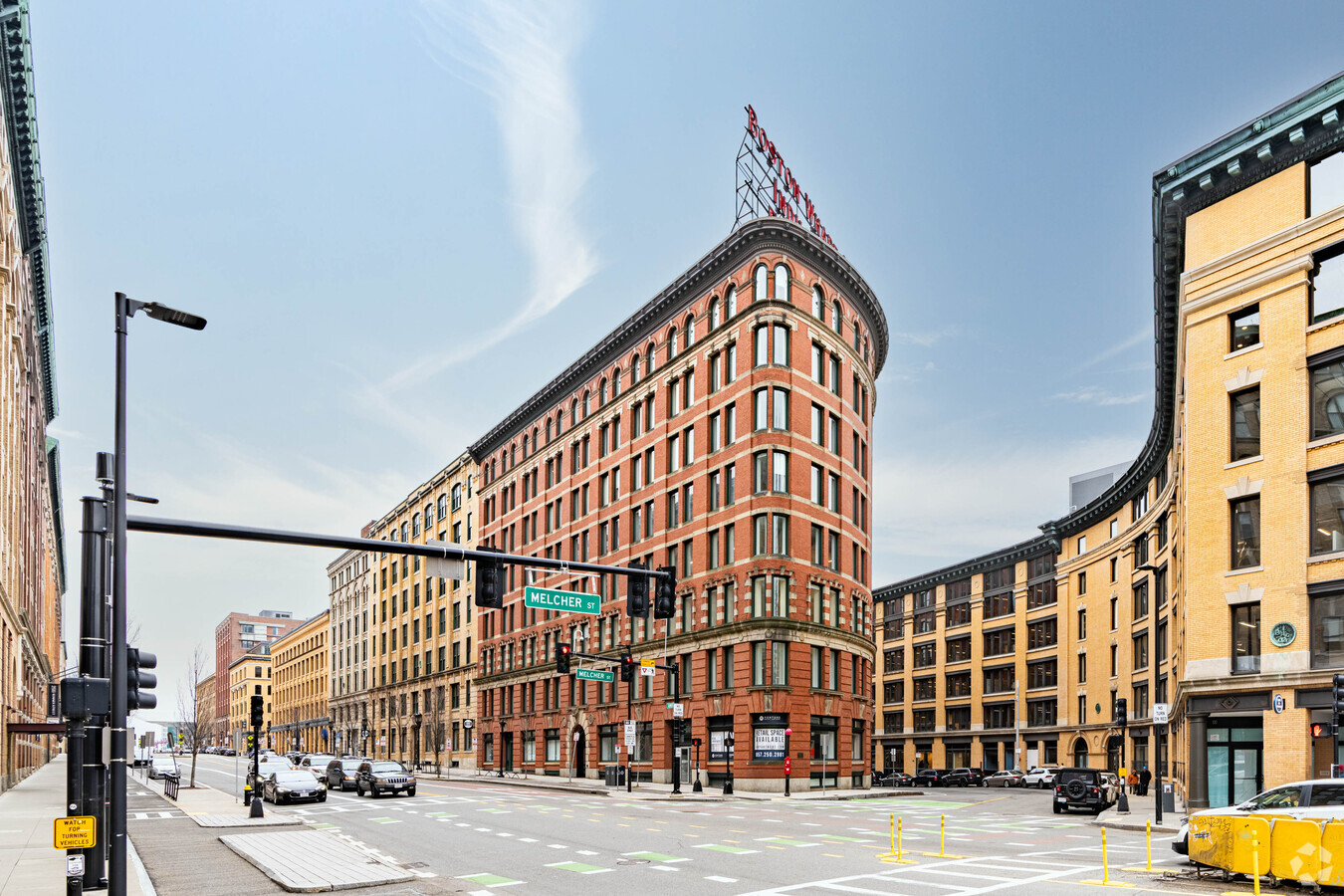
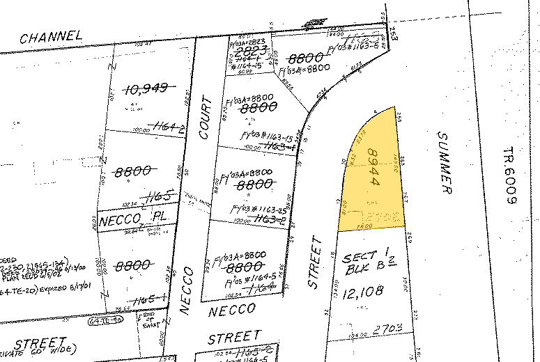
Property Record
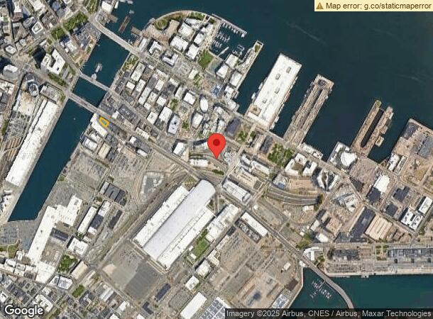
10 Melcher St, Boston, MA 02210
Current Lease Availabilities
NEARBY LISTINGS FOR SALE OR LEASE
-
-
-
-
-
-
-
-
-
-
-
-
-
-
-
-
-
-
-
-
No Photo
-
-
View all Boston listings for lease on LoopNet.com
Property Detail
10 Melcher St
SBOS-000000-000006-002702
Boston Prcl 14
Officebuilding
Suffolk
X
Massachusetts
25025C0081J
0.21 AC
2024
Seaport
2024
Boston
060603
Boston-Cambridge-Newton, MA-NH
60,616 SF
DEMOGRAPHICS near 10 Melcher St
1 Mile
3 Mile
5 Mile
2024 Total Population
52,628
380,691
873,440
2029 Population
51,566
367,102
839,595
Pop Growth 2024-2029
(2.02%)
(3.57%)
(3.87%)
Average Age
39
36
37
2024 Total Households
26,253
164,226
361,569
HH Growth 2024-2029
(2.07%)
(3.79%)
(4.04%)
Median Household Inc
$128,465
$89,513
$87,935
Avg Household Size
1.80
2.00
2.20
2024 Avg HH Vehicles
1.00
1.00
1.00
Median Home Value
$953,299
$833,896
$778,540
Median Year Built
2001
1954
1949
Nearby Places
- Restaurants
- Banks
- Shops
- Fitness
- Groceries
PUBLIC TRANSPORTATION
TRANSIT/SUBWAY
South Station (Red Line - Massachusetts Bay Transportation Authority Subway (The T), Silver Line 1 - Massachusetts Bay Transportation Authority Subway (The T), Silver Line 2 - Massachusetts Bay Transportation Authority Subway (The T))
DRIVE
WALK
Distance
South Station (Red Line - Massachusetts Bay Transportation Authority Subway (The T), Silver Line 1 - Massachusetts Bay Transportation Authority Subway (The T), Silver Line 2 - Massachusetts Bay Transportation Authority Subway (The T))
7 min
15 min
0.8 mi
COMMUTER RAIL
South Station (Fairmount Line - Massachusetts Bay Transportation Authority Commuter Rail (Purple Line), Framingham/Worcester Line - Massachusetts Bay Transportation Authority Commuter Rail (Purple Line), Franklin Line - Massachusetts Bay Transportation Authority Commuter Rail (Purple Line), Greenbush Line - Massachusetts Bay Transportation Authority Commuter Rail (Purple Line), Kingston/Plymouth Line - Massachusetts Bay Transportation Authority Commuter Rail (Purple Line), Middleborough/Lakeville Line - Massachusetts Bay Transportation Authority Commuter Rail (Purple Line), Needham Line - Massachusetts Bay Transportation Authority Commuter Rail (Purple Line), Providence/Stoughton Line - Massachusetts Bay Transportation Authority Commuter Rail (Purple Line))
DRIVE
WALK
Distance
South Station (Fairmount Line - Massachusetts Bay Transportation Authority Commuter Rail (Purple Line), Framingham/Worcester Line - Massachusetts Bay Transportation Authority Commuter Rail (Purple Line), Franklin Line - Massachusetts Bay Transportation Authority Commuter Rail (Purple Line), Greenbush Line - Massachusetts Bay Transportation Authority Commuter Rail (Purple Line), Kingston/Plymouth Line - Massachusetts Bay Transportation Authority Commuter Rail (Purple Line), Middleborough/Lakeville Line - Massachusetts Bay Transportation Authority Commuter Rail (Purple Line), Needham Line - Massachusetts Bay Transportation Authority Commuter Rail (Purple Line), Providence/Stoughton Line - Massachusetts Bay Transportation Authority Commuter Rail (Purple Line))
6 min
15 min
0.8 mi
North Station (Fitchburg/South Acton Line - Massachusetts Bay Transportation Authority Commuter Rail (Purple Line), Haverhill Line - Massachusetts Bay Transportation Authority Commuter Rail (Purple Line), Lowell Line - Massachusetts Bay Transportation Authority Commuter Rail (Purple Line), Newburyport/Rockport Line - Massachusetts Bay Transportation Authority Commuter Rail (Purple Line))
DRIVE
WALK
Distance
North Station (Fitchburg/South Acton Line - Massachusetts Bay Transportation Authority Commuter Rail (Purple Line), Haverhill Line - Massachusetts Bay Transportation Authority Commuter Rail (Purple Line), Lowell Line - Massachusetts Bay Transportation Authority Commuter Rail (Purple Line), Newburyport/Rockport Line - Massachusetts Bay Transportation Authority Commuter Rail (Purple Line))
6 min
2.5 mi
AIRPORT
General Edward Lawrence Logan International
DRIVE
WALK
Distance
General Edward Lawrence Logan International
12 min
5.3 mi
Freight Ports
Port of Boston
DRIVE
WALK
Distance
Port of Boston
11 min
4.8 mi
Nearby Properties
Address
Land Use
TOTAL SIZE
Lot Size
Zoning
Address
Land Use
TOTAL SIZE
Lot Size
Zoning
909,764 SF
25.13 AC
E
Address
Land Use
TOTAL SIZE
Lot Size
Zoning
610,560 SF
4 AC
E
Address
Land Use
TOTAL SIZE
Lot Size
Zoning
707,000 SF
1.60 AC
C
Address
Land Use
TOTAL SIZE
Lot Size
Zoning
2.79 AC
Address
Land Use
TOTAL SIZE
Lot Size
Zoning
825,000 SF
5.17 AC
E
Address
Land Use
TOTAL SIZE
Lot Size
Zoning
488,832 SF
1.38 AC
BB
Address
Land Use
TOTAL SIZE
Lot Size
Zoning
469,670 SF
7.60 AC
C
Address
Land Use
TOTAL SIZE
Lot Size
Zoning
230,394 SF
0.60 AC
MXD
Address
Land Use
TOTAL SIZE
Lot Size
Zoning
448,796 SF
1.84 AC
C
Address
Land Use
TOTAL SIZE
Lot Size
Zoning
342,300 SF
1.04 AC
C
Address
Land Use
TOTAL SIZE
Lot Size
Zoning
239,377 SF
0.71 AC
MXD
Address
Land Use
TOTAL SIZE
Lot Size
Zoning
114,000 SF
1.20 AC
RC
Address
Land Use
TOTAL SIZE
Lot Size
Zoning
46,259 SF
1.04 AC
E
Address
Land Use
TOTAL SIZE
Lot Size
Zoning
379,172 SF
1.04 AC
RC
Address
Land Use
TOTAL SIZE
Lot Size
Zoning
1.13 AC
C
Address
Land Use
TOTAL SIZE
Lot Size
Zoning
408,667 SF
3.27 AC
C
Address
Land Use
TOTAL SIZE
Lot Size
Zoning
157,083 SF
0.41 AC
C
Address
Land Use
TOTAL SIZE
Lot Size
Zoning
227,107 SF
7.70 AC
E
Address
Land Use
TOTAL SIZE
Lot Size
Zoning
334,522 SF
1.26 AC
C
Address
Land Use
TOTAL SIZE
Lot Size
Zoning
341,500 SF
1.18 AC
RC
Address
Land Use
TOTAL SIZE
Lot Size
Zoning
237,928 SF
1.27 AC
C-3
Address
Land Use
TOTAL SIZE
Lot Size
Zoning
325,020 SF
0.62 AC
RC
Address
Land Use
TOTAL SIZE
Lot Size
Zoning
158,526 SF
1.13 AC
MXD
Address
Land Use
TOTAL SIZE
Lot Size
Zoning
378,339 SF
3.02 AC
E
Address
Land Use
TOTAL SIZE
Lot Size
Zoning
241,400 SF
0.57 AC
C
Address
Land Use
TOTAL SIZE
Lot Size
Zoning
259,990 SF
2.84 AC
E
Address
Land Use
TOTAL SIZE
Lot Size
Zoning
284,685 SF
0.61 AC
C
Address
Land Use
TOTAL SIZE
Lot Size
Zoning
281,800 SF
1.17 AC
C
Address
Land Use
TOTAL SIZE
Lot Size
Zoning
526,171 SF
8.39 AC
A
Address
Land Use
TOTAL SIZE
Lot Size
Zoning
248,000 SF
0.58 AC
C
The World's #1 Commercial Real Estate Marketplace
Connect with us
© 2025 CoStar Group
The information above has been obtained from sources believed reliable. While we do not doubt its accuracy we have not verified it and make no guarantee, warranty or representation about it. It is your responsibility to independently confirm its accuracy and completeness. Any projections, opinions, assumptions, or estimates used are for example only and do not represent the current or future performance of the property. The value of this transaction to you depends on tax and other factors which should be evaluated by your tax, financial, and legal advisors. You and your advisors should conduct a careful, independent investigation of the property to determine to your satisfaction the suitability of the property for your needs.