Property Record
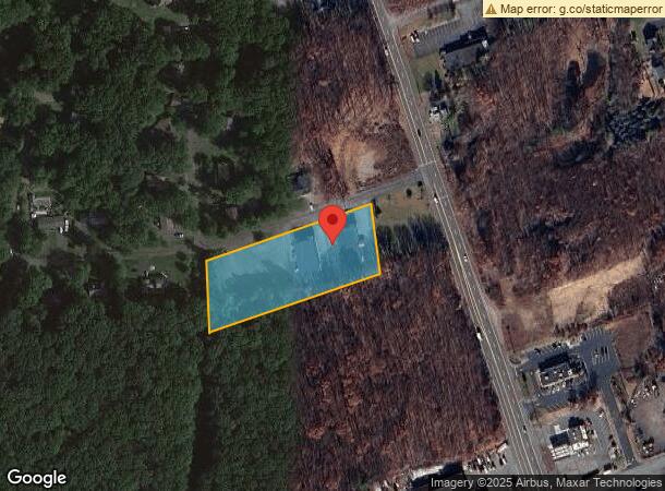
10 N Hunter Hwy, Drums, PA 18222
NEARBY LISTINGS FOR SALE OR LEASE
-
-
View all Drums listings for sale on LoopNet.com
Property Detail
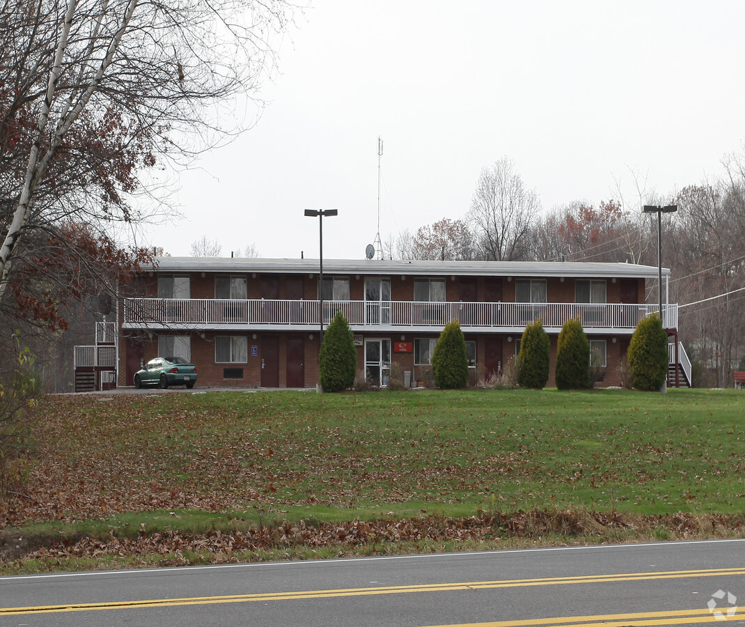
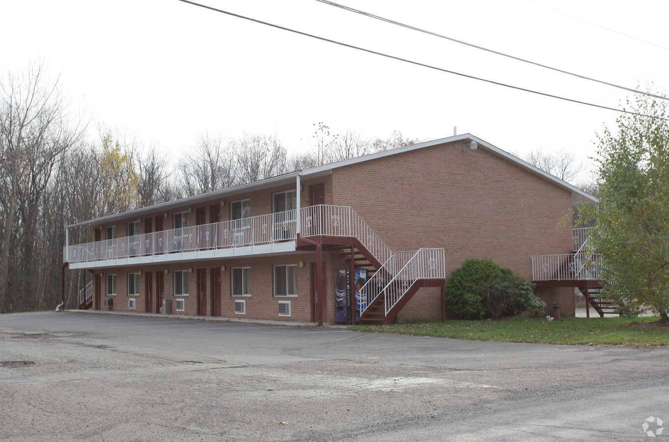
10 N Hunter Hwy
Scranton--Wilkes-Barre--Hazelton, PA
Joseph T Brutosky
06-P8S5-001-017-000
6-1-24-1-D1D3-2-D1-1-R1- N HUNTER HWY
Hotelormotel
Luzerne
X
Pennsylvania
42079C0512E
17
2024
2.03 AC
2024
Scranton & Wilkes-Barre
216601
Philadelphia
DEMOGRAPHICS near 10 N Hunter Hwy
1 Mile
3 Mile
5 Mile
2024 Total Population
1,446
6,582
22,184
2029 Population
1,456
6,589
22,148
Pop Growth 2024-2029
+ 0.69%
+ 0.11%
(0.16%)
Average Age
44
44
44
2024 Total Households
587
2,726
9,198
HH Growth 2024-2029
+ 0.51%
+ 0.07%
(0.15%)
Median Household Inc
$109,531
$100,117
$79,455
Avg Household Size
2.40
2.40
2.40
2024 Avg HH Vehicles
2.00
2.00
2.00
Median Home Value
$247,187
$188,137
$178,405
Median Year Built
1999
1992
1977
Nearby Places
- Restaurants
- Banks
- Shops
- Fitness
- Groceries
PUBLIC TRANSPORTATION
AIRPORT
Wilkes-Barre/Scranton International
DRIVE
WALK
Distance
Wilkes-Barre/Scranton International
37 min
26.0 mi
Freight Ports
Port of Philadelphia
DRIVE
WALK
Distance
Port of Philadelphia
132 min
110.1 mi
Nearby Properties
Address
Land Use
TOTAL SIZE
Lot Size
Zoning
Address
Land Use
TOTAL SIZE
Lot Size
Zoning
3.95 AC
Address
Land Use
TOTAL SIZE
Lot Size
Zoning
8.42 AC
Address
Land Use
TOTAL SIZE
Lot Size
Zoning
5.03 AC
Address
Land Use
TOTAL SIZE
Lot Size
Zoning
8.40 AC
Address
Land Use
TOTAL SIZE
Lot Size
Zoning
8.56 AC
Address
Land Use
TOTAL SIZE
Lot Size
Zoning
12.29 AC
Address
Land Use
TOTAL SIZE
Lot Size
Zoning
12.83 AC
Address
Land Use
TOTAL SIZE
Lot Size
Zoning
32.99 AC
Address
Land Use
TOTAL SIZE
Lot Size
Zoning
10.46 AC
Address
Land Use
TOTAL SIZE
Lot Size
Zoning
57.18 AC
Address
Land Use
TOTAL SIZE
Lot Size
Zoning
73.44 AC
Address
Land Use
TOTAL SIZE
Lot Size
Zoning
162.30 AC
Address
Land Use
TOTAL SIZE
Lot Size
Zoning
2.15 AC
Address
Land Use
TOTAL SIZE
Lot Size
Zoning
Address
Land Use
TOTAL SIZE
Lot Size
Zoning
1.30 AC
Address
Land Use
TOTAL SIZE
Lot Size
Zoning
5.02 AC
Address
Land Use
TOTAL SIZE
Lot Size
Zoning
5.51 AC
Address
Land Use
TOTAL SIZE
Lot Size
Zoning
1.46 AC
Address
Land Use
TOTAL SIZE
Lot Size
Zoning
242.71 AC
Address
Land Use
TOTAL SIZE
Lot Size
Zoning
853.86 AC
Address
Land Use
TOTAL SIZE
Lot Size
Zoning
0.55 AC
Address
Land Use
TOTAL SIZE
Lot Size
Zoning
Address
Land Use
TOTAL SIZE
Lot Size
Zoning
10.68 AC
Address
Land Use
TOTAL SIZE
Lot Size
Zoning
2,171 SF
366.98 AC
Address
Land Use
TOTAL SIZE
Lot Size
Zoning
5.02 AC
Address
Land Use
TOTAL SIZE
Lot Size
Zoning
0.66 AC
Address
Land Use
TOTAL SIZE
Lot Size
Zoning
6.28 AC
Address
Land Use
TOTAL SIZE
Lot Size
Zoning
1.19 AC
Address
Land Use
TOTAL SIZE
Lot Size
Zoning
1,064 SF
6.77 AC
Address
Land Use
TOTAL SIZE
Lot Size
Zoning
0.73 AC
The World's #1 Commercial Real Estate Marketplace
Connect with us
© 2025 CoStar Group
The information above has been obtained from sources believed reliable. While we do not doubt its accuracy we have not verified it and make no guarantee, warranty or representation about it. It is your responsibility to independently confirm its accuracy and completeness. Any projections, opinions, assumptions, or estimates used are for example only and do not represent the current or future performance of the property. The value of this transaction to you depends on tax and other factors which should be evaluated by your tax, financial, and legal advisors. You and your advisors should conduct a careful, independent investigation of the property to determine to your satisfaction the suitability of the property for your needs.