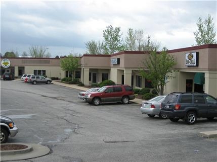
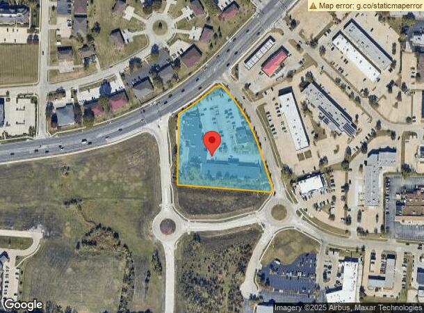
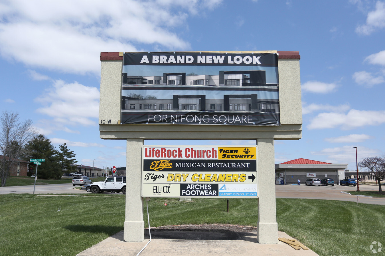
Property Record
10 W Nifong Blvd, Columbia, MO 65203
NEARBY LISTINGS FOR SALE OR LEASE
Property Detail
10 W Nifong Blvd
16-904-00-01-009-00-01
Rockbridge Sd
Storebuilding
ROCKBRIDGE SD BLK IX LOTS 17 & 18 EXC PT FOR STREET
X
Boone
29019C0287E
Missouri
2024
3.10 AC
2024
Columbia/Jefferson City
001109
Other Market Areas
25,228 SF
Columbia, MO
DEMOGRAPHICS near 10 W Nifong Blvd
1 Mile
3 Mile
5 Mile
2024 Total Population
9,047
55,134
112,826
2029 Population
9,514
58,047
119,560
Pop Growth 2024-2029
+ 5.16%
+ 5.28%
+ 5.97%
Average Age
36
33
35
2024 Total Households
4,333
20,808
45,757
HH Growth 2024-2029
+ 5.31%
+ 5.89%
+ 6.42%
Median Household Inc
$52,117
$54,592
$55,512
Avg Household Size
2.00
2.20
2.20
2024 Avg HH Vehicles
2.00
2.00
2.00
Median Home Value
$257,554
$288,819
$263,888
Median Year Built
1991
1993
1990
Nearby Places
- Restaurants
- Banks
- Shops
- Fitness
- Groceries
PUBLIC TRANSPORTATION
AIRPORT
Columbia Regional
DRIVE
WALK
Distance
Columbia Regional
16 min
11.5 mi
Freight Ports
Tulsa Port of Inola
DRIVE
WALK
Distance
Tulsa Port of Inola
377 min
334.1 mi
SALE & LEASE HISTORY
LISTING DATE
SALE/LEASE

Apr 23, 2018
For Lease
Nearby Properties
Address
Land Use
TOTAL SIZE
Lot Size
Zoning
Address
Land Use
TOTAL SIZE
Lot Size
Zoning
373,370 SF
77.30 AC
O1
Address
Land Use
TOTAL SIZE
Lot Size
Zoning
149,686 SF
15.26 AC
MC
Address
Land Use
TOTAL SIZE
Lot Size
Zoning
3,808 SF
0.39 AC
C2
Address
Land Use
TOTAL SIZE
Lot Size
Zoning
234,111 SF
2.27 AC
Address
Land Use
TOTAL SIZE
Lot Size
Zoning
50,304 SF
8.78 AC
C1
Address
Land Use
TOTAL SIZE
Lot Size
Zoning
10,459 SF
39.22 AC
RMH
Address
Land Use
TOTAL SIZE
Lot Size
Zoning
159,169 SF
1.26 AC
R3
Address
Land Use
TOTAL SIZE
Lot Size
Zoning
52,568 SF
9.50 AC
Address
Land Use
TOTAL SIZE
Lot Size
Zoning
134,625 SF
0.78 AC
C2
Address
Land Use
TOTAL SIZE
Lot Size
Zoning
185,585 SF
18.57 AC
Address
Land Use
TOTAL SIZE
Lot Size
Zoning
70,930 SF
9.66 AC
Address
Land Use
TOTAL SIZE
Lot Size
Zoning
97,092 SF
1.56 AC
Address
Land Use
TOTAL SIZE
Lot Size
Zoning
24,624 SF
21.42 AC
Address
Land Use
TOTAL SIZE
Lot Size
Zoning
136,448 SF
0.78 AC
C2
Address
Land Use
TOTAL SIZE
Lot Size
Zoning
3,420 SF
18.60 AC
R3
Address
Land Use
TOTAL SIZE
Lot Size
Zoning
8,678 SF
23.15 AC
R3
Address
Land Use
TOTAL SIZE
Lot Size
Zoning
148,500 SF
22.62 AC
R3
Address
Land Use
TOTAL SIZE
Lot Size
Zoning
17,589 SF
0.52 AC
C2
Address
Land Use
TOTAL SIZE
Lot Size
Zoning
119,520 SF
12.56 AC
Address
Land Use
TOTAL SIZE
Lot Size
Zoning
34,357 SF
15.59 AC
Address
Land Use
TOTAL SIZE
Lot Size
Zoning
159,568 SF
9.53 AC
Address
Land Use
TOTAL SIZE
Lot Size
Zoning
136,851 SF
2.23 AC
CP
Address
Land Use
TOTAL SIZE
Lot Size
Zoning
31,200 SF
14.84 AC
Address
Land Use
TOTAL SIZE
Lot Size
Zoning
119,988 SF
8.87 AC
Address
Land Use
TOTAL SIZE
Lot Size
Zoning
2,922 SF
11.40 AC
PUD1
Address
Land Use
TOTAL SIZE
Lot Size
Zoning
94,185 SF
3.19 AC
C3
Address
Land Use
TOTAL SIZE
Lot Size
Zoning
159,984 SF
15.20 AC
R3
Address
Land Use
TOTAL SIZE
Lot Size
Zoning
91,249 SF
11.66 AC
Address
Land Use
TOTAL SIZE
Lot Size
Zoning
13,024 SF
11.90 AC
R3
Address
Land Use
TOTAL SIZE
Lot Size
Zoning
176,300 SF
5.22 AC
The World's #1 Commercial Real Estate Marketplace
Connect with us
© 2025 CoStar Group
The information above has been obtained from sources believed reliable. While we do not doubt its accuracy we have not verified it and make no guarantee, warranty or representation about it. It is your responsibility to independently confirm its accuracy and completeness. Any projections, opinions, assumptions, or estimates used are for example only and do not represent the current or future performance of the property. The value of this transaction to you depends on tax and other factors which should be evaluated by your tax, financial, and legal advisors. You and your advisors should conduct a careful, independent investigation of the property to determine to your satisfaction the suitability of the property for your needs.