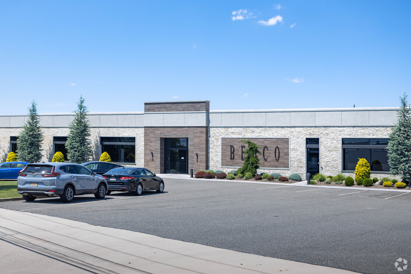
Property Record
100 Adams Blvd, Farmingdale, NY 11735
NEARBY LISTINGS FOR SALE OR LEASE
Property Detail
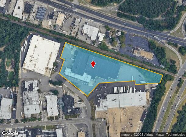
100 Adams Blvd
Nassau County-Suffolk County, NY
N-L.I.R.R. E-SOUTHERN ST. S-ADAMS BLVD. W-ADAMS BLVD.
0100-099-00-01-00-008-000
Suffolk
Industrialgeneral
New York
X
8
36103C0835H
5.70 AC
2023
East Farmingdale
2023
Long Island (New York)
123201
DEMOGRAPHICS near 100 Adams Blvd
1 Mile
3 Mile
5 Mile
2024 Total Population
6,405
125,970
339,299
2029 Population
6,309
123,005
332,213
Pop Growth 2024-2029
(1.50%)
(2.35%)
(2.09%)
Average Age
40
41
42
2024 Total Households
1,765
40,643
112,510
HH Growth 2024-2029
(1.70%)
(2.53%)
(2.25%)
Median Household Inc
$82,812
$110,867
$118,810
Avg Household Size
3.10
2.90
2.90
2024 Avg HH Vehicles
2.00
2.00
2.00
Median Home Value
$530,180
$465,511
$501,498
Median Year Built
1978
1958
1958
Nearby Places
- Restaurants
- Banks
- Shops
- Fitness
- Groceries
PUBLIC TRANSPORTATION
COMMUTER RAIL
Farmingdale Station (Ronkonkoma Branch - Long Island Rail Road)
DRIVE
WALK
Distance
Farmingdale Station (Ronkonkoma Branch - Long Island Rail Road)
8 min
3.7 mi
Pinelawn Station (Ronkonkoma Branch - Long Island Rail Road)
DRIVE
WALK
Distance
Pinelawn Station (Ronkonkoma Branch - Long Island Rail Road)
8 min
3.8 mi
AIRPORT
Long Island MacArthur
DRIVE
WALK
Distance
Long Island MacArthur
34 min
22.8 mi
John F Kennedy International
DRIVE
WALK
Distance
John F Kennedy International
36 min
24.7 mi
Laguardia
DRIVE
WALK
Distance
Laguardia
47 min
31.6 mi
Freight Ports
NY - Red Hook Container Terminal
DRIVE
WALK
Distance
NY - Red Hook Container Terminal
57 min
36.1 mi
SALE & LEASE HISTORY
LISTING DATE
SALE/LEASE

Sep 19, 2024
For Lease
Jun 21, 2018
For Lease
Jun 20, 2018
For Sale
Jul 17, 2020
For Lease
Feb 27, 2023
For Lease
Apr 28, 2023
For Lease
Nearby Properties
Address
Land Use
TOTAL SIZE
Lot Size
Zoning
Address
Land Use
TOTAL SIZE
Lot Size
Zoning
20,697 SF
1.91 AC
B1
Address
Land Use
TOTAL SIZE
Lot Size
Zoning
9.95 AC
BUS3
Address
Land Use
TOTAL SIZE
Lot Size
Zoning
892,140 SF
31.82 AC
Address
Land Use
TOTAL SIZE
Lot Size
Zoning
116,514 SF
382 AC
Address
Land Use
TOTAL SIZE
Lot Size
Zoning
35,978 SF
375.68 AC
Address
Land Use
TOTAL SIZE
Lot Size
Zoning
6.37 AC
BUS3
Address
Land Use
TOTAL SIZE
Lot Size
Zoning
77,270 SF
21.67 AC
Address
Land Use
TOTAL SIZE
Lot Size
Zoning
336,442 SF
43.50 AC
G
Address
Land Use
TOTAL SIZE
Lot Size
Zoning
288 SF
194.85 AC
Address
Land Use
TOTAL SIZE
Lot Size
Zoning
22.10 AC
Address
Land Use
TOTAL SIZE
Lot Size
Zoning
13.63 AC
B
Address
Land Use
TOTAL SIZE
Lot Size
Zoning
68,555 SF
20.14 AC
Address
Land Use
TOTAL SIZE
Lot Size
Zoning
183.15 AC
Address
Land Use
TOTAL SIZE
Lot Size
Zoning
1,620 SF
0.14 AC
Address
Land Use
TOTAL SIZE
Lot Size
Zoning
91,228 SF
0.05 AC
Address
Land Use
TOTAL SIZE
Lot Size
Zoning
157,191 SF
17.70 AC
G
Address
Land Use
TOTAL SIZE
Lot Size
Zoning
136,804 SF
10.56 AC
Address
Land Use
TOTAL SIZE
Lot Size
Zoning
9.68 AC
SC
Address
Land Use
TOTAL SIZE
Lot Size
Zoning
74.90 AC
G
Address
Land Use
TOTAL SIZE
Lot Size
Zoning
114.70 AC
A
Address
Land Use
TOTAL SIZE
Lot Size
Zoning
292.40 AC
A
Address
Land Use
TOTAL SIZE
Lot Size
Zoning
248.60 AC
A
Address
Land Use
TOTAL SIZE
Lot Size
Zoning
49,004 SF
13.34 AC
Address
Land Use
TOTAL SIZE
Lot Size
Zoning
9.39 AC
SC
Address
Land Use
TOTAL SIZE
Lot Size
Zoning
144,813 SF
1.91 AC
Address
Land Use
TOTAL SIZE
Lot Size
Zoning
135,605 SF
15.05 AC
E
Address
Land Use
TOTAL SIZE
Lot Size
Zoning
611,060 SF
22.85 AC
GA
Address
Land Use
TOTAL SIZE
Lot Size
Zoning
206,737 SF
15.41 AC
Address
Land Use
TOTAL SIZE
Lot Size
Zoning
7.15 AC
Address
Land Use
TOTAL SIZE
Lot Size
Zoning
14,162 SF
8.15 AC
The World's #1 Commercial Real Estate Marketplace
Connect with us
© 2025 CoStar Group
The information above has been obtained from sources believed reliable. While we do not doubt its accuracy we have not verified it and make no guarantee, warranty or representation about it. It is your responsibility to independently confirm its accuracy and completeness. Any projections, opinions, assumptions, or estimates used are for example only and do not represent the current or future performance of the property. The value of this transaction to you depends on tax and other factors which should be evaluated by your tax, financial, and legal advisors. You and your advisors should conduct a careful, independent investigation of the property to determine to your satisfaction the suitability of the property for your needs.