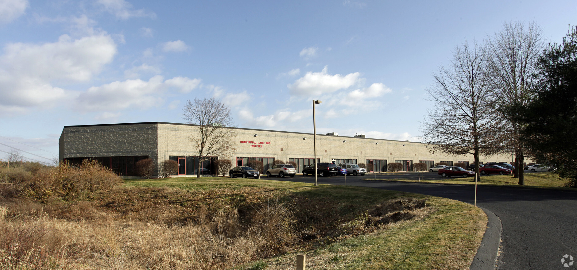
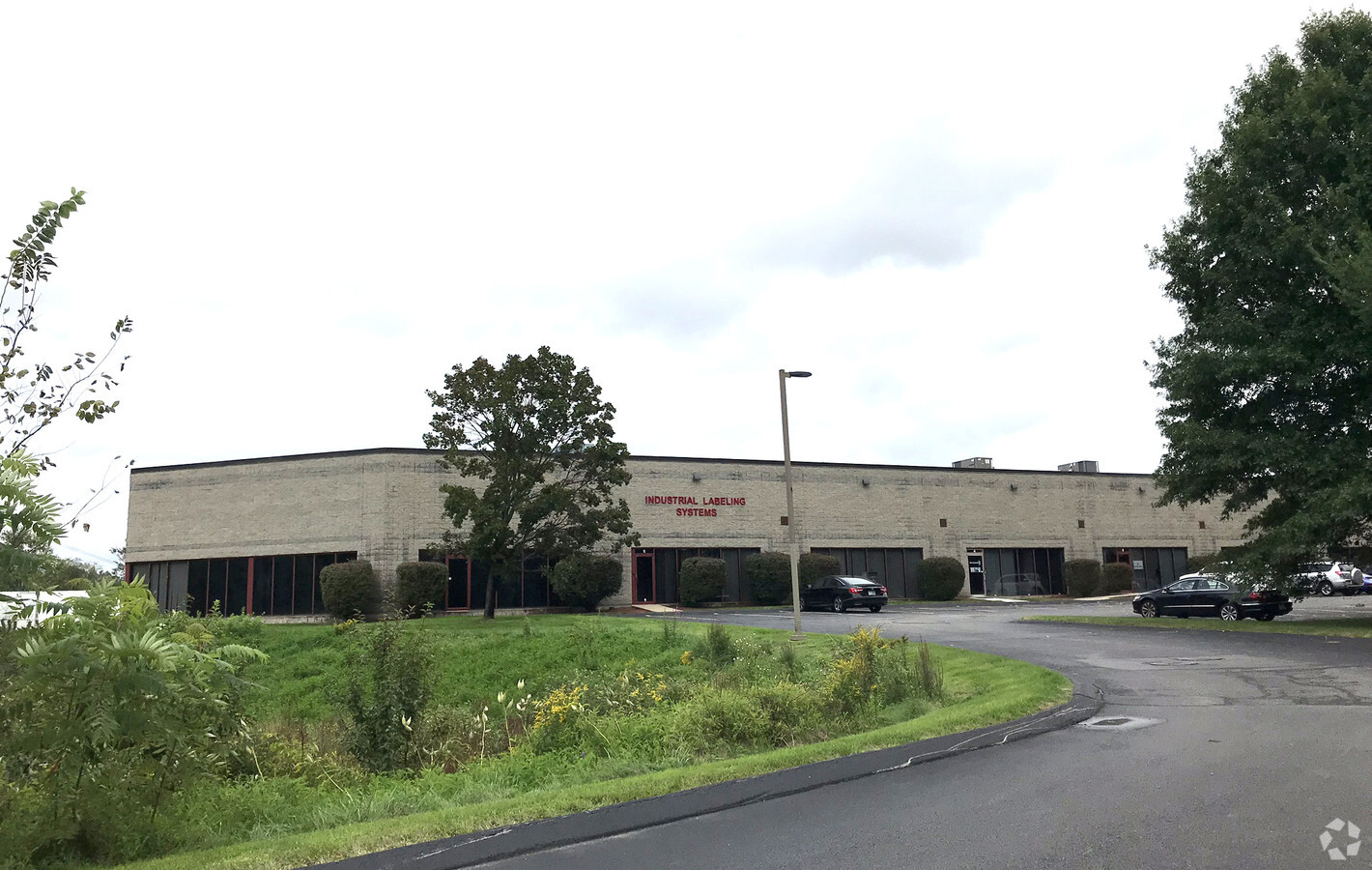
Property Record
100 Business Park Dr, Tyngsboro, MA 01879

NEARBY LISTINGS FOR SALE OR LEASE
Property Detail
100 Business Park Dr
Industrialgeneral
Middlesex
A
Massachusetts
25017C0112E
19.95 AC
2025
Groton/Townsend
2025
Boston
313101
Boston-Cambridge-Newton, MA-NH
42,354 SF
TYNG-000012-000013
DEMOGRAPHICS near 100 Business Park Dr
1 Mile
3 Mile
5 Mile
2024 Total Population
354
25,629
93,426
2029 Population
352
25,835
94,204
Pop Growth 2024-2029
(0.56%)
+ 0.80%
+ 0.83%
Average Age
42
41
42
2024 Total Households
143
10,771
36,261
HH Growth 2024-2029
(0.70%)
+ 0.89%
+ 0.82%
Median Household Inc
$101,136
$108,303
$103,278
Avg Household Size
2.50
2.40
2.50
2024 Avg HH Vehicles
2.00
2.00
2.00
Median Home Value
$439,062
$456,500
$412,013
Median Year Built
2000
1985
1980
Nearby Places
- Restaurants
- Banks
- Shops
- Fitness
- Groceries
PUBLIC TRANSPORTATION
COMMUTER RAIL
Lowell (Lowell Line - Massachusetts Bay Transportation Authority Commuter Rail (Purple Line))
DRIVE
WALK
Distance
Lowell (Lowell Line - Massachusetts Bay Transportation Authority Commuter Rail (Purple Line))
16 min
9.6 mi
AIRPORT
Manchester Boston Regional
DRIVE
WALK
Distance
Manchester Boston Regional
33 min
22.0 mi
Freight Ports
Port of Boston
DRIVE
WALK
Distance
Port of Boston
58 min
42.4 mi
SALE & LEASE HISTORY
LISTING DATE
SALE/LEASE

Nov 07, 2017
For Lease
Nearby Properties
Address
Land Use
TOTAL SIZE
Lot Size
Zoning
Address
Land Use
TOTAL SIZE
Lot Size
Zoning
610.72 AC
RC
Address
Land Use
TOTAL SIZE
Lot Size
Zoning
506.09 AC
RC
Address
Land Use
TOTAL SIZE
Lot Size
Zoning
160.22 AC
PI
Address
Land Use
TOTAL SIZE
Lot Size
Zoning
393.68 AC
RC
Address
Land Use
TOTAL SIZE
Lot Size
Zoning
227.85 AC
RC
Address
Land Use
TOTAL SIZE
Lot Size
Zoning
355.49 AC
PI
Address
Land Use
TOTAL SIZE
Lot Size
Zoning
124.77 AC
RC
Address
Land Use
TOTAL SIZE
Lot Size
Zoning
303,508 SF
171.19 AC
G1
Address
Land Use
TOTAL SIZE
Lot Size
Zoning
524.47 AC
R18
Address
Land Use
TOTAL SIZE
Lot Size
Zoning
206,913 SF
18.30 AC
GB
Address
Land Use
TOTAL SIZE
Lot Size
Zoning
30.32 AC
GI
Address
Land Use
TOTAL SIZE
Lot Size
Zoning
149.77 AC
RC
Address
Land Use
TOTAL SIZE
Lot Size
Zoning
199.97 AC
B2
Address
Land Use
TOTAL SIZE
Lot Size
Zoning
37.64 AC
RC
Address
Land Use
TOTAL SIZE
Lot Size
Zoning
127,494 SF
9.09 AC
GB
Address
Land Use
TOTAL SIZE
Lot Size
Zoning
190.53 AC
RC
Address
Land Use
TOTAL SIZE
Lot Size
Zoning
80.90 AC
RC
Address
Land Use
TOTAL SIZE
Lot Size
Zoning
154,620 SF
8.63 AC
GB
Address
Land Use
TOTAL SIZE
Lot Size
Zoning
116,602 SF
23.47 AC
GB
Address
Land Use
TOTAL SIZE
Lot Size
Zoning
45.10 AC
R1
Address
Land Use
TOTAL SIZE
Lot Size
Zoning
263.97 AC
RC
Address
Land Use
TOTAL SIZE
Lot Size
Zoning
146,536 SF
7.45 AC
GB
Address
Land Use
TOTAL SIZE
Lot Size
Zoning
144,018 SF
13.89 AC
PI
Address
Land Use
TOTAL SIZE
Lot Size
Zoning
8.30 AC
B3
Address
Land Use
TOTAL SIZE
Lot Size
Zoning
135,324 SF
70.07 AC
R1
Address
Land Use
TOTAL SIZE
Lot Size
Zoning
161,790 SF
9 AC
PI
Address
Land Use
TOTAL SIZE
Lot Size
Zoning
177.27 AC
R1
Address
Land Use
TOTAL SIZE
Lot Size
Zoning
241,146 SF
33.66 AC
PI
Address
Land Use
TOTAL SIZE
Lot Size
Zoning
43.26 AC
RC
Address
Land Use
TOTAL SIZE
Lot Size
Zoning
56,460 SF
5.80 AC
GB
The World's #1 Commercial Real Estate Marketplace
Connect with us
© 2025 CoStar Group
The information above has been obtained from sources believed reliable. While we do not doubt its accuracy we have not verified it and make no guarantee, warranty or representation about it. It is your responsibility to independently confirm its accuracy and completeness. Any projections, opinions, assumptions, or estimates used are for example only and do not represent the current or future performance of the property. The value of this transaction to you depends on tax and other factors which should be evaluated by your tax, financial, and legal advisors. You and your advisors should conduct a careful, independent investigation of the property to determine to your satisfaction the suitability of the property for your needs.