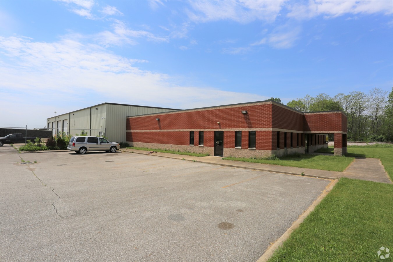
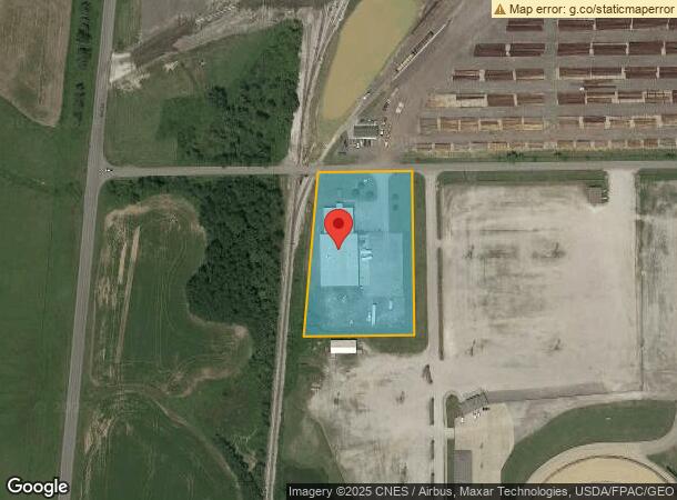
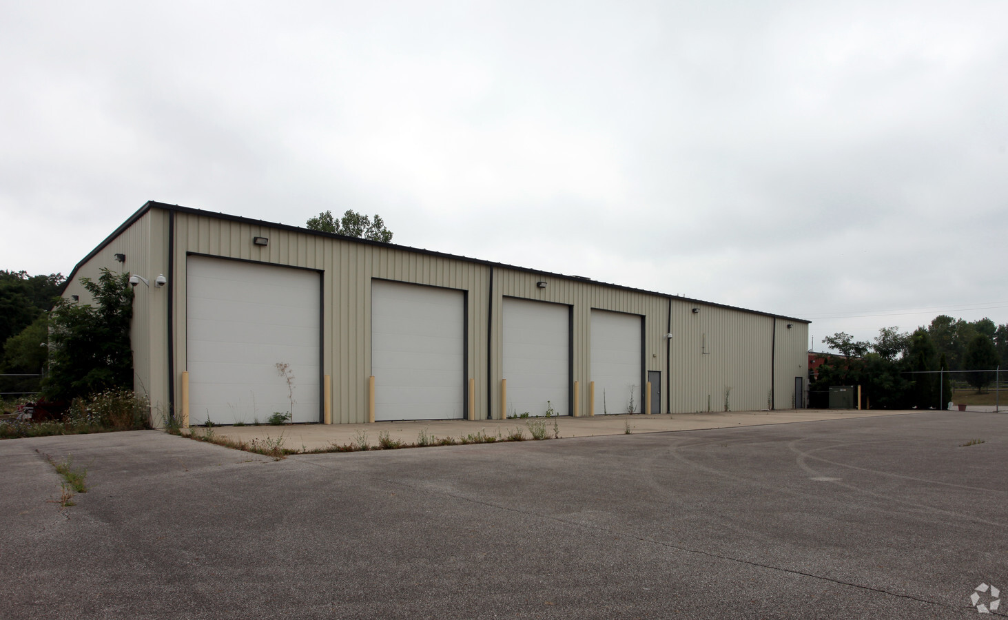
Property Record
100 Crall Rd, Mansfield, OH 44903
NEARBY LISTINGS FOR SALE OR LEASE
-
-
View all Mansfield listings for sale on LoopNet.com
Property Detail
100 Crall Rd
028-90-073-13-001
NE A 2.76 LT 1 PT
Industrialgeneral
Richland
X
Ohio
39139C0175E
1
2023
2.76 AC
2023
Richland County
001700
Cleveland
19,600 SF
Mansfield, OH
DEMOGRAPHICS near 100 Crall Rd
1 Mile
3 Mile
5 Mile
2024 Total Population
197
12,580
49,659
2029 Population
194
12,593
50,092
Pop Growth 2024-2029
(1.52%)
+ 0.10%
+ 0.87%
Average Age
44
41
40
2024 Total Households
77
3,062
18,737
HH Growth 2024-2029
(1.30%)
+ 0.13%
+ 0.95%
Median Household Inc
$79,545
$52,919
$38,611
Avg Household Size
2.40
2.30
2.20
2024 Avg HH Vehicles
3.00
2.00
2.00
Median Home Value
$184,482
$118,134
$91,268
Median Year Built
1967
1959
1957
Nearby Places
- Restaurants
- Banks
- Shops
- Fitness
- Groceries
Nearby Properties
Address
Land Use
TOTAL SIZE
Lot Size
Zoning
Address
Land Use
TOTAL SIZE
Lot Size
Zoning
456.50 AC
Address
Land Use
TOTAL SIZE
Lot Size
Zoning
27,360 SF
63.77 AC
Address
Land Use
TOTAL SIZE
Lot Size
Zoning
404,200 SF
14.76 AC
Address
Land Use
TOTAL SIZE
Lot Size
Zoning
221,864 SF
20 AC
Address
Land Use
TOTAL SIZE
Lot Size
Zoning
318,366 SF
26.16 AC
Address
Land Use
TOTAL SIZE
Lot Size
Zoning
458,316 SF
27.90 AC
Address
Land Use
TOTAL SIZE
Lot Size
Zoning
4,950 SF
158.55 AC
Address
Land Use
TOTAL SIZE
Lot Size
Zoning
160,000 SF
15.87 AC
Address
Land Use
TOTAL SIZE
Lot Size
Zoning
47.90 AC
Address
Land Use
TOTAL SIZE
Lot Size
Zoning
30,306 SF
5.63 AC
Address
Land Use
TOTAL SIZE
Lot Size
Zoning
106,361 SF
5.06 AC
Address
Land Use
TOTAL SIZE
Lot Size
Zoning
31,064 SF
9 AC
Address
Land Use
TOTAL SIZE
Lot Size
Zoning
103,000 SF
17.38 AC
Address
Land Use
TOTAL SIZE
Lot Size
Zoning
43,356 SF
5.30 AC
Address
Land Use
TOTAL SIZE
Lot Size
Zoning
163,292 SF
16.76 AC
Address
Land Use
TOTAL SIZE
Lot Size
Zoning
70,665 SF
10.56 AC
Address
Land Use
TOTAL SIZE
Lot Size
Zoning
80,000 SF
12.10 AC
Address
Land Use
TOTAL SIZE
Lot Size
Zoning
46,040 SF
8.57 AC
Address
Land Use
TOTAL SIZE
Lot Size
Zoning
138,116 SF
21.57 AC
Address
Land Use
TOTAL SIZE
Lot Size
Zoning
78,014 SF
3.50 AC
Address
Land Use
TOTAL SIZE
Lot Size
Zoning
28,157 SF
5.31 AC
Address
Land Use
TOTAL SIZE
Lot Size
Zoning
101,000 SF
5.80 AC
Address
Land Use
TOTAL SIZE
Lot Size
Zoning
16.38 AC
Address
Land Use
TOTAL SIZE
Lot Size
Zoning
2,525 SF
0.61 AC
Address
Land Use
TOTAL SIZE
Lot Size
Zoning
4,361 SF
2 AC
Address
Land Use
TOTAL SIZE
Lot Size
Zoning
11,068 SF
2.40 AC
Address
Land Use
TOTAL SIZE
Lot Size
Zoning
152,800 SF
7.66 AC
Address
Land Use
TOTAL SIZE
Lot Size
Zoning
68,500 SF
5.65 AC
Address
Land Use
TOTAL SIZE
Lot Size
Zoning
39,476 SF
38.10 AC
Address
Land Use
TOTAL SIZE
Lot Size
Zoning
119,756 SF
7.14 AC
The World's #1 Commercial Real Estate Marketplace
Connect with us
© 2025 CoStar Group
The information above has been obtained from sources believed reliable. While we do not doubt its accuracy we have not verified it and make no guarantee, warranty or representation about it. It is your responsibility to independently confirm its accuracy and completeness. Any projections, opinions, assumptions, or estimates used are for example only and do not represent the current or future performance of the property. The value of this transaction to you depends on tax and other factors which should be evaluated by your tax, financial, and legal advisors. You and your advisors should conduct a careful, independent investigation of the property to determine to your satisfaction the suitability of the property for your needs.