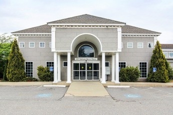
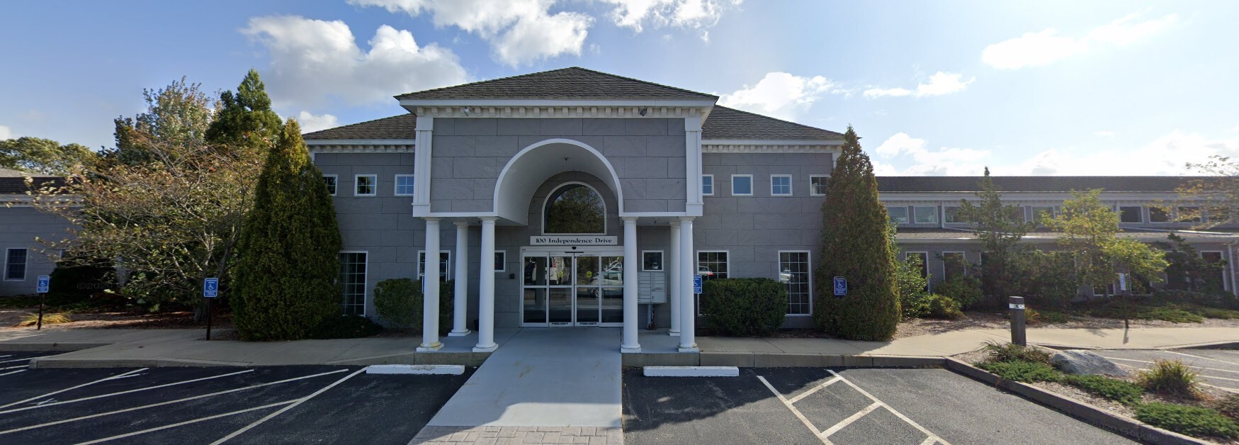
Property Record
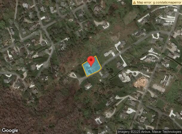
100 Independence Ln, Chatham, MA 02633
NEARBY LISTINGS FOR SALE OR LEASE
Property Detail
100 Independence Ln
Barnstable Town, MA
Barnstable
CHAT-000013B-000033-D000004C
Massachusetts
Sfr
0.46 AC
X
Cape Cod
25001C0637J
Other Market Areas
2,635 SF
DEMOGRAPHICS near 100 Independence Ln
1 Mile
3 Mile
5 Mile
2024 Total Population
2,775
27,116
51,717
2029 Population
2,821
27,495
52,938
Pop Growth 2024-2029
+ 1.66%
+ 1.40%
+ 2.36%
Average Age
42
45
46
2024 Total Households
1,094
11,324
22,254
HH Growth 2024-2029
+ 1.55%
+ 1.19%
+ 2.34%
Median Household Inc
$61,128
$69,698
$74,401
Avg Household Size
2.40
2.20
2.20
2024 Avg HH Vehicles
2.00
2.00
2.00
Median Home Value
$395,889
$440,912
$447,938
Median Year Built
1979
1974
1974
Nearby Places
- Restaurants
- Banks
- Shops
- Fitness
- Groceries
SALE & LEASE HISTORY
LISTING DATE
SALE/LEASE

Mar 30, 2022
For Lease
Mar 09, 2018
For Lease
Mar 05, 2022
For Lease
Nearby Properties
Address
Land Use
TOTAL SIZE
Lot Size
Zoning
Address
Land Use
TOTAL SIZE
Lot Size
Zoning
2,295.68 AC
RC
Address
Land Use
TOTAL SIZE
Lot Size
Zoning
129,534 SF
31.75 AC
M
Address
Land Use
TOTAL SIZE
Lot Size
Zoning
3.16 AC
R40
Address
Land Use
TOTAL SIZE
Lot Size
Zoning
1.90 AC
40A
Address
Land Use
TOTAL SIZE
Lot Size
Zoning
3,584 SF
2.26 AC
R40
Address
Land Use
TOTAL SIZE
Lot Size
Zoning
6.69 AC
M
Address
Land Use
TOTAL SIZE
Lot Size
Zoning
66.01 AC
R40
Address
Land Use
TOTAL SIZE
Lot Size
Zoning
6.01 AC
R40
Address
Land Use
TOTAL SIZE
Lot Size
Zoning
2.93 AC
R20
Address
Land Use
TOTAL SIZE
Lot Size
Zoning
2,597 SF
3.93 AC
R40
Address
Land Use
TOTAL SIZE
Lot Size
Zoning
3,357 SF
0.99 AC
R40
Address
Land Use
TOTAL SIZE
Lot Size
Zoning
101.55 AC
M
Address
Land Use
TOTAL SIZE
Lot Size
Zoning
57,634 SF
5.93 AC
SB
Address
Land Use
TOTAL SIZE
Lot Size
Zoning
72.55 AC
R60
Address
Land Use
TOTAL SIZE
Lot Size
Zoning
80 AC
M
Address
Land Use
TOTAL SIZE
Lot Size
Zoning
1,880 SF
R40
Address
Land Use
TOTAL SIZE
Lot Size
Zoning
8,574 SF
4.39 AC
R40
Address
Land Use
TOTAL SIZE
Lot Size
Zoning
4.33 AC
R40
Address
Land Use
TOTAL SIZE
Lot Size
Zoning
5.23 AC
R40
Address
Land Use
TOTAL SIZE
Lot Size
Zoning
2,321 SF
1.29 AC
R40
Address
Land Use
TOTAL SIZE
Lot Size
Zoning
3 AC
RC
Address
Land Use
TOTAL SIZE
Lot Size
Zoning
1.75 AC
R20
Address
Land Use
TOTAL SIZE
Lot Size
Zoning
4.40 AC
R40
Address
Land Use
TOTAL SIZE
Lot Size
Zoning
2.05 AC
R40
Address
Land Use
TOTAL SIZE
Lot Size
Zoning
0.97 AC
R40
Address
Land Use
TOTAL SIZE
Lot Size
Zoning
10.19 AC
R30
Address
Land Use
TOTAL SIZE
Lot Size
Zoning
28,587 SF
10.91 AC
M
Address
Land Use
TOTAL SIZE
Lot Size
Zoning
1.68 AC
R40
Address
Land Use
TOTAL SIZE
Lot Size
Zoning
2,436 SF
2.18 AC
R40
Address
Land Use
TOTAL SIZE
Lot Size
Zoning
1.06 AC
R40
The World's #1 Commercial Real Estate Marketplace
Connect with us
© 2025 CoStar Group
The information above has been obtained from sources believed reliable. While we do not doubt its accuracy we have not verified it and make no guarantee, warranty or representation about it. It is your responsibility to independently confirm its accuracy and completeness. Any projections, opinions, assumptions, or estimates used are for example only and do not represent the current or future performance of the property. The value of this transaction to you depends on tax and other factors which should be evaluated by your tax, financial, and legal advisors. You and your advisors should conduct a careful, independent investigation of the property to determine to your satisfaction the suitability of the property for your needs.