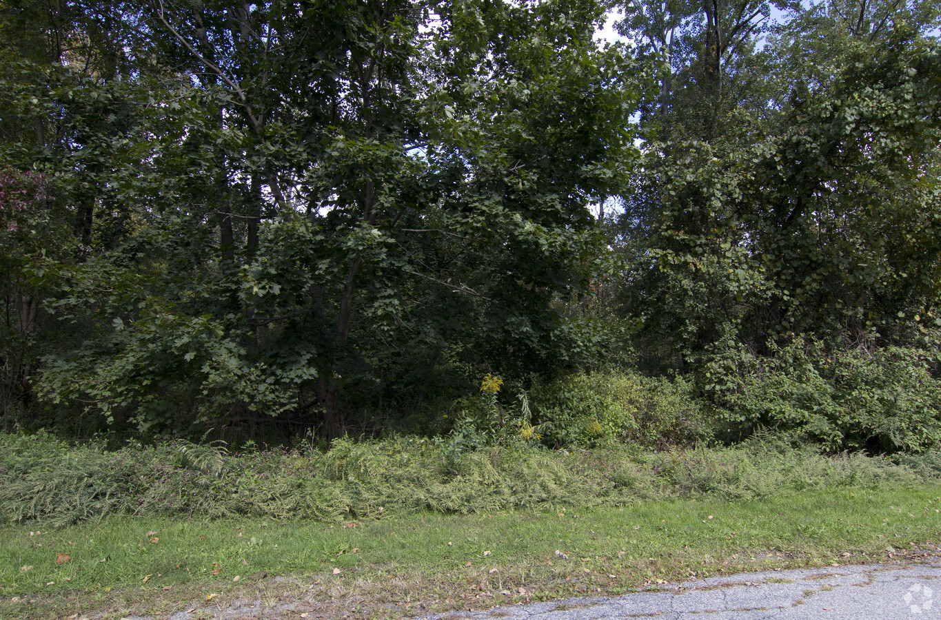
Property Record
100 Orchard St, Patterson, NY 12563

NEARBY LISTINGS FOR SALE OR LEASE
Property Detail
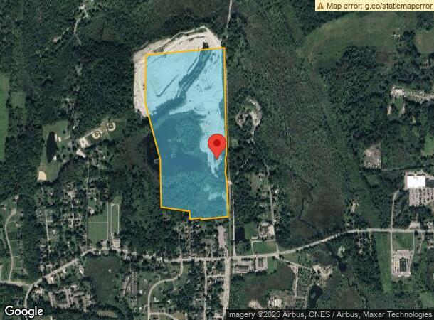
100 Orchard St
372400-003-000-0001-075-000-0000
Putnam
Miningfacilityoilgasmineralpreciousmetals
New York
X
75.000
36079C0063E
74.01 AC
2023
Brewster
2023
Westchester/So Connecticut
010202
Dutchess County-Putnam County, NY
1,120 SF
DEMOGRAPHICS near 100 Orchard St
1 Mile
3 Mile
5 Mile
2024 Total Population
1,285
6,536
23,804
2029 Population
1,266
6,519
23,891
Pop Growth 2024-2029
(1.48%)
(0.26%)
+ 0.37%
Average Age
42
44
43
2024 Total Households
469
2,181
8,470
HH Growth 2024-2029
(1.71%)
(0.32%)
+ 0.34%
Median Household Inc
$80,921
$105,744
$104,364
Avg Household Size
2.60
2.60
2.60
2024 Avg HH Vehicles
2.00
2.00
2.00
Median Home Value
$379,268
$419,192
$372,520
Median Year Built
1966
1979
1967
Nearby Places
- Restaurants
- Banks
- Shops
- Fitness
- Groceries
PUBLIC TRANSPORTATION
COMMUTER RAIL
Patterson Station (Harlem Line - Metro-North Commuter Railroad Company (Metro-North))
DRIVE
WALK
Distance
Patterson Station (Harlem Line - Metro-North Commuter Railroad Company (Metro-North))
2 min
9 min
0.5 mi
Pawling Station (Harlem Line - Metro-North Commuter Railroad Company (Metro-North))
DRIVE
WALK
Distance
Pawling Station (Harlem Line - Metro-North Commuter Railroad Company (Metro-North))
11 min
5.0 mi
AIRPORT
New York Stewart International
DRIVE
WALK
Distance
New York Stewart International
51 min
34.8 mi
Freight Ports
Port of New Haven
DRIVE
WALK
Distance
Port of New Haven
79 min
50.1 mi
Nearby Properties
Address
Land Use
TOTAL SIZE
Lot Size
Zoning
Address
Land Use
TOTAL SIZE
Lot Size
Zoning
59,520 SF
361.91 AC
R4
Address
Land Use
TOTAL SIZE
Lot Size
Zoning
12,064 SF
12.10 AC
C1
Address
Land Use
TOTAL SIZE
Lot Size
Zoning
84,651 SF
22.01 AC
C1
Address
Land Use
TOTAL SIZE
Lot Size
Zoning
63,050 SF
31.51 AC
C1
Address
Land Use
TOTAL SIZE
Lot Size
Zoning
13,958 SF
19.41 AC
R1
Address
Land Use
TOTAL SIZE
Lot Size
Zoning
3,352 SF
277.38 AC
R4
Address
Land Use
TOTAL SIZE
Lot Size
Zoning
19,768 SF
2.70 AC
GB
Address
Land Use
TOTAL SIZE
Lot Size
Zoning
9,864 SF
57.08 AC
R80
Address
Land Use
TOTAL SIZE
Lot Size
Zoning
Address
Land Use
TOTAL SIZE
Lot Size
Zoning
Address
Land Use
TOTAL SIZE
Lot Size
Zoning
581.90 AC
R4
Address
Land Use
TOTAL SIZE
Lot Size
Zoning
50,339 SF
14.96 AC
C1
Address
Land Use
TOTAL SIZE
Lot Size
Zoning
Address
Land Use
TOTAL SIZE
Lot Size
Zoning
5.54 AC
Address
Land Use
TOTAL SIZE
Lot Size
Zoning
29,220 SF
23.83 AC
C1
Address
Land Use
TOTAL SIZE
Lot Size
Zoning
22,670 SF
10.58 AC
C1
Address
Land Use
TOTAL SIZE
Lot Size
Zoning
24,550 SF
2.02 AC
GB
Address
Land Use
TOTAL SIZE
Lot Size
Zoning
32.64 AC
R1
Address
Land Use
TOTAL SIZE
Lot Size
Zoning
11,708 SF
8.52 AC
R1
Address
Land Use
TOTAL SIZE
Lot Size
Zoning
149.68 AC
C1
Address
Land Use
TOTAL SIZE
Lot Size
Zoning
6,376 SF
30.93 AC
R4
Address
Land Use
TOTAL SIZE
Lot Size
Zoning
Address
Land Use
TOTAL SIZE
Lot Size
Zoning
Address
Land Use
TOTAL SIZE
Lot Size
Zoning
0.23 AC
R4
Address
Land Use
TOTAL SIZE
Lot Size
Zoning
1.26 AC
GB
Address
Land Use
TOTAL SIZE
Lot Size
Zoning
Address
Land Use
TOTAL SIZE
Lot Size
Zoning
10,733 SF
2 AC
GB
Address
Land Use
TOTAL SIZE
Lot Size
Zoning
290.21 AC
R4
Address
Land Use
TOTAL SIZE
Lot Size
Zoning
96.55 AC
R4
Address
Land Use
TOTAL SIZE
Lot Size
Zoning
237.25 AC
R4
The World's #1 Commercial Real Estate Marketplace
Connect with us
© 2025 CoStar Group
The information above has been obtained from sources believed reliable. While we do not doubt its accuracy we have not verified it and make no guarantee, warranty or representation about it. It is your responsibility to independently confirm its accuracy and completeness. Any projections, opinions, assumptions, or estimates used are for example only and do not represent the current or future performance of the property. The value of this transaction to you depends on tax and other factors which should be evaluated by your tax, financial, and legal advisors. You and your advisors should conduct a careful, independent investigation of the property to determine to your satisfaction the suitability of the property for your needs.