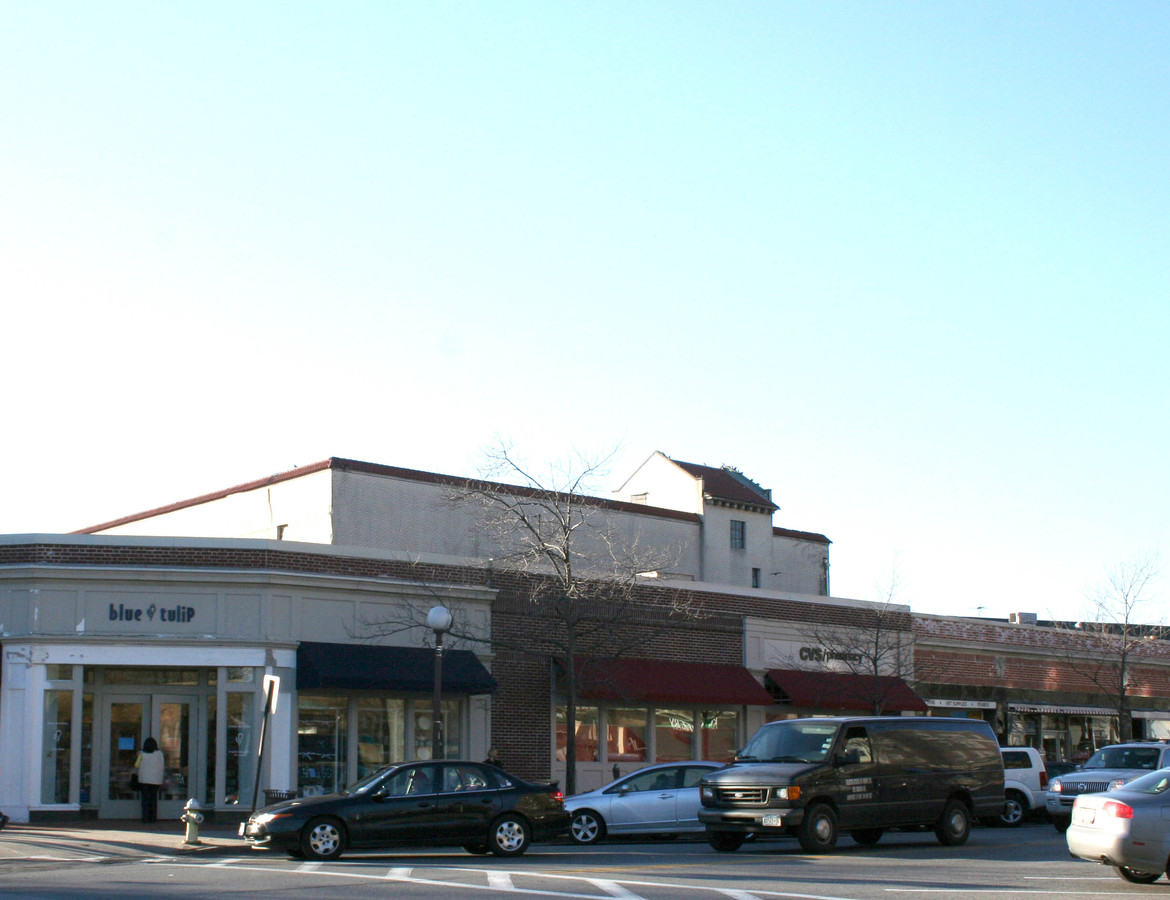
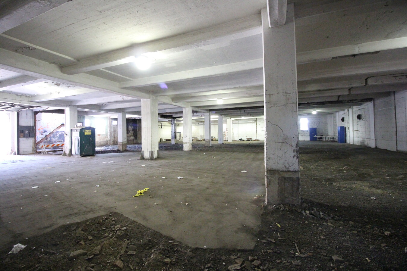
Property Record
100 Pondfield Rd, Bronxville, NY 10708
NEARBY LISTINGS FOR SALE OR LEASE
Property Detail
100 Pondfield Rd
New York-Jersey City-White Plains, NY-NJ
Map Of Property Owned By Walter E Andrew
2401-004-000-00003-000-0011
Westchester
Apartment
New York
X
0.28 AC
36119C0329F
Southeast
36,000 SF
Westchester/So Connecticut
DEMOGRAPHICS near 100 Pondfield Rd
1 Mile
3 Mile
5 Mile
2024 Total Population
26,798
252,558
673,024
2029 Population
26,411
243,817
642,711
Pop Growth 2024-2029
(1.44%)
(3.46%)
(4.50%)
Average Age
44
41
41
2024 Total Households
11,295
93,803
249,775
HH Growth 2024-2029
(1.51%)
(3.55%)
(4.70%)
Median Household Inc
$123,898
$88,884
$77,952
Avg Household Size
2.30
2.60
2.60
2024 Avg HH Vehicles
1.00
1.00
1.00
Median Home Value
$602,361
$556,708
$577,842
Median Year Built
1948
1949
1953
Nearby Places
- Restaurants
- Banks
- Shops
- Fitness
- Groceries
PUBLIC TRANSPORTATION
COMMUTER RAIL
Bronxville Station (Harlem Line - Metro-North Commuter Railroad Company (Metro-North))
DRIVE
WALK
Distance
Bronxville Station (Harlem Line - Metro-North Commuter Railroad Company (Metro-North))
1 min
4 min
0.2 mi
Tuckahoe Station (Harlem Line - Metro-North Commuter Railroad Company (Metro-North))
DRIVE
WALK
Distance
Tuckahoe Station (Harlem Line - Metro-North Commuter Railroad Company (Metro-North))
2 min
17 min
0.9 mi
AIRPORT
Westchester County
DRIVE
WALK
Distance
Westchester County
25 min
15.5 mi
Laguardia
DRIVE
WALK
Distance
Laguardia
29 min
16.7 mi
John F Kennedy International
DRIVE
WALK
Distance
John F Kennedy International
36 min
24.3 mi
Freight Ports
NY - Red Hook Container Terminal
DRIVE
WALK
Distance
NY - Red Hook Container Terminal
43 min
25.4 mi
SALE & LEASE HISTORY
LISTING DATE
SALE/LEASE

Apr 14, 2020
For Sale
Nearby Properties
Address
Land Use
TOTAL SIZE
Lot Size
Zoning
Address
Land Use
TOTAL SIZE
Lot Size
Zoning
18,000 SF
13.85 AC
A
Address
Land Use
TOTAL SIZE
Lot Size
Zoning
201,590 SF
4.13 AC
BA
Address
Land Use
TOTAL SIZE
Lot Size
Zoning
301,156 SF
13.94 AC
A
Address
Land Use
TOTAL SIZE
Lot Size
Zoning
70,737 SF
1.67 AC
BB
Address
Land Use
TOTAL SIZE
Lot Size
Zoning
Address
Land Use
TOTAL SIZE
Lot Size
Zoning
Address
Land Use
TOTAL SIZE
Lot Size
Zoning
64,165 SF
3.24 AC
B
Address
Land Use
TOTAL SIZE
Lot Size
Zoning
165,529 SF
7.05 AC
RA3
Address
Land Use
TOTAL SIZE
Lot Size
Zoning
5,170 SF
9.08 AC
B
Address
Land Use
TOTAL SIZE
Lot Size
Zoning
Address
Land Use
TOTAL SIZE
Lot Size
Zoning
7,855 SF
1.10 AC
C
Address
Land Use
TOTAL SIZE
Lot Size
Zoning
38,912 SF
19.25 AC
R4
Address
Land Use
TOTAL SIZE
Lot Size
Zoning
Address
Land Use
TOTAL SIZE
Lot Size
Zoning
36,413 SF
0.89 AC
A
Address
Land Use
TOTAL SIZE
Lot Size
Zoning
34,560 SF
0.28 AC
BA
Address
Land Use
TOTAL SIZE
Lot Size
Zoning
23,116 SF
1.82 AC
C
Address
Land Use
TOTAL SIZE
Lot Size
Zoning
96,420 SF
4.89 AC
RB1
Address
Land Use
TOTAL SIZE
Lot Size
Zoning
7,771 SF
1.21 AC
A
Address
Land Use
TOTAL SIZE
Lot Size
Zoning
162.42 AC
T
Address
Land Use
TOTAL SIZE
Lot Size
Zoning
1,658 SF
3.28 AC
A
Address
Land Use
TOTAL SIZE
Lot Size
Zoning
4,732 SF
16.18 AC
BUS
Address
Land Use
TOTAL SIZE
Lot Size
Zoning
15,132 SF
0.28 AC
A
Address
Land Use
TOTAL SIZE
Lot Size
Zoning
27,699 SF
0.74 AC
BA
Address
Land Use
TOTAL SIZE
Lot Size
Zoning
41,910 SF
0.65 AC
C
Address
Land Use
TOTAL SIZE
Lot Size
Zoning
60,689 SF
0.35 AC
RA2
Address
Land Use
TOTAL SIZE
Lot Size
Zoning
66,549 SF
4.74 AC
OFF1
Address
Land Use
TOTAL SIZE
Lot Size
Zoning
Address
Land Use
TOTAL SIZE
Lot Size
Zoning
29,420 SF
0.97 AC
BA
Address
Land Use
TOTAL SIZE
Lot Size
Zoning
2,048 SF
1.38 AC
A
Address
Land Use
TOTAL SIZE
Lot Size
Zoning
30,521 SF
0.24 AC
B1
The World's #1 Commercial Real Estate Marketplace
Connect with us
© 2025 CoStar Group
The information above has been obtained from sources believed reliable. While we do not doubt its accuracy we have not verified it and make no guarantee, warranty or representation about it. It is your responsibility to independently confirm its accuracy and completeness. Any projections, opinions, assumptions, or estimates used are for example only and do not represent the current or future performance of the property. The value of this transaction to you depends on tax and other factors which should be evaluated by your tax, financial, and legal advisors. You and your advisors should conduct a careful, independent investigation of the property to determine to your satisfaction the suitability of the property for your needs.