Property Record
100 Ponds Edge Dr, Nottingham, PA 19362

NEARBY LISTINGS FOR SALE OR LEASE
Property Detail
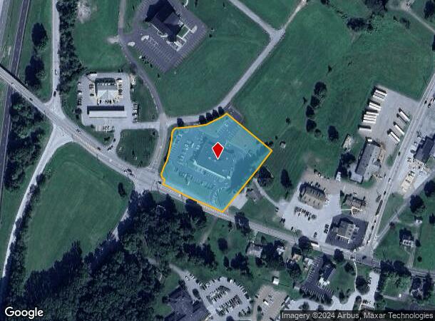
100 Ponds Edge Dr
Philadelphia-Camden-Wilmington, PA-NJ-DE-MD
Nottingham Busn Center Final P
68-002-0056.0200
2.5 AC & COMM BLDG LOT 1
Commercialnec
Chester
X
Pennsylvania
42029C0360G
1
2024
2.55 AC
2024
Outer Chester County
308200
Philadelphia
13,060 SF
DEMOGRAPHICS near 100 Ponds Edge Dr
1 Mile
3 Mile
5 Mile
2024 Total Population
1,087
8,222
25,797
2029 Population
1,118
8,493
26,455
Pop Growth 2024-2029
+ 2.85%
+ 3.30%
+ 2.55%
Average Age
40
40
40
2024 Total Households
367
2,823
8,966
HH Growth 2024-2029
+ 3.27%
+ 3.44%
+ 2.59%
Median Household Inc
$95,042
$89,847
$79,753
Avg Household Size
2.80
2.80
2.80
2024 Avg HH Vehicles
2.00
2.00
2.00
Median Home Value
$272,856
$309,117
$305,335
Median Year Built
1986
1989
1983
Nearby Places
- Restaurants
- Banks
- Shops
- Fitness
- Groceries
Nearby Properties
Address
Land Use
TOTAL SIZE
Lot Size
Zoning
Address
Land Use
TOTAL SIZE
Lot Size
Zoning
10,381 SF
15.34 AC
R4
Address
Land Use
TOTAL SIZE
Lot Size
Zoning
33,716 SF
4.30 AC
R2
Address
Land Use
TOTAL SIZE
Lot Size
Zoning
360,627 SF
13.80 AC
I
Address
Land Use
TOTAL SIZE
Lot Size
Zoning
12,000 SF
7.02 AC
BG
Address
Land Use
TOTAL SIZE
Lot Size
Zoning
5,776 SF
7.26 AC
BG
Address
Land Use
TOTAL SIZE
Lot Size
Zoning
88,884 SF
16.82 AC
R3
Address
Land Use
TOTAL SIZE
Lot Size
Zoning
32,658 SF
3.40 AC
R2
Address
Land Use
TOTAL SIZE
Lot Size
Zoning
29,104 SF
3.70 AC
R2
Address
Land Use
TOTAL SIZE
Lot Size
Zoning
2,916 SF
515.30 AC
R1
Address
Land Use
TOTAL SIZE
Lot Size
Zoning
10,163 SF
150.29 AC
R1
Address
Land Use
TOTAL SIZE
Lot Size
Zoning
4,372 SF
140.53 AC
A-1
Address
Land Use
TOTAL SIZE
Lot Size
Zoning
29,832 SF
4.60 AC
C2
Address
Land Use
TOTAL SIZE
Lot Size
Zoning
15,550 SF
2.30 AC
C2
Address
Land Use
TOTAL SIZE
Lot Size
Zoning
9,600 SF
25.99 AC
BG
Address
Land Use
TOTAL SIZE
Lot Size
Zoning
8,400 SF
7.97 AC
BG
Address
Land Use
TOTAL SIZE
Lot Size
Zoning
61,695 SF
63.30 AC
R1
Address
Land Use
TOTAL SIZE
Lot Size
Zoning
9,000 SF
14.84 AC
BG
Address
Land Use
TOTAL SIZE
Lot Size
Zoning
31,949 SF
8.70 AC
C
Address
Land Use
TOTAL SIZE
Lot Size
Zoning
4,800 SF
12 AC
BG
Address
Land Use
TOTAL SIZE
Lot Size
Zoning
3,450 SF
115 AC
A-1
Address
Land Use
TOTAL SIZE
Lot Size
Zoning
22,500 SF
3.10 AC
C2
Address
Land Use
TOTAL SIZE
Lot Size
Zoning
7,330 SF
28.40 AC
R2
Address
Land Use
TOTAL SIZE
Lot Size
Zoning
35,076 SF
5.20 AC
C2
Address
Land Use
TOTAL SIZE
Lot Size
Zoning
1,668 SF
196.20 AC
R1
Address
Land Use
TOTAL SIZE
Lot Size
Zoning
2,382 SF
183.70 AC
R1
Address
Land Use
TOTAL SIZE
Lot Size
Zoning
53,679 SF
10.90 AC
R1
Address
Land Use
TOTAL SIZE
Lot Size
Zoning
33,000 SF
2.30 AC
C2
Address
Land Use
TOTAL SIZE
Lot Size
Zoning
4,743 SF
2.66 AC
C
Address
Land Use
TOTAL SIZE
Lot Size
Zoning
34,000 SF
15.20 AC
R1
The World's #1 Commercial Real Estate Marketplace
Connect with us
© 2025 CoStar Group
The information above has been obtained from sources believed reliable. While we do not doubt its accuracy we have not verified it and make no guarantee, warranty or representation about it. It is your responsibility to independently confirm its accuracy and completeness. Any projections, opinions, assumptions, or estimates used are for example only and do not represent the current or future performance of the property. The value of this transaction to you depends on tax and other factors which should be evaluated by your tax, financial, and legal advisors. You and your advisors should conduct a careful, independent investigation of the property to determine to your satisfaction the suitability of the property for your needs.