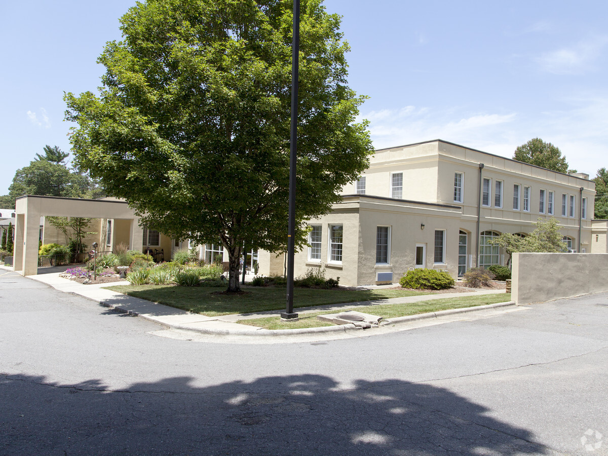
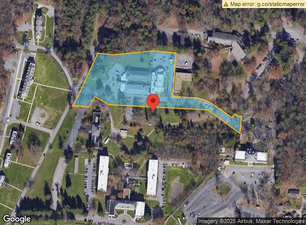
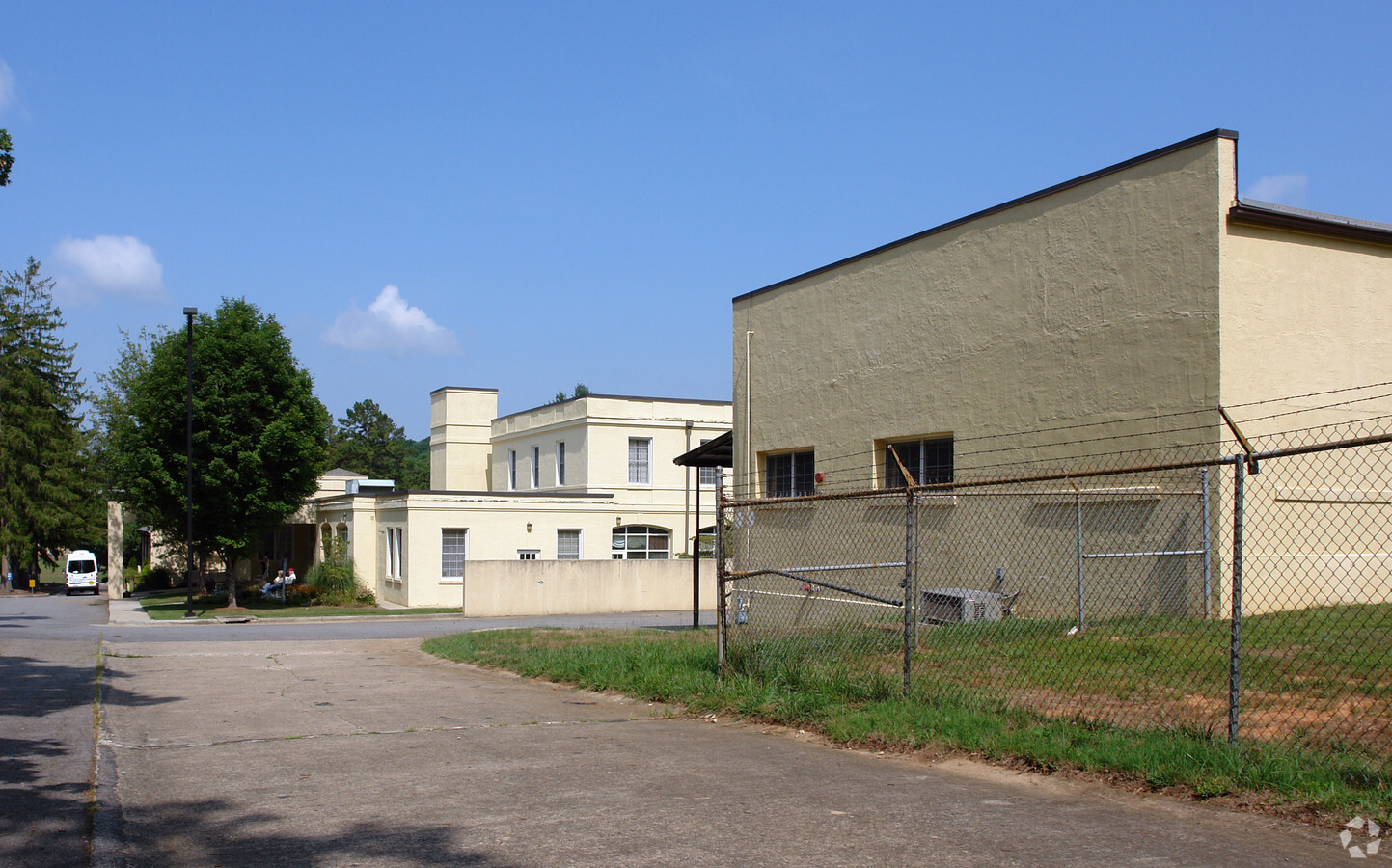
Property Record
100 Riceville Rd, Asheville, NC 28805
NEARBY LISTINGS FOR SALE OR LEASE
-
-
View all Asheville listings for sale on LoopNet.com
Property Detail
100 Riceville Rd
Asheville, NC
The Summit Condominium Phase 1 A
9668-48-5517-00000
LOT: 1 PLAT: 0192-0001
Hospitalprivate
Buncombe
X
North Carolina
3700966800J
1
2023
4.98 AC
2023
Buncombe County
001802
Asheville
31,065 SF
DEMOGRAPHICS near 100 Riceville Rd
1 Mile
3 Mile
5 Mile
2024 Total Population
4,630
25,596
71,807
2029 Population
4,732
26,469
74,591
Pop Growth 2024-2029
+ 2.20%
+ 3.41%
+ 3.88%
Average Age
46
45
43
2024 Total Households
2,203
12,090
32,740
HH Growth 2024-2029
+ 1.59%
+ 2.89%
+ 3.41%
Median Household Inc
$59,244
$62,415
$64,448
Avg Household Size
2.00
2.00
2.00
2024 Avg HH Vehicles
2.00
2.00
2.00
Median Home Value
$286,734
$332,162
$366,999
Median Year Built
1979
1985
1980
Nearby Places
- Restaurants
- Banks
- Shops
- Fitness
- Groceries
PUBLIC TRANSPORTATION
AIRPORT
Asheville Regional
DRIVE
WALK
Distance
Asheville Regional
25 min
14.1 mi
Freight Ports
North Charleston Terminal
DRIVE
WALK
Distance
North Charleston Terminal
297 min
257.8 mi
Nearby Properties
Address
Land Use
TOTAL SIZE
Lot Size
Zoning
Address
Land Use
TOTAL SIZE
Lot Size
Zoning
426,688 SF
40.88 AC
RB
Address
Land Use
TOTAL SIZE
Lot Size
Zoning
79,701 SF
15.26 AC
RM16
Address
Land Use
TOTAL SIZE
Lot Size
Zoning
71,241 SF
7.75 AC
HB
Address
Land Use
TOTAL SIZE
Lot Size
Zoning
45.86 AC
INST
Address
Land Use
TOTAL SIZE
Lot Size
Zoning
100,643 SF
15.06 AC
INST
Address
Land Use
TOTAL SIZE
Lot Size
Zoning
90,832 SF
1,103.09 AC
CR
Address
Land Use
TOTAL SIZE
Lot Size
Zoning
130,636 SF
13.19 AC
RB
Address
Land Use
TOTAL SIZE
Lot Size
Zoning
153,820 SF
13.79 AC
RB
Address
Land Use
TOTAL SIZE
Lot Size
Zoning
47,416 SF
7 AC
RS8
Address
Land Use
TOTAL SIZE
Lot Size
Zoning
220,408 SF
21.03 AC
UP
Address
Land Use
TOTAL SIZE
Lot Size
Zoning
75,979 SF
10.40 AC
R-3
Address
Land Use
TOTAL SIZE
Lot Size
Zoning
40,735 SF
4.67 AC
UP
Address
Land Use
TOTAL SIZE
Lot Size
Zoning
118,407 SF
11 AC
RB
Address
Land Use
TOTAL SIZE
Lot Size
Zoning
32,858 SF
13.52 AC
INST
Address
Land Use
TOTAL SIZE
Lot Size
Zoning
66,858 SF
10.24 AC
RM16
Address
Land Use
TOTAL SIZE
Lot Size
Zoning
100,124 SF
50.50 AC
RIVER
Address
Land Use
TOTAL SIZE
Lot Size
Zoning
70,025 SF
22.85 AC
RS4
Address
Land Use
TOTAL SIZE
Lot Size
Zoning
41,751 SF
10.05 AC
RS4
Address
Land Use
TOTAL SIZE
Lot Size
Zoning
14,001 SF
3.49 AC
HB
Address
Land Use
TOTAL SIZE
Lot Size
Zoning
16,780 SF
1.88 AC
RB
Address
Land Use
TOTAL SIZE
Lot Size
Zoning
13,135 SF
1.86 AC
LODG EXP
Address
Land Use
TOTAL SIZE
Lot Size
Zoning
24,136 SF
6.07 AC
HB
Address
Land Use
TOTAL SIZE
Lot Size
Zoning
115,530 SF
15.06 AC
RIVER
Address
Land Use
TOTAL SIZE
Lot Size
Zoning
119,054 SF
12.06 AC
CI
Address
Land Use
TOTAL SIZE
Lot Size
Zoning
68,662 SF
7.58 AC
RM16
Address
Land Use
TOTAL SIZE
Lot Size
Zoning
26,618 SF
2.88 AC
HB
Address
Land Use
TOTAL SIZE
Lot Size
Zoning
52,382 SF
12.50 AC
INST
Address
Land Use
TOTAL SIZE
Lot Size
Zoning
32,620 SF
2.76 AC
CBI
Address
Land Use
TOTAL SIZE
Lot Size
Zoning
125,482 SF
12.07 AC
CI
Address
Land Use
TOTAL SIZE
Lot Size
Zoning
19,276 SF
3.14 AC
RB
The World's #1 Commercial Real Estate Marketplace
Connect with us
© 2025 CoStar Group
The information above has been obtained from sources believed reliable. While we do not doubt its accuracy we have not verified it and make no guarantee, warranty or representation about it. It is your responsibility to independently confirm its accuracy and completeness. Any projections, opinions, assumptions, or estimates used are for example only and do not represent the current or future performance of the property. The value of this transaction to you depends on tax and other factors which should be evaluated by your tax, financial, and legal advisors. You and your advisors should conduct a careful, independent investigation of the property to determine to your satisfaction the suitability of the property for your needs.