Property Record
100 S State St, Manhattan, IL 60442
NEARBY LISTINGS FOR SALE OR LEASE
-
-
View all Manhattan listings for lease on LoopNet.com
Property Detail
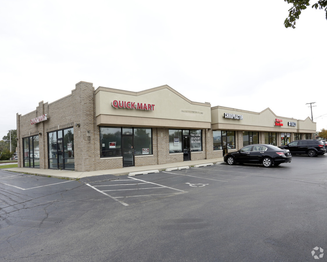
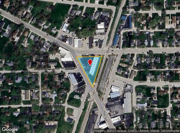
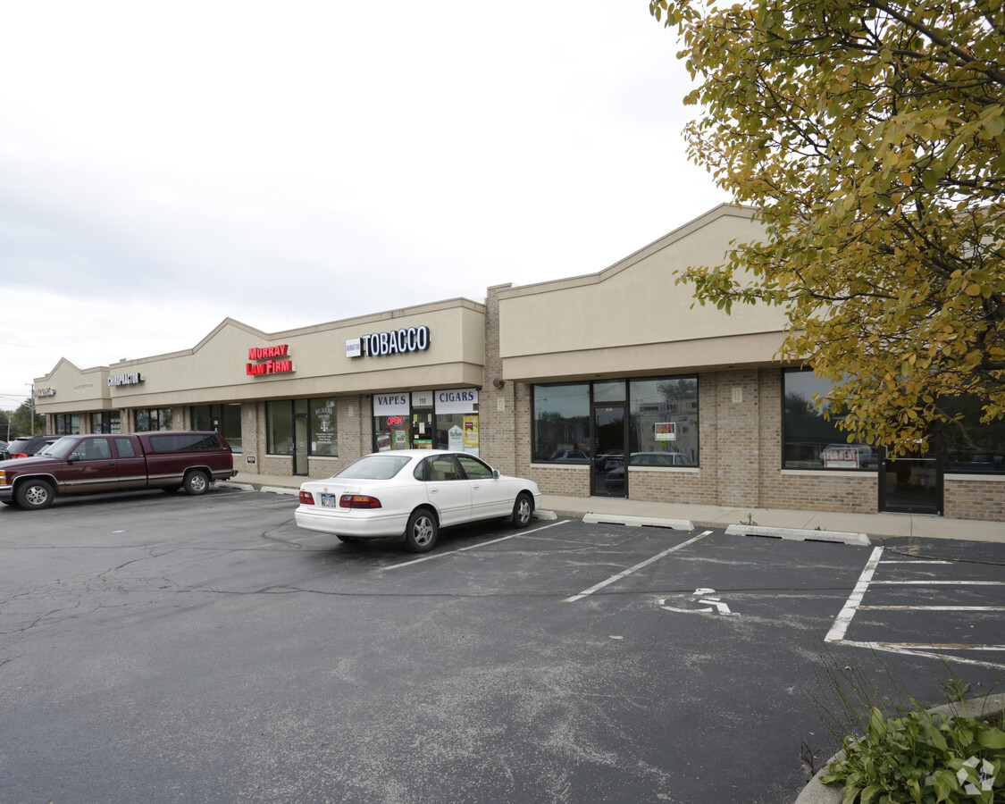
100 S State St
12-20-201-011
CONSOL PER PET 95-309 NDA: ALL OF BLK 1 IN THE ORIG TOWN OF MANHATTAN, LOCATED IN THE E1/2 NE1/4 SEC 20, T34N-R11E ALL OF WI
Commercialnec
Will
X
Illinois
17197C0311G
0.69 AC
2023
Joliet/Central Will
2023
Chicago
8835091017
Chicago-Naperville-Elgin, IL-IN-WI
7,128 SF
DEMOGRAPHICS near 100 S State St
1 Mile
3 Mile
5 Mile
2024 Total Population
6,777
11,982
24,795
2029 Population
6,740
12,148
25,007
Pop Growth 2024-2029
(0.55%)
+ 1.39%
+ 0.86%
Average Age
37
36
37
2024 Total Households
2,337
3,985
8,216
HH Growth 2024-2029
(0.73%)
+ 1.15%
+ 0.68%
Median Household Inc
$111,036
$116,613
$119,019
Avg Household Size
2.90
3.00
3.00
2024 Avg HH Vehicles
2.00
2.00
2.00
Median Home Value
$266,955
$302,737
$324,411
Median Year Built
1998
2000
1999
Nearby Places
- Restaurants
- Banks
- Shops
- Fitness
- Groceries
PUBLIC TRANSPORTATION
COMMUTER RAIL
Manhattan Station (SouthWest Service - Northeast Illinois Regional Commuter Railroad (Metra))
DRIVE
WALK
Distance
Manhattan Station (SouthWest Service - Northeast Illinois Regional Commuter Railroad (Metra))
1 min
5 min
0.3 mi
New Lenox Laraway Road (SouthWest Service - Northeast Illinois Regional Commuter Railroad (Metra))
DRIVE
WALK
Distance
New Lenox Laraway Road (SouthWest Service - Northeast Illinois Regional Commuter Railroad (Metra))
10 min
6.0 mi
AIRPORT
Chicago Midway International
DRIVE
WALK
Distance
Chicago Midway International
55 min
38.3 mi
Freight Ports
Port Milwaukee
DRIVE
WALK
Distance
Port Milwaukee
153 min
121.5 mi
SALE & LEASE HISTORY
LISTING DATE
SALE/LEASE

Dec 04, 2018
For Lease
Nearby Properties
Address
Land Use
TOTAL SIZE
Lot Size
Zoning
Address
Land Use
TOTAL SIZE
Lot Size
Zoning
31.17 AC
Address
Land Use
TOTAL SIZE
Lot Size
Zoning
97.04 AC
Address
Land Use
TOTAL SIZE
Lot Size
Zoning
40.48 AC
Address
Land Use
TOTAL SIZE
Lot Size
Zoning
2,198 SF
132.69 AC
AP
Address
Land Use
TOTAL SIZE
Lot Size
Zoning
6,530 SF
1.57 AC
Address
Land Use
TOTAL SIZE
Lot Size
Zoning
1.44 AC
Address
Land Use
TOTAL SIZE
Lot Size
Zoning
0.85 AC
Address
Land Use
TOTAL SIZE
Lot Size
Zoning
20.98 AC
Address
Land Use
TOTAL SIZE
Lot Size
Zoning
Address
Land Use
TOTAL SIZE
Lot Size
Zoning
1.26 AC
Address
Land Use
TOTAL SIZE
Lot Size
Zoning
Address
Land Use
TOTAL SIZE
Lot Size
Zoning
1,626 SF
78.50 AC
Address
Land Use
TOTAL SIZE
Lot Size
Zoning
160 AC
Address
Land Use
TOTAL SIZE
Lot Size
Zoning
4.39 AC
Address
Land Use
TOTAL SIZE
Lot Size
Zoning
Address
Land Use
TOTAL SIZE
Lot Size
Zoning
5.40 AC
Address
Land Use
TOTAL SIZE
Lot Size
Zoning
2.38 AC
Address
Land Use
TOTAL SIZE
Lot Size
Zoning
8.73 AC
Address
Land Use
TOTAL SIZE
Lot Size
Zoning
Address
Land Use
TOTAL SIZE
Lot Size
Zoning
17,356 SF
0.50 AC
Address
Land Use
TOTAL SIZE
Lot Size
Zoning
7,737 SF
2.46 AC
Address
Land Use
TOTAL SIZE
Lot Size
Zoning
0.18 AC
Address
Land Use
TOTAL SIZE
Lot Size
Zoning
13,855 SF
2.88 AC
Address
Land Use
TOTAL SIZE
Lot Size
Zoning
1.25 AC
Address
Land Use
TOTAL SIZE
Lot Size
Zoning
2,812 SF
0.64 AC
Address
Land Use
TOTAL SIZE
Lot Size
Zoning
0.32 AC
Address
Land Use
TOTAL SIZE
Lot Size
Zoning
1.96 AC
Address
Land Use
TOTAL SIZE
Lot Size
Zoning
4,438 SF
25.52 AC
The World's #1 Commercial Real Estate Marketplace
Connect with us
© 2025 CoStar Group
The information above has been obtained from sources believed reliable. While we do not doubt its accuracy we have not verified it and make no guarantee, warranty or representation about it. It is your responsibility to independently confirm its accuracy and completeness. Any projections, opinions, assumptions, or estimates used are for example only and do not represent the current or future performance of the property. The value of this transaction to you depends on tax and other factors which should be evaluated by your tax, financial, and legal advisors. You and your advisors should conduct a careful, independent investigation of the property to determine to your satisfaction the suitability of the property for your needs.