Property Record
100 S Swing Rd, Greensboro, NC 27409
NEARBY LISTINGS FOR SALE OR LEASE
Property Detail
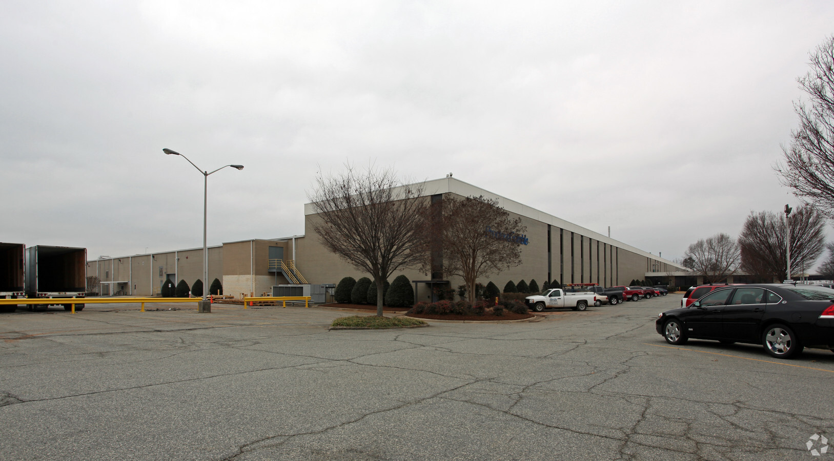
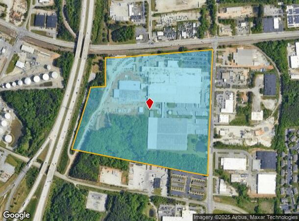
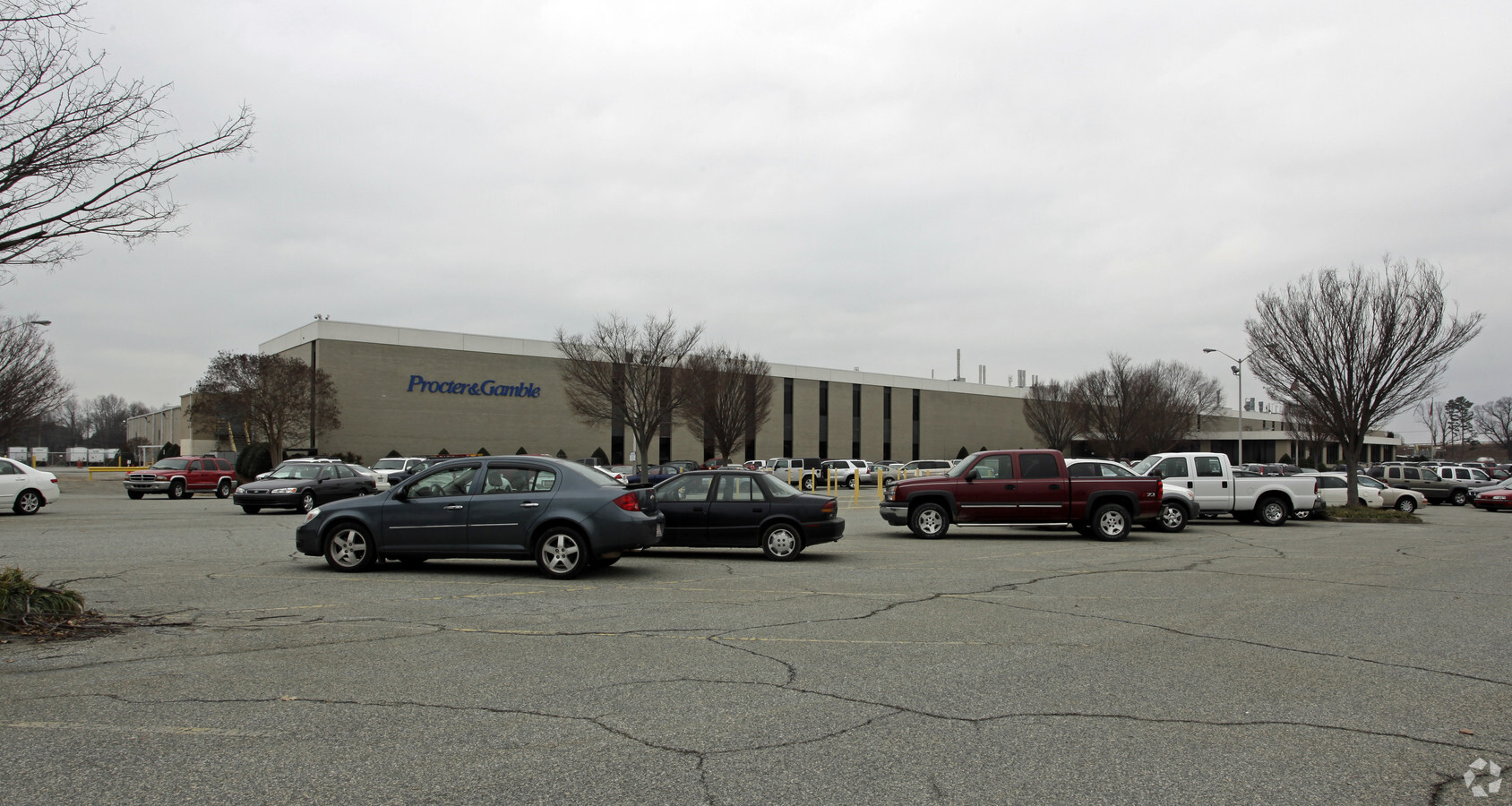
100 S Swing Rd
Greensboro-High Point, NC
Market St
0074573
PROCTER & GAMBLE
Industrialgeneral
Guilford
X
North Carolina
3710783400J
e002
2024
52.92 AC
2023
Airport/W Guilford County
016011
Greensboro/Winston-Salem
120,354 SF
DEMOGRAPHICS near 100 S Swing Rd
1 Mile
3 Mile
5 Mile
2024 Total Population
5,953
50,277
135,472
2029 Population
6,044
50,072
135,011
Pop Growth 2024-2029
+ 1.53%
(0.41%)
(0.34%)
Average Age
35
39
40
2024 Total Households
3,125
24,310
58,879
HH Growth 2024-2029
+ 1.60%
(0.37%)
(0.34%)
Median Household Inc
$38,050
$57,888
$67,134
Avg Household Size
1.90
2.00
2.20
2024 Avg HH Vehicles
1.00
2.00
2.00
Median Home Value
$146,532
$191,958
$237,758
Median Year Built
1991
1989
1988
Nearby Places
- Restaurants
- Banks
- Shops
- Fitness
- Groceries
PUBLIC TRANSPORTATION
COMMUTER RAIL
Greensboro Station (Piedmont - North Carolina by Train (NC Train))
DRIVE
WALK
Distance
Greensboro Station (Piedmont - North Carolina by Train (NC Train))
17 min
9.4 mi
AIRPORT
Piedmont Triad International
DRIVE
WALK
Distance
Piedmont Triad International
12 min
3.2 mi
Freight Ports
Virginia Port Authority - Richmond
DRIVE
WALK
Distance
Virginia Port Authority - Richmond
239 min
205.6 mi
Nearby Properties
Address
Land Use
TOTAL SIZE
Lot Size
Zoning
Address
Land Use
TOTAL SIZE
Lot Size
Zoning
747,867 SF
349.10 AC
PI
Address
Land Use
TOTAL SIZE
Lot Size
Zoning
21,687 SF
268.52 AC
HI
Address
Land Use
TOTAL SIZE
Lot Size
Zoning
892,800 SF
51.53 AC
HI
Address
Land Use
TOTAL SIZE
Lot Size
Zoning
404,766 SF
153.35 AC
AR
Address
Land Use
TOTAL SIZE
Lot Size
Zoning
501,140 SF
50.04 AC
R-3
Address
Land Use
TOTAL SIZE
Lot Size
Zoning
410,298 SF
33.10 AC
CU-RM-12
Address
Land Use
TOTAL SIZE
Lot Size
Zoning
412,635 SF
37.70 AC
CU-RM-12
Address
Land Use
TOTAL SIZE
Lot Size
Zoning
275,782 SF
27.65 AC
CU-RM-12
Address
Land Use
TOTAL SIZE
Lot Size
Zoning
691,408 SF
58.69 AC
LI
Address
Land Use
TOTAL SIZE
Lot Size
Zoning
279,853 SF
19.80 AC
CD-RM-18
Address
Land Use
TOTAL SIZE
Lot Size
Zoning
552,314 SF
38.47 AC
CU-RS-12
Address
Land Use
TOTAL SIZE
Lot Size
Zoning
138,843 SF
115.56 AC
CU-LI
Address
Land Use
TOTAL SIZE
Lot Size
Zoning
374,522 SF
56.55 AC
HI
Address
Land Use
TOTAL SIZE
Lot Size
Zoning
367,819 SF
32.88 AC
CU-SC
Address
Land Use
TOTAL SIZE
Lot Size
Zoning
217,594 SF
20.01 AC
CU-RM-18
Address
Land Use
TOTAL SIZE
Lot Size
Zoning
245,192 SF
15.27 AC
CU-RM-12
Address
Land Use
TOTAL SIZE
Lot Size
Zoning
312,732 SF
14.27 AC
CU-RM-18
Address
Land Use
TOTAL SIZE
Lot Size
Zoning
358,900 SF
60.50 AC
PI
Address
Land Use
TOTAL SIZE
Lot Size
Zoning
354,454 SF
20.65 AC
CD-RM-12
Address
Land Use
TOTAL SIZE
Lot Size
Zoning
156,800 SF
30.81 AC
R-3
Address
Land Use
TOTAL SIZE
Lot Size
Zoning
316,205 SF
17.84 AC
CU-RM-18
Address
Land Use
TOTAL SIZE
Lot Size
Zoning
145,105 SF
20.12 AC
O
Address
Land Use
TOTAL SIZE
Lot Size
Zoning
234,173 SF
22.14 AC
CU-RM-12
Address
Land Use
TOTAL SIZE
Lot Size
Zoning
256,423 SF
20.64 AC
CU-PDR
Address
Land Use
TOTAL SIZE
Lot Size
Zoning
309,749 SF
16.74 AC
CZ-PDM
Address
Land Use
TOTAL SIZE
Lot Size
Zoning
325.42 AC
AR
Address
Land Use
TOTAL SIZE
Lot Size
Zoning
180,568 SF
0.01 AC
AR
Address
Land Use
TOTAL SIZE
Lot Size
Zoning
311,199 SF
20.79 AC
CU-RM-12
Address
Land Use
TOTAL SIZE
Lot Size
Zoning
336,176 SF
31.73 AC
CU-SC
The World's #1 Commercial Real Estate Marketplace
Connect with us
© 2025 CoStar Group
The information above has been obtained from sources believed reliable. While we do not doubt its accuracy we have not verified it and make no guarantee, warranty or representation about it. It is your responsibility to independently confirm its accuracy and completeness. Any projections, opinions, assumptions, or estimates used are for example only and do not represent the current or future performance of the property. The value of this transaction to you depends on tax and other factors which should be evaluated by your tax, financial, and legal advisors. You and your advisors should conduct a careful, independent investigation of the property to determine to your satisfaction the suitability of the property for your needs.