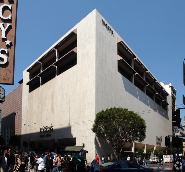
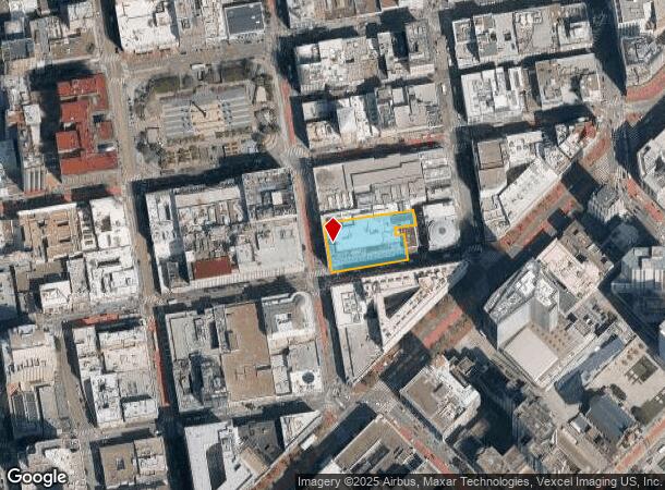
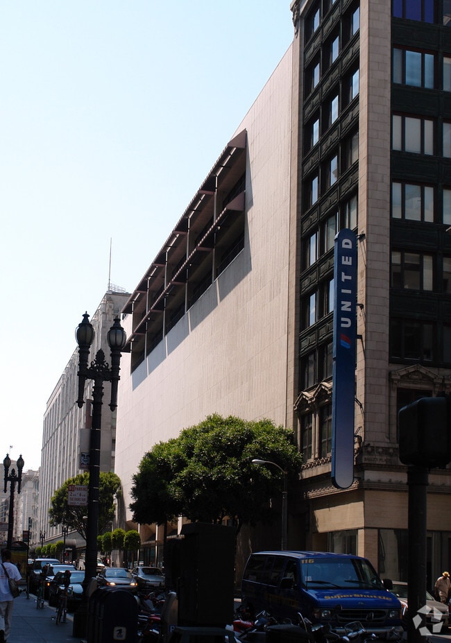
Property Record
100 Stockton St, San Francisco, CA 94108
NEARBY LISTINGS FOR SALE OR LEASE
Property Detail
100 Stockton St
San Francisco
50 Vara
San Francisco-Redwood City-South San Francisco, CA
TRACT 50 VARA BL
0313-017
San Francisco
Officebuilding
California
2024
17
2025
0.72 AC
011700
Union Square
263,640 SF
DEMOGRAPHICS near 100 Stockton St
1 Mile
3 Mile
5 Mile
2024 Total Population
137,236
419,061
653,617
2029 Population
128,072
391,087
605,911
Pop Growth 2024-2029
(6.68%)
(6.68%)
(7.30%)
Average Age
43
42
42
2024 Total Households
72,133
204,751
290,658
HH Growth 2024-2029
(7.27%)
(7.23%)
(7.69%)
Median Household Inc
$85,073
$129,207
$129,893
Avg Household Size
1.70
1.90
2.10
2024 Avg HH Vehicles
.00
1.00
1.00
Median Home Value
$1,067,262
$1,100,563
$1,102,764
Median Year Built
1964
1949
1949
Nearby Places
Map Layers
Map Styles
 Street
 Aerial
- Restaurants
- Banks
- Shops
- Fitness
- Groceries
SALE & LEASE HISTORY
LISTING DATE
SALE/LEASE

Oct 11, 2017
For Lease
Mar 01, 2019
For Lease
Aug 08, 2019
For Lease
Nearby Properties
Address
Land Use
TOTAL SIZE
Lot Size
Zoning
Address
Land Use
TOTAL SIZE
Lot Size
Zoning
1,015,000 SF
2.43 AC
RC4
Address
Land Use
TOTAL SIZE
Lot Size
Zoning
764,661 SF
0.67 AC
C3OSD
Address
Land Use
TOTAL SIZE
Lot Size
Zoning
750,370 SF
3.25 AC
MBR3
Address
Land Use
TOTAL SIZE
Lot Size
Zoning
1,471,929 SF
1.93 AC
C3O
Address
Land Use
TOTAL SIZE
Lot Size
Zoning
1,300,000 SF
1.74 AC
C3O
Address
Land Use
TOTAL SIZE
Lot Size
Zoning
1,420,430 SF
1.16 AC
C3OSD
Address
Land Use
TOTAL SIZE
Lot Size
Zoning
1,534,312 SF
2.60 AC
C3O
Address
Land Use
TOTAL SIZE
Lot Size
Zoning
914,037 SF
1.36 AC
C3O
Address
Land Use
TOTAL SIZE
Lot Size
Zoning
248,303 SF
4.35 AC
Address
Land Use
TOTAL SIZE
Lot Size
Zoning
717,234 SF
3.47 AC
UMU
Address
Land Use
TOTAL SIZE
Lot Size
Zoning
605,459 SF
0.63 AC
C3O
Address
Land Use
TOTAL SIZE
Lot Size
Zoning
475,791 SF
0.55 AC
C3OSD
Address
Land Use
TOTAL SIZE
Lot Size
Zoning
690,442 SF
0.79 AC
C3O
Address
Land Use
TOTAL SIZE
Lot Size
Zoning
10.92 AC
Address
Land Use
TOTAL SIZE
Lot Size
Zoning
750,491 SF
0.51 AC
C3O
Address
Land Use
TOTAL SIZE
Lot Size
Zoning
432,000 SF
0.35 AC
C3OSD
Address
Land Use
TOTAL SIZE
Lot Size
Zoning
266,143 SF
4 AC
C-3-R
Address
Land Use
TOTAL SIZE
Lot Size
Zoning
885,581 SF
5.20 AC
M2
Address
Land Use
TOTAL SIZE
Lot Size
Zoning
512,395 SF
1.24 AC
C3O
Address
Land Use
TOTAL SIZE
Lot Size
Zoning
508,714 SF
1.29 AC
C3R
Address
Land Use
TOTAL SIZE
Lot Size
Zoning
1,084,662 SF
1.67 AC
C3O
Address
Land Use
TOTAL SIZE
Lot Size
Zoning
505,120 SF
0.41 AC
C3O
Address
Land Use
TOTAL SIZE
Lot Size
Zoning
694,334 SF
1.01 AC
C3O
Address
Land Use
TOTAL SIZE
Lot Size
Zoning
696,431 SF
0.97 AC
C3G
Address
Land Use
TOTAL SIZE
Lot Size
Zoning
139,070 SF
0.64 AC
C3O
Address
Land Use
TOTAL SIZE
Lot Size
Zoning
1.52 AC
C3G
Address
Land Use
TOTAL SIZE
Lot Size
Zoning
1,424,230 SF
2.60 AC
C3G
Address
Land Use
TOTAL SIZE
Lot Size
Zoning
614,740 SF
1.74 AC
C3OSD
Address
Land Use
TOTAL SIZE
Lot Size
Zoning
615,957 SF
0.63 AC
C3O
Address
Land Use
TOTAL SIZE
Lot Size
Zoning
492,980 SF
0.43 AC
C3O
The World's #1 Commercial Real Estate Marketplace
Connect with us
© 2025 CoStar Group
The information above has been obtained from sources believed reliable. While we do not doubt its accuracy we have not verified it and make no guarantee, warranty or representation about it. It is your responsibility to independently confirm its accuracy and completeness. Any projections, opinions, assumptions, or estimates used are for example only and do not represent the current or future performance of the property. The value of this transaction to you depends on tax and other factors which should be evaluated by your tax, financial, and legal advisors. You and your advisors should conduct a careful, independent investigation of the property to determine to your satisfaction the suitability of the property for your needs.