Property Record
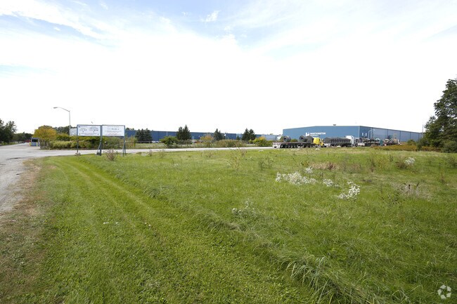
100 Worthington Dr, Chesterton, IN 46304


NEARBY LISTINGS FOR SALE OR LEASE
Property Detail
100 Worthington Dr
64-03-34-300-001.000-026
W1528.4 N RD 20 EX S 350 SW & PAR W1528.4 LT 4S RR & EX PAR SD NW 34-37-6 45.579A TIF 99-004158
Heavyindustrial
Porter
X
Indiana
18127C0126D
4s
2023
0.01 AC
2024
Porter County
050302
Chicago
478,084 SF
Chicago-Naperville-Elgin, IL-IN-WI
DEMOGRAPHICS near 100 Worthington Dr
1 Mile
3 Mile
5 Mile
2024 Total Population
2,227
22,159
51,401
2029 Population
2,294
22,787
52,963
Pop Growth 2024-2029
+ 3.01%
+ 2.83%
+ 3.04%
Average Age
39
40
41
2024 Total Households
829
8,866
19,973
HH Growth 2024-2029
+ 3.14%
+ 2.89%
+ 3.09%
Median Household Inc
$75,760
$80,875
$83,347
Avg Household Size
2.70
2.50
2.50
2024 Avg HH Vehicles
2.00
2.00
2.00
Median Home Value
$245,484
$238,457
$249,447
Median Year Built
1993
1981
1984
Nearby Places
Map Layers
Map Styles
 Street
 Aerial
- Restaurants
- Banks
- Shops
- Fitness
- Groceries
PUBLIC TRANSPORTATION
COMMUTER RAIL
Dune Park (Chesterton) Station (South Shore Line - Northern Indiana Commuter Transportation District (South Shore Line))
DRIVE
WALK
Distance
Dune Park (Chesterton) Station (South Shore Line - Northern Indiana Commuter Transportation District (South Shore Line))
8 min
3.7 mi
Ogden Dunes (Portage) Station (South Shore Line - Northern Indiana Commuter Transportation District (South Shore Line))
DRIVE
WALK
Distance
Ogden Dunes (Portage) Station (South Shore Line - Northern Indiana Commuter Transportation District (South Shore Line))
10 min
6.0 mi
Freight Ports
Port Milwaukee
DRIVE
WALK
Distance
Port Milwaukee
162 min
129.2 mi
Nearby Properties
Address
Land Use
TOTAL SIZE
Lot Size
Zoning
Address
Land Use
TOTAL SIZE
Lot Size
Zoning
5,092,064 SF
0.06 AC
Address
Land Use
TOTAL SIZE
Lot Size
Zoning
511,056 SF
131 SF
Address
Land Use
TOTAL SIZE
Lot Size
Zoning
3,430,063 SF
0.04 AC
Address
Land Use
TOTAL SIZE
Lot Size
Zoning
567,109 SF
131 SF
Address
Land Use
TOTAL SIZE
Lot Size
Zoning
400,440 SF
87 SF
Address
Land Use
TOTAL SIZE
Lot Size
Zoning
533,172 SF
Address
Land Use
TOTAL SIZE
Lot Size
Zoning
789,622 SF
0.02 AC
Address
Land Use
TOTAL SIZE
Lot Size
Zoning
199,296 SF
87 SF
Address
Land Use
TOTAL SIZE
Lot Size
Zoning
167,850 SF
46.39 AC
Address
Land Use
TOTAL SIZE
Lot Size
Zoning
204,400 SF
Address
Land Use
TOTAL SIZE
Lot Size
Zoning
243,963 SF
Address
Land Use
TOTAL SIZE
Lot Size
Zoning
233,491 SF
174 SF
Address
Land Use
TOTAL SIZE
Lot Size
Zoning
73,376 SF
44 SF
Address
Land Use
TOTAL SIZE
Lot Size
Zoning
38,337 SF
44 SF
Address
Land Use
TOTAL SIZE
Lot Size
Zoning
114,061 SF
6.26 AC
Address
Land Use
TOTAL SIZE
Lot Size
Zoning
61,561 SF
3.71 AC
Address
Land Use
TOTAL SIZE
Lot Size
Zoning
216,590 SF
Address
Land Use
TOTAL SIZE
Lot Size
Zoning
159,933 SF
0.01 AC
Address
Land Use
TOTAL SIZE
Lot Size
Zoning
34,360 SF
131 SF
Address
Land Use
TOTAL SIZE
Lot Size
Zoning
164,640 SF
44 SF
Address
Land Use
TOTAL SIZE
Lot Size
Zoning
174,960 SF
Address
Land Use
TOTAL SIZE
Lot Size
Zoning
60,861 SF
44 SF
Address
Land Use
TOTAL SIZE
Lot Size
Zoning
90,396 SF
6.82 AC
Address
Land Use
TOTAL SIZE
Lot Size
Zoning
63,357 SF
44 SF
Address
Land Use
TOTAL SIZE
Lot Size
Zoning
100,656 SF
44 SF
Address
Land Use
TOTAL SIZE
Lot Size
Zoning
65,950 SF
44 SF
Address
Land Use
TOTAL SIZE
Lot Size
Zoning
91,750 SF
44 SF
Address
Land Use
TOTAL SIZE
Lot Size
Zoning
148,942 SF
Address
Land Use
TOTAL SIZE
Lot Size
Zoning
190,645 SF
The World's #1 Commercial Real Estate Marketplace
Connect with us
© 2026 CoStar Group
The information above has been obtained from sources believed reliable. While we do not doubt its accuracy we have not verified it and make no guarantee, warranty or representation about it. It is your responsibility to independently confirm its accuracy and completeness. Any projections, opinions, assumptions, or estimates used are for example only and do not represent the current or future performance of the property. The value of this transaction to you depends on tax and other factors which should be evaluated by your tax, financial, and legal advisors. You and your advisors should conduct a careful, independent investigation of the property to determine to your satisfaction the suitability of the property for your needs.