Property Record
1000 Carter Ave, Ashland, KY 41101
NEARBY LISTINGS FOR SALE OR LEASE
Property Detail
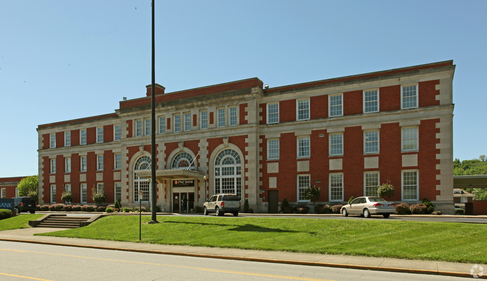
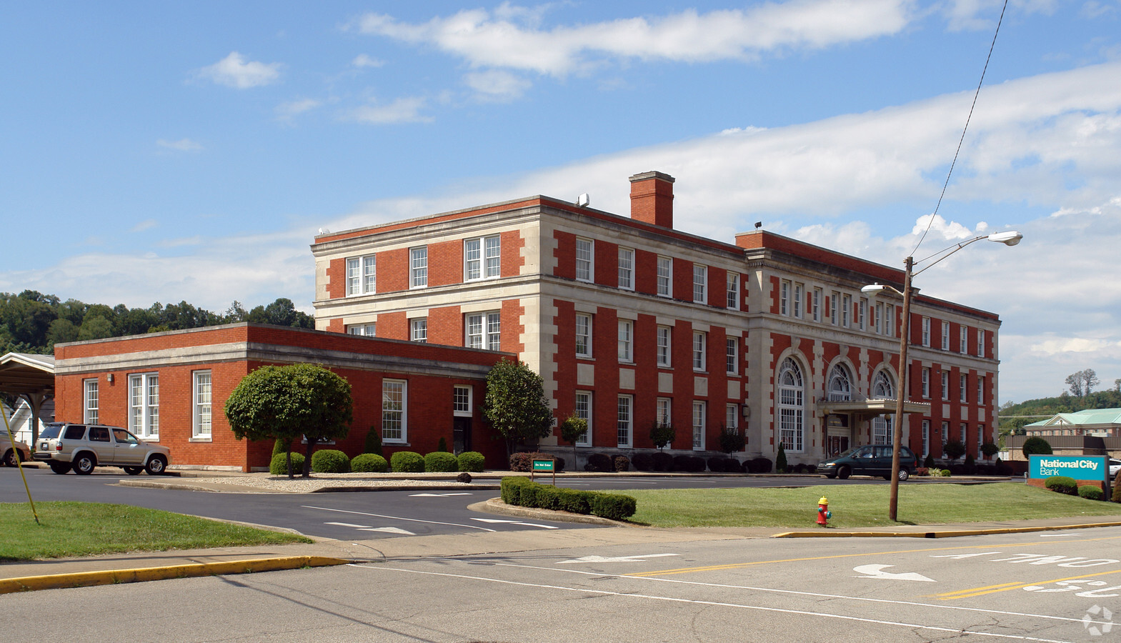
1000 Carter Ave
Huntington-Ashland, WV-KY-OH
1000 Carter Avenue
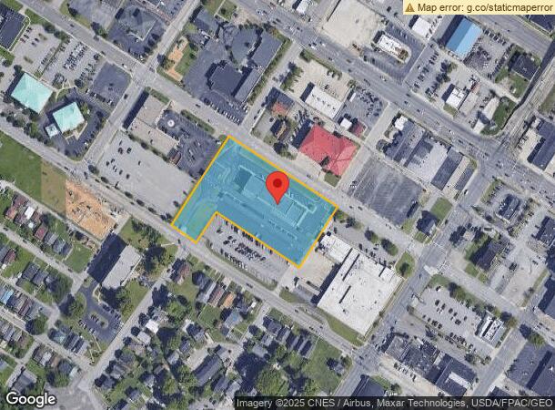
030-08-00-002.00
C & O PROP TRACT 1 2.3328 ACRES
Financialbuilding
Boyd
X
Kentucky
21019C0057E
2.33 AC
2024
Greater Ashland
2024
Huntington/Ashland
030200
DEMOGRAPHICS near 1000 Carter Ave
1 Mile
3 Mile
5 Mile
2024 Total Population
4,522
32,061
58,443
2029 Population
4,458
31,578
57,470
Pop Growth 2024-2029
(1.42%)
(1.51%)
(1.66%)
Average Age
40
42
42
2024 Total Households
2,005
13,442
24,314
HH Growth 2024-2029
(1.40%)
(1.42%)
(1.60%)
Median Household Inc
$25,371
$49,235
$50,910
Avg Household Size
2.10
2.30
2.30
2024 Avg HH Vehicles
1.00
2.00
2.00
Median Home Value
$79,531
$109,823
$119,600
Median Year Built
1959
1963
1965
Nearby Places
- Restaurants
- Banks
- Shops
- Fitness
- Groceries
PUBLIC TRANSPORTATION
COMMUTER RAIL
Ashland Amtrak Station (Cardinal - Amtrak)
DRIVE
WALK
Distance
Ashland Amtrak Station (Cardinal - Amtrak)
2 min
10 min
0.5 mi
AIRPORT
Tri-State/Milton J Ferguson Field
DRIVE
WALK
Distance
Tri-State/Milton J Ferguson Field
22 min
12.4 mi
Freight Ports
Port of Toledo
DRIVE
WALK
Distance
Port of Toledo
333 min
257.7 mi
Nearby Properties
Address
Land Use
TOTAL SIZE
Lot Size
Zoning
Address
Land Use
TOTAL SIZE
Lot Size
Zoning
6.96 AC
Z02
Address
Land Use
TOTAL SIZE
Lot Size
Zoning
36.49 AC
OTHER
Address
Land Use
TOTAL SIZE
Lot Size
Zoning
29.92 AC
Z02
Address
Land Use
TOTAL SIZE
Lot Size
Zoning
3,514 SF
21.96 AC
Z02
Address
Land Use
TOTAL SIZE
Lot Size
Zoning
0.99 AC
Z02
Address
Land Use
TOTAL SIZE
Lot Size
Zoning
1.94 AC
Z03
Address
Land Use
TOTAL SIZE
Lot Size
Zoning
16.29 AC
COMMERCIAL
Address
Land Use
TOTAL SIZE
Lot Size
Zoning
116,640 SF
0.97 AC
COMMERCIAL
Address
Land Use
TOTAL SIZE
Lot Size
Zoning
11.95 AC
Address
Land Use
TOTAL SIZE
Lot Size
Zoning
4.47 AC
COMMERCIAL
Address
Land Use
TOTAL SIZE
Lot Size
Zoning
28.87 AC
COMMERCIAL
Address
Land Use
TOTAL SIZE
Lot Size
Zoning
91,786 SF
2.93 AC
Address
Land Use
TOTAL SIZE
Lot Size
Zoning
0.73 AC
Z02
Address
Land Use
TOTAL SIZE
Lot Size
Zoning
0.38 AC
COMMERCIAL
Address
Land Use
TOTAL SIZE
Lot Size
Zoning
139,148 SF
Address
Land Use
TOTAL SIZE
Lot Size
Zoning
Address
Land Use
TOTAL SIZE
Lot Size
Zoning
1.67 AC
RESIDENTIA
Address
Land Use
TOTAL SIZE
Lot Size
Zoning
1.63 AC
COMMERCIAL
Address
Land Use
TOTAL SIZE
Lot Size
Zoning
1.95 AC
COMMERCIAL
Address
Land Use
TOTAL SIZE
Lot Size
Zoning
35,014 SF
3.81 AC
Address
Land Use
TOTAL SIZE
Lot Size
Zoning
4.30 AC
COMMERCIAL
Address
Land Use
TOTAL SIZE
Lot Size
Zoning
22,592 SF
43.50 AC
OTHER
Address
Land Use
TOTAL SIZE
Lot Size
Zoning
30,250 SF
8.29 AC
Address
Land Use
TOTAL SIZE
Lot Size
Zoning
141 AC
COMMERCIAL
Address
Land Use
TOTAL SIZE
Lot Size
Zoning
47,107 SF
4.67 AC
Address
Land Use
TOTAL SIZE
Lot Size
Zoning
1.46 AC
COMMERCIAL
Address
Land Use
TOTAL SIZE
Lot Size
Zoning
Address
Land Use
TOTAL SIZE
Lot Size
Zoning
0.20 AC
Z02
Address
Land Use
TOTAL SIZE
Lot Size
Zoning
3.50 AC
Z02
Address
Land Use
TOTAL SIZE
Lot Size
Zoning
1,920 SF
33.30 AC
Z03
The World's #1 Commercial Real Estate Marketplace
Connect with us
© 2025 CoStar Group
The information above has been obtained from sources believed reliable. While we do not doubt its accuracy we have not verified it and make no guarantee, warranty or representation about it. It is your responsibility to independently confirm its accuracy and completeness. Any projections, opinions, assumptions, or estimates used are for example only and do not represent the current or future performance of the property. The value of this transaction to you depends on tax and other factors which should be evaluated by your tax, financial, and legal advisors. You and your advisors should conduct a careful, independent investigation of the property to determine to your satisfaction the suitability of the property for your needs.