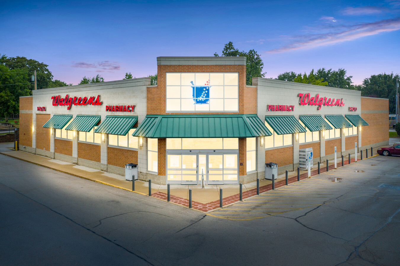
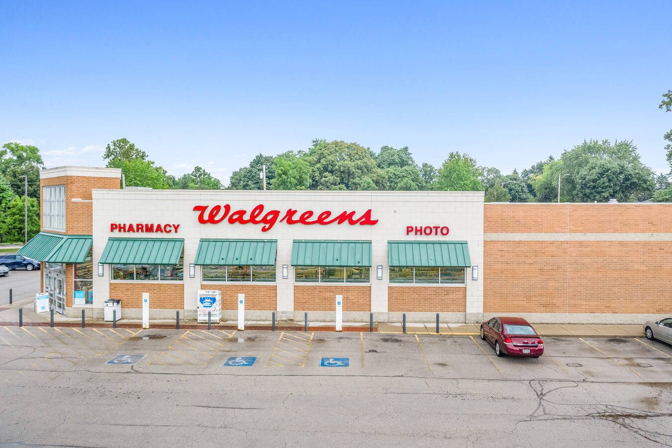
Property Record
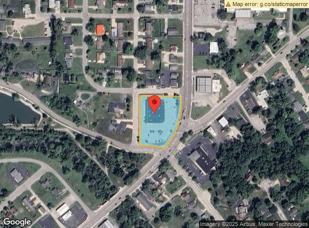
1000 E Main St, Greenville, OH 45331

NEARBY LISTINGS FOR SALE OR LEASE
Property Detail
1000 E Main St
F27-2-212-26-02-05-14300
Wayne Wood Addn
Storebuilding
WAYNE WOOD ADDN PT LOTS 2553-2560 & WHOLE LOTS 2609-2612
X
Darke
39037C0251E
Ohio
2023
1.49 AC
2023
Ohio South Area
555001
Other Market Areas
13,578 SF
Greenville, OH
DEMOGRAPHICS near 1000 E Main St
1 Mile
3 Mile
5 Mile
2024 Total Population
9,410
16,309
19,726
2029 Population
9,583
16,503
19,884
Pop Growth 2024-2029
+ 1.84%
+ 1.19%
+ 0.80%
Average Age
44
44
44
2024 Total Households
4,282
7,412
8,758
HH Growth 2024-2029
+ 1.75%
+ 1.07%
+ 0.71%
Median Household Inc
$49,189
$48,540
$50,457
Avg Household Size
2.10
2.10
2.20
2024 Avg HH Vehicles
2.00
2.00
2.00
Median Home Value
$136,866
$131,775
$140,196
Median Year Built
1966
1965
1965
Nearby Places
- Restaurants
- Banks
- Shops
- Fitness
- Groceries
PUBLIC TRANSPORTATION
AIRPORT
James M Cox Dayton International
DRIVE
WALK
Distance
James M Cox Dayton International
52 min
33.0 mi
Freight Ports
Port of Toledo
DRIVE
WALK
Distance
Port of Toledo
179 min
147.9 mi
SALE & LEASE HISTORY
LISTING DATE
SALE/LEASE

Sep 01, 2020
For Sale
Feb 03, 2021
For Sale
Nearby Properties
Address
Land Use
TOTAL SIZE
Lot Size
Zoning
Address
Land Use
TOTAL SIZE
Lot Size
Zoning
165,258 SF
10.08 AC
Address
Land Use
TOTAL SIZE
Lot Size
Zoning
14,501 SF
61.83 AC
Address
Land Use
TOTAL SIZE
Lot Size
Zoning
654,444 SF
38.74 AC
Address
Land Use
TOTAL SIZE
Lot Size
Zoning
202,926 SF
34.01 AC
Address
Land Use
TOTAL SIZE
Lot Size
Zoning
287,880 SF
16.46 AC
Address
Land Use
TOTAL SIZE
Lot Size
Zoning
27,414 SF
19.67 AC
Address
Land Use
TOTAL SIZE
Lot Size
Zoning
4,860 SF
86.54 AC
Address
Land Use
TOTAL SIZE
Lot Size
Zoning
30.71 AC
Address
Land Use
TOTAL SIZE
Lot Size
Zoning
64,926 SF
12 AC
Address
Land Use
TOTAL SIZE
Lot Size
Zoning
1,850 SF
79.96 AC
Address
Land Use
TOTAL SIZE
Lot Size
Zoning
13.81 AC
Address
Land Use
TOTAL SIZE
Lot Size
Zoning
54,232 SF
5.44 AC
Address
Land Use
TOTAL SIZE
Lot Size
Zoning
32,944 SF
13.91 AC
Address
Land Use
TOTAL SIZE
Lot Size
Zoning
110,444 SF
15.58 AC
Address
Land Use
TOTAL SIZE
Lot Size
Zoning
1,260 SF
15.01 AC
Address
Land Use
TOTAL SIZE
Lot Size
Zoning
119,140 SF
5.37 AC
Address
Land Use
TOTAL SIZE
Lot Size
Zoning
63,168 SF
8.62 AC
Address
Land Use
TOTAL SIZE
Lot Size
Zoning
211,048 SF
5.68 AC
Address
Land Use
TOTAL SIZE
Lot Size
Zoning
62,842 SF
7.64 AC
Address
Land Use
TOTAL SIZE
Lot Size
Zoning
11,251 SF
17.32 AC
Address
Land Use
TOTAL SIZE
Lot Size
Zoning
25,190 SF
3.69 AC
Address
Land Use
TOTAL SIZE
Lot Size
Zoning
26,250 SF
12.21 AC
Address
Land Use
TOTAL SIZE
Lot Size
Zoning
55,100 SF
5.76 AC
Address
Land Use
TOTAL SIZE
Lot Size
Zoning
58,168 SF
8.56 AC
Address
Land Use
TOTAL SIZE
Lot Size
Zoning
34,080 SF
3.68 AC
Address
Land Use
TOTAL SIZE
Lot Size
Zoning
23,609 SF
0.84 AC
Address
Land Use
TOTAL SIZE
Lot Size
Zoning
16,304 SF
26.70 AC
Address
Land Use
TOTAL SIZE
Lot Size
Zoning
15,250 SF
11.58 AC
Address
Land Use
TOTAL SIZE
Lot Size
Zoning
66,400 SF
19.89 AC
Address
Land Use
TOTAL SIZE
Lot Size
Zoning
38,806 SF
9.64 AC
The World's #1 Commercial Real Estate Marketplace
Connect with us
© 2025 CoStar Group
The information above has been obtained from sources believed reliable. While we do not doubt its accuracy we have not verified it and make no guarantee, warranty or representation about it. It is your responsibility to independently confirm its accuracy and completeness. Any projections, opinions, assumptions, or estimates used are for example only and do not represent the current or future performance of the property. The value of this transaction to you depends on tax and other factors which should be evaluated by your tax, financial, and legal advisors. You and your advisors should conduct a careful, independent investigation of the property to determine to your satisfaction the suitability of the property for your needs.