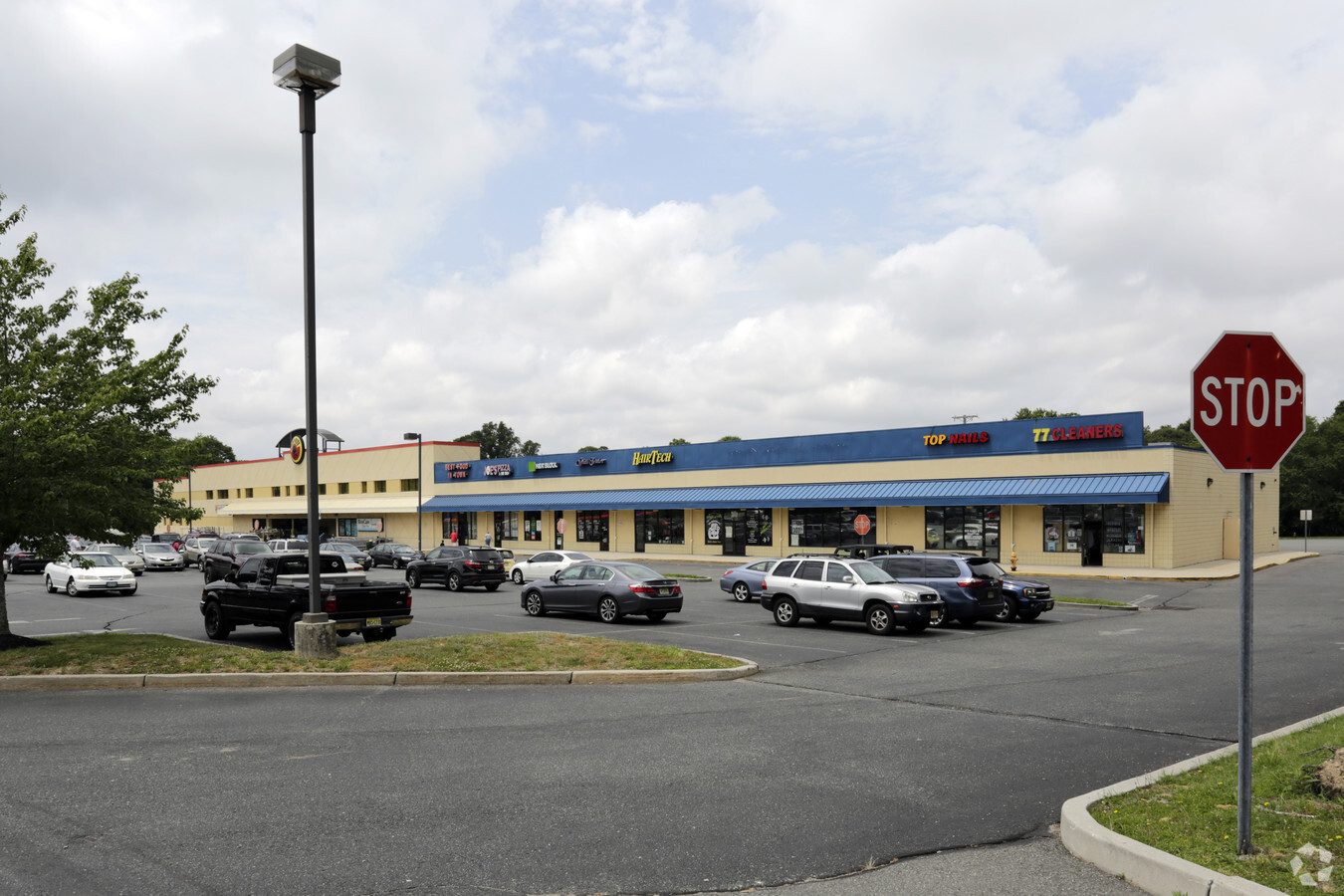
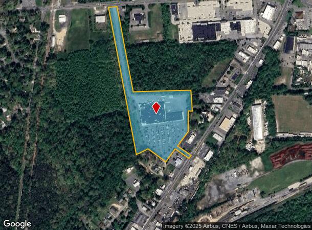
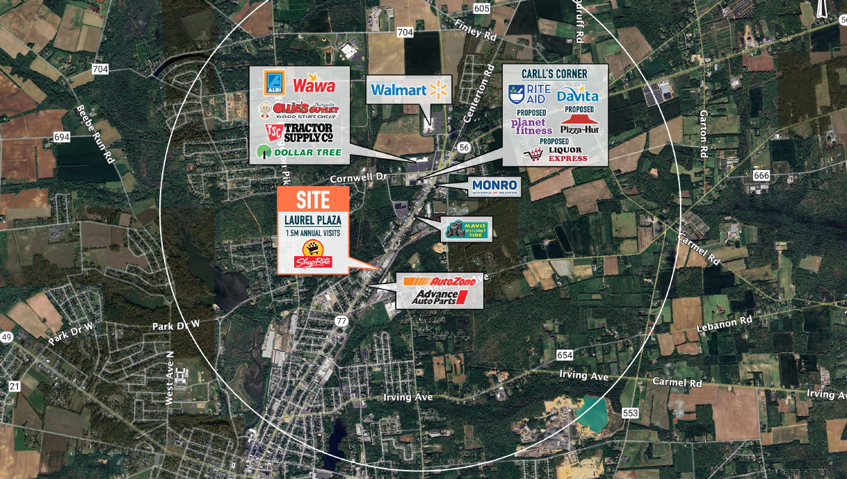
Property Record
1020 N Pearl St, Bridgeton, NJ 08302
Current Lease Availabilities
NEARBY LISTINGS FOR SALE OR LEASE
Property Detail
1020 N Pearl St
Vineland-Bridgeton, NJ
ADDITIONAL LOTS: LAUREL PLAZA
13-01901-0000-00008
Cumberland
Regionalshoppingcenterormallwithanchorstore
New Jersey
X
8
34011C0154E
13.67 AC
2024
Vineland/Bridgeton
2024
Philadelphia
010702
DEMOGRAPHICS near 1020 N Pearl St
1 Mile
3 Mile
5 Mile
2024 Total Population
1,818
28,851
39,712
2029 Population
1,793
28,369
39,084
Pop Growth 2024-2029
(1.38%)
(1.67%)
(1.58%)
Average Age
41
35
36
2024 Total Households
667
9,019
12,931
HH Growth 2024-2029
(1.50%)
(1.67%)
(1.62%)
Median Household Inc
$63,371
$51,617
$54,641
Avg Household Size
2.70
3.00
2.90
2024 Avg HH Vehicles
2.00
2.00
2.00
Median Home Value
$184,387
$180,972
$190,489
Median Year Built
1969
1963
1964
Nearby Places
- Restaurants
- Banks
- Shops
- Fitness
- Groceries
PUBLIC TRANSPORTATION
AIRPORT
Philadelphia International
DRIVE
WALK
Distance
Philadelphia International
65 min
39.6 mi
Freight Ports
Port of Wilmington, RI
DRIVE
WALK
Distance
Port of Wilmington, RI
49 min
34.8 mi
Nearby Properties
Address
Land Use
TOTAL SIZE
Lot Size
Zoning
Address
Land Use
TOTAL SIZE
Lot Size
Zoning
140.15 AC
R1
Address
Land Use
TOTAL SIZE
Lot Size
Zoning
3.19 AC
Address
Land Use
TOTAL SIZE
Lot Size
Zoning
52,724 SF
3.32 AC
Address
Land Use
TOTAL SIZE
Lot Size
Zoning
2.71 AC
Address
Land Use
TOTAL SIZE
Lot Size
Zoning
6.20 AC
R1
Address
Land Use
TOTAL SIZE
Lot Size
Zoning
1.73 AC
Address
Land Use
TOTAL SIZE
Lot Size
Zoning
28.60 AC
Address
Land Use
TOTAL SIZE
Lot Size
Zoning
16.23 AC
Address
Land Use
TOTAL SIZE
Lot Size
Zoning
29.17 AC
B2
Address
Land Use
TOTAL SIZE
Lot Size
Zoning
25.91 AC
Address
Land Use
TOTAL SIZE
Lot Size
Zoning
29.38 AC
Address
Land Use
TOTAL SIZE
Lot Size
Zoning
32.89 AC
GI
Address
Land Use
TOTAL SIZE
Lot Size
Zoning
Address
Land Use
TOTAL SIZE
Lot Size
Zoning
13.18 AC
Address
Land Use
TOTAL SIZE
Lot Size
Zoning
32.57 AC
GI
Address
Land Use
TOTAL SIZE
Lot Size
Zoning
22 AC
B2
Address
Land Use
TOTAL SIZE
Lot Size
Zoning
16.54 AC
Address
Land Use
TOTAL SIZE
Lot Size
Zoning
19.94 AC
Address
Land Use
TOTAL SIZE
Lot Size
Zoning
1.86 AC
Address
Land Use
TOTAL SIZE
Lot Size
Zoning
2.57 AC
Address
Land Use
TOTAL SIZE
Lot Size
Zoning
12.95 AC
Address
Land Use
TOTAL SIZE
Lot Size
Zoning
5.13 AC
Address
Land Use
TOTAL SIZE
Lot Size
Zoning
Address
Land Use
TOTAL SIZE
Lot Size
Zoning
13.46 AC
B-2
Address
Land Use
TOTAL SIZE
Lot Size
Zoning
Address
Land Use
TOTAL SIZE
Lot Size
Zoning
310 AC
I
Address
Land Use
TOTAL SIZE
Lot Size
Zoning
10.70 AC
Address
Land Use
TOTAL SIZE
Lot Size
Zoning
13.94 AC
Address
Land Use
TOTAL SIZE
Lot Size
Zoning
9.17 AC
R2
The World's #1 Commercial Real Estate Marketplace
Connect with us
© 2025 CoStar Group
The information above has been obtained from sources believed reliable. While we do not doubt its accuracy we have not verified it and make no guarantee, warranty or representation about it. It is your responsibility to independently confirm its accuracy and completeness. Any projections, opinions, assumptions, or estimates used are for example only and do not represent the current or future performance of the property. The value of this transaction to you depends on tax and other factors which should be evaluated by your tax, financial, and legal advisors. You and your advisors should conduct a careful, independent investigation of the property to determine to your satisfaction the suitability of the property for your needs.