Property Record
1000 Reynolds Rd, Charlotte, MI 48813
NEARBY LISTINGS FOR SALE OR LEASE
-
-
View all Charlotte listings for sale on LoopNet.com
Property Detail
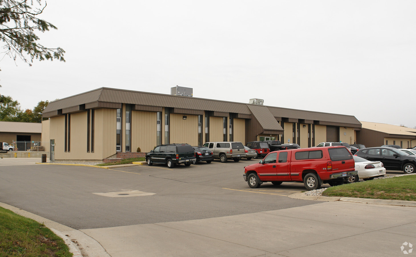
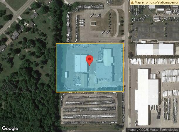
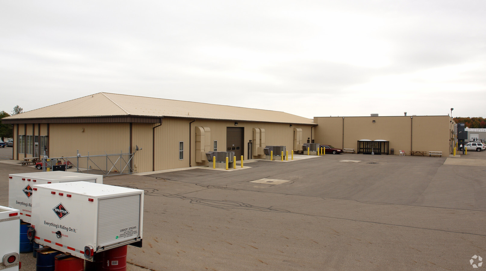
1000 Reynolds Rd
200-045-600-105-01
S 75 FT OF LOT 10. LOTS 11,12, 13 & 14. DEAN INDUSTRIAL PARK. CITY OF CHARLOTTE. D 4-14-20 (COMBINATION APPROVED) COMBINED
Manufacturinglight
Eaton
X
Michigan
26045C0311E
10-14
2023
7.34 AC
2024
Outlying Eaton County
020902
West Michigan
63,498 SF
Lansing-East Lansing, MI
DEMOGRAPHICS near 1000 Reynolds Rd
1 Mile
3 Mile
5 Mile
2024 Total Population
3,474
10,842
16,203
2029 Population
3,466
10,823
16,170
Pop Growth 2024-2029
(0.23%)
(0.18%)
(0.20%)
Average Age
42
41
42
2024 Total Households
1,413
4,381
6,434
HH Growth 2024-2029
(0.21%)
(0.16%)
(0.19%)
Median Household Inc
$64,677
$61,987
$65,825
Avg Household Size
2.30
2.30
2.40
2024 Avg HH Vehicles
2.00
2.00
2.00
Median Home Value
$148,023
$152,185
$170,549
Median Year Built
1964
1964
1972
Nearby Places
- Restaurants
- Banks
- Shops
- Fitness
- Groceries
PUBLIC TRANSPORTATION
AIRPORT
Capital Region International
DRIVE
WALK
Distance
Capital Region International
35 min
25.3 mi
Freight Ports
Port of Toledo
DRIVE
WALK
Distance
Port of Toledo
161 min
113.7 mi
Nearby Properties
Address
Land Use
TOTAL SIZE
Lot Size
Zoning
Address
Land Use
TOTAL SIZE
Lot Size
Zoning
625,893 SF
101.57 AC
N/A
Address
Land Use
TOTAL SIZE
Lot Size
Zoning
158,736 SF
28.10 AC
N/A
Address
Land Use
TOTAL SIZE
Lot Size
Zoning
126,110 SF
9.92 AC
N/A
Address
Land Use
TOTAL SIZE
Lot Size
Zoning
135,109 SF
8.57 AC
N/A
Address
Land Use
TOTAL SIZE
Lot Size
Zoning
106,705 SF
11.63 AC
LA
Address
Land Use
TOTAL SIZE
Lot Size
Zoning
86,060 SF
15.56 AC
N/A
Address
Land Use
TOTAL SIZE
Lot Size
Zoning
81,764 SF
11.44 AC
N/A
Address
Land Use
TOTAL SIZE
Lot Size
Zoning
146,685 SF
10.86 AC
N/A
Address
Land Use
TOTAL SIZE
Lot Size
Zoning
38,722 SF
4.23 AC
N/A
Address
Land Use
TOTAL SIZE
Lot Size
Zoning
110,000 SF
13.86 AC
N/A
Address
Land Use
TOTAL SIZE
Lot Size
Zoning
141,244 SF
10 AC
N/A
Address
Land Use
TOTAL SIZE
Lot Size
Zoning
19,613 SF
6.99 AC
N/A
Address
Land Use
TOTAL SIZE
Lot Size
Zoning
60,513 SF
11 AC
N/A
Address
Land Use
TOTAL SIZE
Lot Size
Zoning
96,611 SF
7.14 AC
N/A
Address
Land Use
TOTAL SIZE
Lot Size
Zoning
174,712 SF
9.50 AC
N/A
Address
Land Use
TOTAL SIZE
Lot Size
Zoning
Address
Land Use
TOTAL SIZE
Lot Size
Zoning
Address
Land Use
TOTAL SIZE
Lot Size
Zoning
78,302 SF
13.86 AC
N/A
Address
Land Use
TOTAL SIZE
Lot Size
Zoning
10,449 SF
3.15 AC
N/A
Address
Land Use
TOTAL SIZE
Lot Size
Zoning
40,484 SF
2.28 AC
N/A
Address
Land Use
TOTAL SIZE
Lot Size
Zoning
45,729 SF
6.46 AC
N/A
Address
Land Use
TOTAL SIZE
Lot Size
Zoning
65,731 SF
12.60 AC
N/A
Address
Land Use
TOTAL SIZE
Lot Size
Zoning
Address
Land Use
TOTAL SIZE
Lot Size
Zoning
Address
Land Use
TOTAL SIZE
Lot Size
Zoning
14,440 SF
0.94 AC
N/A
Address
Land Use
TOTAL SIZE
Lot Size
Zoning
97,600 SF
11.52 AC
N/A
Address
Land Use
TOTAL SIZE
Lot Size
Zoning
4,608 SF
1.90 AC
N/A
Address
Land Use
TOTAL SIZE
Lot Size
Zoning
41,605 SF
17 AC
N/A
Address
Land Use
TOTAL SIZE
Lot Size
Zoning
26,862 SF
7.36 AC
N/A
The World's #1 Commercial Real Estate Marketplace
Connect with us
© 2025 CoStar Group
The information above has been obtained from sources believed reliable. While we do not doubt its accuracy we have not verified it and make no guarantee, warranty or representation about it. It is your responsibility to independently confirm its accuracy and completeness. Any projections, opinions, assumptions, or estimates used are for example only and do not represent the current or future performance of the property. The value of this transaction to you depends on tax and other factors which should be evaluated by your tax, financial, and legal advisors. You and your advisors should conduct a careful, independent investigation of the property to determine to your satisfaction the suitability of the property for your needs.