Property Record
1000 S Mccaslin Blvd, Superior, CO 80027
Current Lease Availabilities
NEARBY LISTINGS FOR SALE OR LEASE
Property Detail
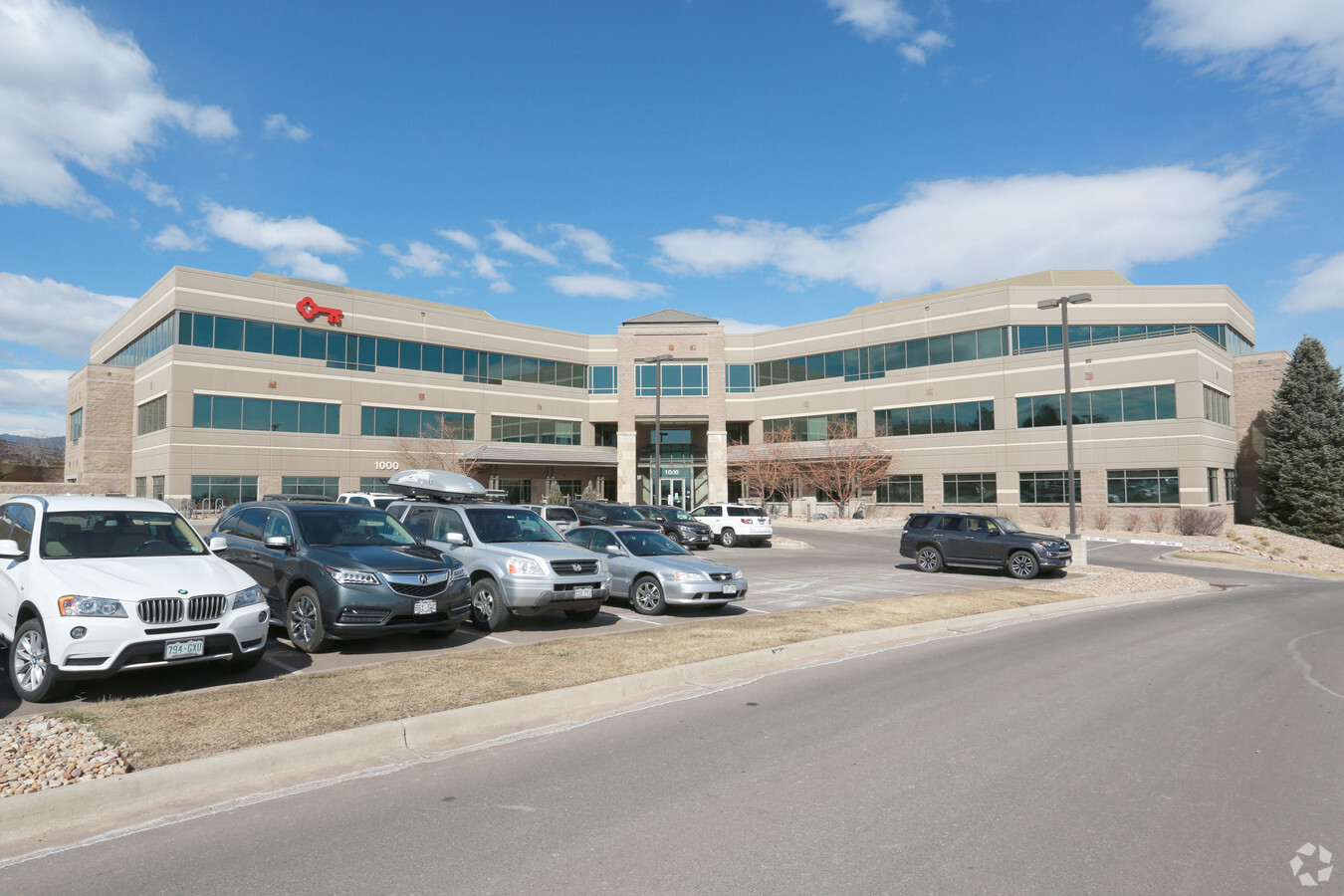
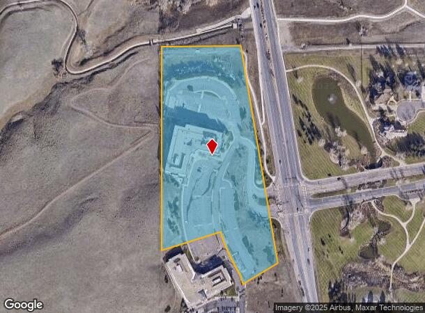
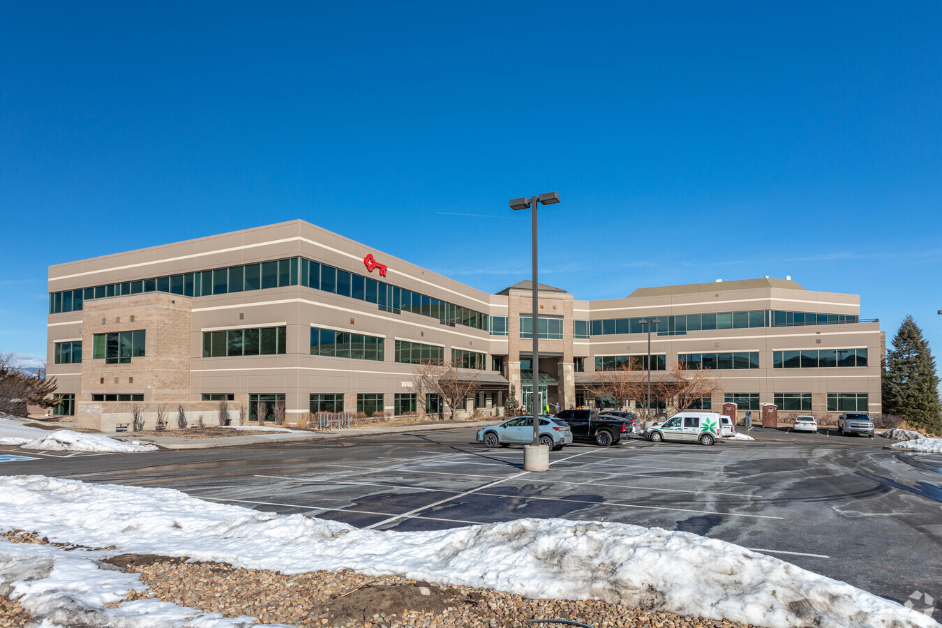
1000 S Mccaslin Blvd
Boulder, CO
Superior Hill Office Park
1575193-06-003
LOT 1 & 2 SUPERIOR HILL OFFICE PARK R0130322 & R0031070 COMBINED 2024
Storesoffices
Boulder
X
Colorado
08059C0075G
1,2
2022
13.96 AC
2024
Boulder County
060602
Denver
154,528 SF
DEMOGRAPHICS near 1000 S Mccaslin Blvd
1 Mile
3 Mile
5 Mile
2024 Total Population
5,281
36,426
91,630
2029 Population
5,317
37,163
93,106
Pop Growth 2024-2029
+ 0.68%
+ 2.02%
+ 1.61%
Average Age
39
39
40
2024 Total Households
1,918
15,268
38,866
HH Growth 2024-2029
+ 0.89%
+ 2.92%
+ 2.01%
Median Household Inc
$141,790
$113,870
$107,832
Avg Household Size
2.70
2.30
2.30
2024 Avg HH Vehicles
2.00
2.00
2.00
Median Home Value
$746,401
$756,968
$696,211
Median Year Built
1994
1996
1991
Nearby Places
- Restaurants
- Banks
- Shops
- Fitness
- Groceries
PUBLIC TRANSPORTATION
AIRPORT
Denver International
DRIVE
WALK
Distance
Denver International
43 min
37.0 mi
Freight Ports
Tulsa Port Of Catoosa
DRIVE
WALK
Distance
Tulsa Port Of Catoosa
746 min
723.6 mi
Nearby Properties
Address
Land Use
TOTAL SIZE
Lot Size
Zoning
Address
Land Use
TOTAL SIZE
Lot Size
Zoning
776,625 SF
43.40 AC
PUD
Address
Land Use
TOTAL SIZE
Lot Size
Zoning
305,331 SF
14.41 AC
PUD
Address
Land Use
TOTAL SIZE
Lot Size
Zoning
411,485 SF
24.79 AC
Address
Land Use
TOTAL SIZE
Lot Size
Zoning
254,500 SF
13.42 AC
PUD
Address
Land Use
TOTAL SIZE
Lot Size
Zoning
279,770 SF
34.13 AC
Address
Land Use
TOTAL SIZE
Lot Size
Zoning
320,771 SF
18.60 AC
PUD
Address
Land Use
TOTAL SIZE
Lot Size
Zoning
130,769 SF
18.61 AC
PUD
Address
Land Use
TOTAL SIZE
Lot Size
Zoning
643,992 SF
13.24 AC
PUD
Address
Land Use
TOTAL SIZE
Lot Size
Zoning
453,015 SF
12.10 AC
B-PUD
Address
Land Use
TOTAL SIZE
Lot Size
Zoning
446,461 SF
18.19 AC
B-PUD
Address
Land Use
TOTAL SIZE
Lot Size
Zoning
207,248 SF
15.66 AC
Address
Land Use
TOTAL SIZE
Lot Size
Zoning
200,000 SF
20.32 AC
Address
Land Use
TOTAL SIZE
Lot Size
Zoning
135,508 SF
9.64 AC
Address
Land Use
TOTAL SIZE
Lot Size
Zoning
313,394 SF
24.47 AC
PUD
Address
Land Use
TOTAL SIZE
Lot Size
Zoning
42.46 AC
A
Address
Land Use
TOTAL SIZE
Lot Size
Zoning
347,150 SF
19.50 AC
PUD
Address
Land Use
TOTAL SIZE
Lot Size
Zoning
201,000 SF
9.42 AC
PUD
Address
Land Use
TOTAL SIZE
Lot Size
Zoning
153,430 SF
12.16 AC
Address
Land Use
TOTAL SIZE
Lot Size
Zoning
191,727 SF
4 AC
PUD
Address
Land Use
TOTAL SIZE
Lot Size
Zoning
387,684 SF
9.37 AC
PUD
Address
Land Use
TOTAL SIZE
Lot Size
Zoning
34.84 AC
Address
Land Use
TOTAL SIZE
Lot Size
Zoning
256,344 SF
11.02 AC
PUD
Address
Land Use
TOTAL SIZE
Lot Size
Zoning
208,303 SF
23.04 AC
PUD
Address
Land Use
TOTAL SIZE
Lot Size
Zoning
285,588 SF
15.04 AC
PUD
Address
Land Use
TOTAL SIZE
Lot Size
Zoning
308,482 SF
16.27 AC
B-PUD
Address
Land Use
TOTAL SIZE
Lot Size
Zoning
146,318 SF
10.46 AC
Address
Land Use
TOTAL SIZE
Lot Size
Zoning
400,742 SF
24.25 AC
Address
Land Use
TOTAL SIZE
Lot Size
Zoning
160,675 SF
7.24 AC
PUD
Address
Land Use
TOTAL SIZE
Lot Size
Zoning
57.62 AC
The World's #1 Commercial Real Estate Marketplace
Connect with us
© 2025 CoStar Group
The information above has been obtained from sources believed reliable. While we do not doubt its accuracy we have not verified it and make no guarantee, warranty or representation about it. It is your responsibility to independently confirm its accuracy and completeness. Any projections, opinions, assumptions, or estimates used are for example only and do not represent the current or future performance of the property. The value of this transaction to you depends on tax and other factors which should be evaluated by your tax, financial, and legal advisors. You and your advisors should conduct a careful, independent investigation of the property to determine to your satisfaction the suitability of the property for your needs.