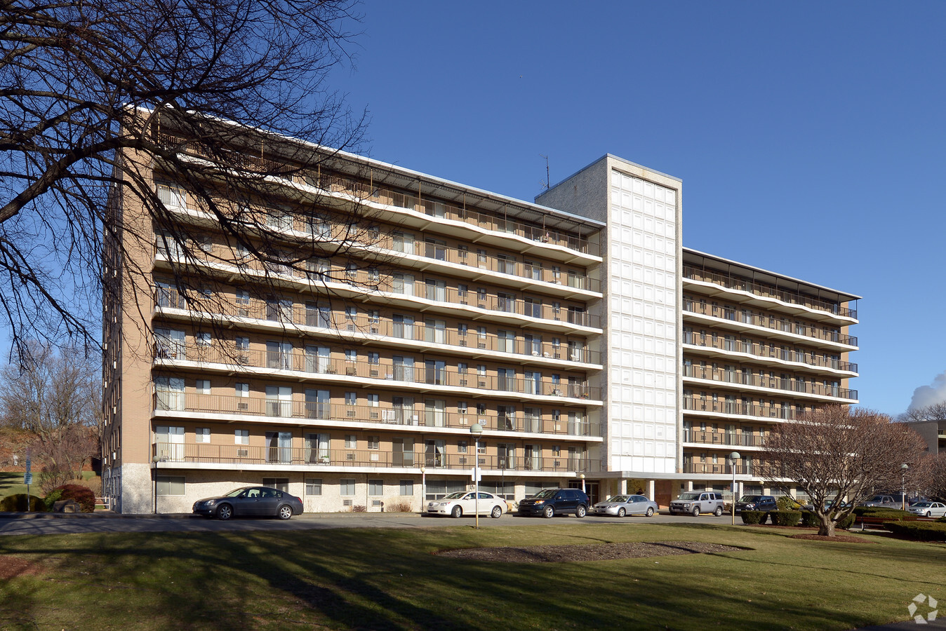
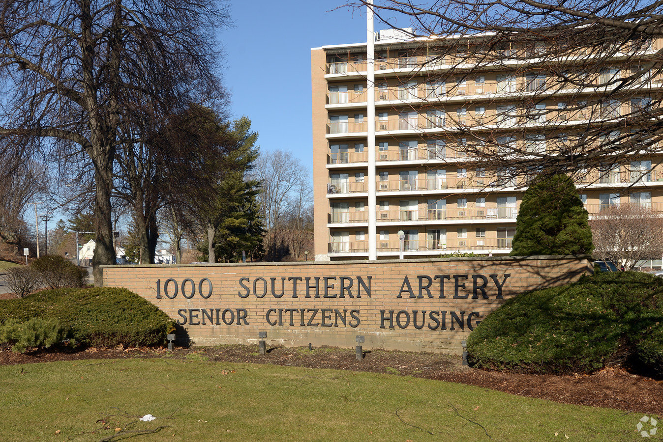
Property Record
1000 Southern Artery, Quincy, MA 02169

NEARBY LISTINGS FOR SALE OR LEASE
Property Detail
1000 Southern Artery
QUIN-002084C-000047-A000000
Norfolk
Apartment
Massachusetts
X
a
25021C0226F
4 AC
2024
Quincy Point
2024
Boston
417901
Boston-Cambridge-Newton, MA-NH
132,194 SF
DEMOGRAPHICS near 1000 Southern Artery
1 Mile
3 Mile
5 Mile
2024 Total Population
20,615
123,929
225,414
2029 Population
20,254
122,951
223,557
Pop Growth 2024-2029
(1.75%)
(0.79%)
(0.82%)
Average Age
42
41
42
2024 Total Households
9,731
52,352
94,161
HH Growth 2024-2029
(1.82%)
(0.76%)
(0.83%)
Median Household Inc
$69,978
$91,098
$98,492
Avg Household Size
2.00
2.30
2.30
2024 Avg HH Vehicles
1.00
2.00
2.00
Median Home Value
$515,045
$566,039
$610,115
Median Year Built
1969
1955
1958
Nearby Places
- Restaurants
- Banks
- Shops
- Fitness
- Groceries
PUBLIC TRANSPORTATION
COMMUTER RAIL
Weymouth Landing/East Braintree (Greenbush Line - MBTA)
DRIVE
WALK
Distance
Weymouth Landing/East Braintree (Greenbush Line - MBTA)
5 min
1.9 mi
Quincy Center Station (Greenbush Line - Massachusetts Bay Transportation Authority Commuter Rail (Purple Line), Kingston/Plymouth Line - Massachusetts Bay Transportation Authority Commuter Rail (Purple Line), Middleborough/Lakeville Line - Massachusetts Bay Transportation Authority Commuter Rail (Purple Line), Red Line - Massachusetts Bay Transportation Authority Commuter Rail (Purple Line))
DRIVE
WALK
Distance
Quincy Center Station (Greenbush Line - Massachusetts Bay Transportation Authority Commuter Rail (Purple Line), Kingston/Plymouth Line - Massachusetts Bay Transportation Authority Commuter Rail (Purple Line), Middleborough/Lakeville Line - Massachusetts Bay Transportation Authority Commuter Rail (Purple Line), Red Line - Massachusetts Bay Transportation Authority Commuter Rail (Purple Line))
4 min
1.9 mi
AIRPORT
General Edward Lawrence Logan International
DRIVE
WALK
Distance
General Edward Lawrence Logan International
24 min
12.9 mi
Freight Ports
Port of Boston
DRIVE
WALK
Distance
Port of Boston
21 min
10.7 mi
Nearby Properties
Address
Land Use
TOTAL SIZE
Lot Size
Zoning
Address
Land Use
TOTAL SIZE
Lot Size
Zoning
148,456 SF
0.43 AC
Address
Land Use
TOTAL SIZE
Lot Size
Zoning
50.61 AC
IND
Address
Land Use
TOTAL SIZE
Lot Size
Zoning
17.33 AC
Address
Land Use
TOTAL SIZE
Lot Size
Zoning
167,328 SF
24.72 AC
Address
Land Use
TOTAL SIZE
Lot Size
Zoning
20,596 SF
16.20 AC
PUD
Address
Land Use
TOTAL SIZE
Lot Size
Zoning
236,154 SF
1.40 AC
BUSC
Address
Land Use
TOTAL SIZE
Lot Size
Zoning
3.31 AC
BUSC
Address
Land Use
TOTAL SIZE
Lot Size
Zoning
15.81 AC
Address
Land Use
TOTAL SIZE
Lot Size
Zoning
14.81 AC
Address
Land Use
TOTAL SIZE
Lot Size
Zoning
233,488 SF
9.82 AC
Address
Land Use
TOTAL SIZE
Lot Size
Zoning
202,858 SF
2.30 AC
Address
Land Use
TOTAL SIZE
Lot Size
Zoning
33.81 AC
A3
Address
Land Use
TOTAL SIZE
Lot Size
Zoning
5.06 AC
BUSC
Address
Land Use
TOTAL SIZE
Lot Size
Zoning
132,997 SF
1.45 AC
Address
Land Use
TOTAL SIZE
Lot Size
Zoning
9.10 AC
RESC
Address
Land Use
TOTAL SIZE
Lot Size
Zoning
131,686 SF
4.21 AC
Address
Land Use
TOTAL SIZE
Lot Size
Zoning
11.90 AC
PUD
Address
Land Use
TOTAL SIZE
Lot Size
Zoning
147,611 SF
0.62 AC
BUSC
Address
Land Use
TOTAL SIZE
Lot Size
Zoning
232,262 SF
15 AC
INDB
Address
Land Use
TOTAL SIZE
Lot Size
Zoning
233,530 SF
6.70 AC
PUD
Address
Land Use
TOTAL SIZE
Lot Size
Zoning
296,238 SF
15.87 AC
100
Address
Land Use
TOTAL SIZE
Lot Size
Zoning
10.38 AC
Address
Land Use
TOTAL SIZE
Lot Size
Zoning
124,274 SF
0.62 AC
Address
Land Use
TOTAL SIZE
Lot Size
Zoning
66,750 SF
4.50 AC
OS
Address
Land Use
TOTAL SIZE
Lot Size
Zoning
5.38 AC
Address
Land Use
TOTAL SIZE
Lot Size
Zoning
3,375 SF
12.03 AC
PUD
Address
Land Use
TOTAL SIZE
Lot Size
Zoning
238,217 SF
10.76 AC
INDB
Address
Land Use
TOTAL SIZE
Lot Size
Zoning
10.04 AC
PUD
Address
Land Use
TOTAL SIZE
Lot Size
Zoning
24,156 SF
7.65 AC
RESB
Address
Land Use
TOTAL SIZE
Lot Size
Zoning
264,417 SF
2.42 AC
The World's #1 Commercial Real Estate Marketplace
Connect with us
© 2025 CoStar Group
The information above has been obtained from sources believed reliable. While we do not doubt its accuracy we have not verified it and make no guarantee, warranty or representation about it. It is your responsibility to independently confirm its accuracy and completeness. Any projections, opinions, assumptions, or estimates used are for example only and do not represent the current or future performance of the property. The value of this transaction to you depends on tax and other factors which should be evaluated by your tax, financial, and legal advisors. You and your advisors should conduct a careful, independent investigation of the property to determine to your satisfaction the suitability of the property for your needs.