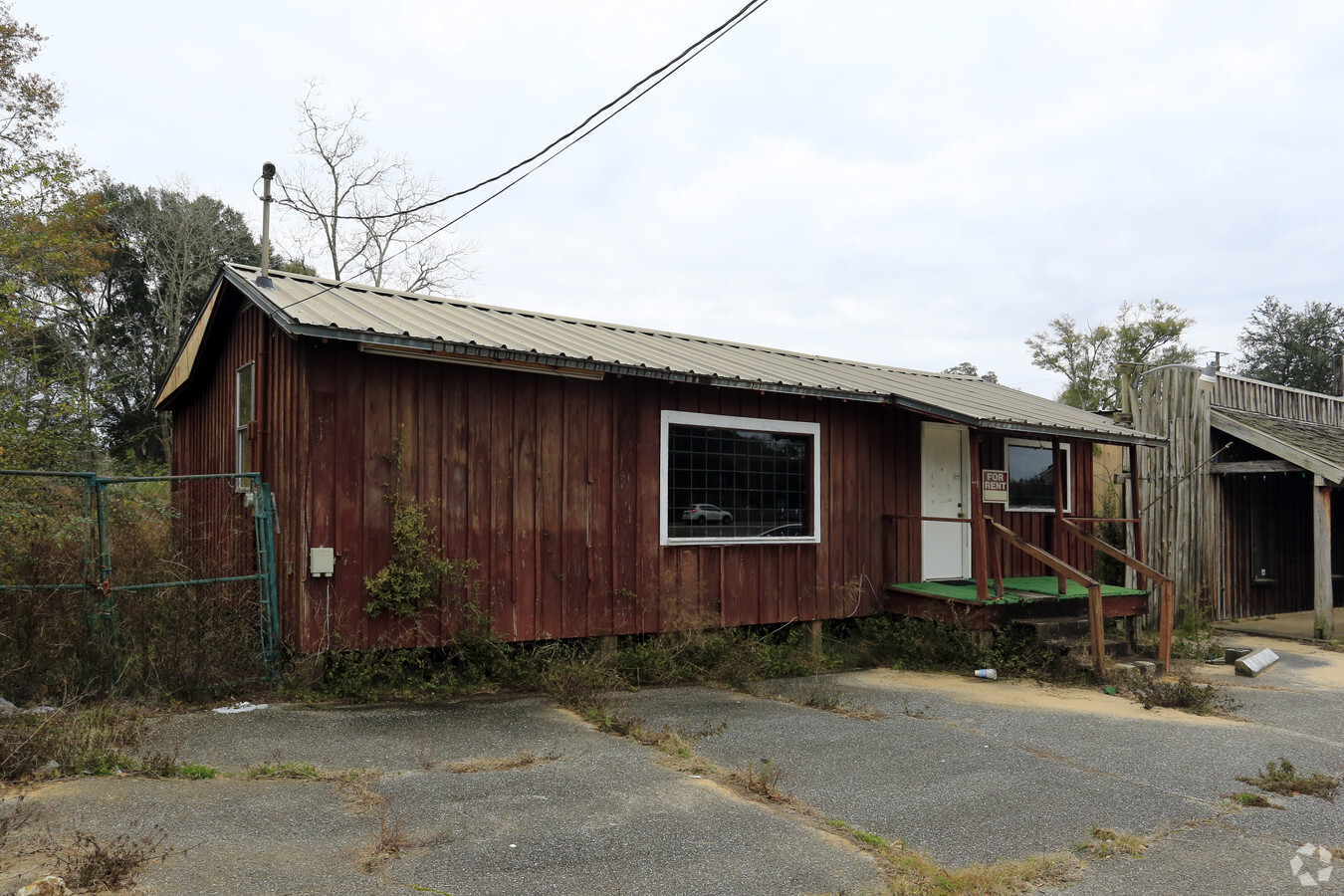
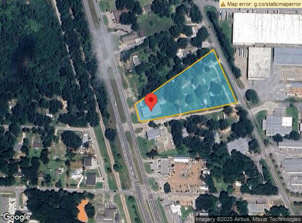
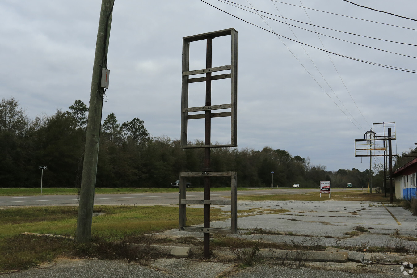
Property Record
10001 N Palafox St, Pensacola, FL 32534
NEARBY LISTINGS FOR SALE OR LEASE
Property Detail
10001 N Palafox St
Pensacola-Ferry Pass-Brent, FL
Beverly Homes Unit #2
08-1S-30-3103-000-001
LTS 1 TO 13 AND PART OF LT 14 BEVERLY HOMES NO 2 PB 2 P 71 DB 497 P 365 OR 7340 P 485 SEC 8/9 T 1S R 30
Storesoffices
Escambia
X
Florida
12033C0295G
1
2023
3.83 AC
2024
Gonzalez/SW Santa Rosa
003609
Pensacola
10,262 SF
DEMOGRAPHICS near 10001 N Palafox St
1 Mile
3 Mile
5 Mile
2024 Total Population
4,144
40,423
86,692
2029 Population
4,151
40,944
88,298
Pop Growth 2024-2029
+ 0.17%
+ 1.29%
+ 1.85%
Average Age
40
41
41
2024 Total Households
1,732
16,435
35,174
HH Growth 2024-2029
+ 0.23%
+ 1.38%
+ 1.84%
Median Household Inc
$73,741
$59,293
$58,469
Avg Household Size
2.30
2.40
2.30
2024 Avg HH Vehicles
2.00
2.00
2.00
Median Home Value
$208,434
$204,503
$214,142
Median Year Built
1987
1989
1989
Nearby Places
- Restaurants
- Banks
- Shops
- Fitness
- Groceries
PUBLIC TRANSPORTATION
AIRPORT
Pensacola International
DRIVE
WALK
Distance
Pensacola International
19 min
10.5 mi
Freight Ports
Port of Mobile
DRIVE
WALK
Distance
Port of Mobile
59 min
50.1 mi
Nearby Properties
Address
Land Use
TOTAL SIZE
Lot Size
Zoning
Address
Land Use
TOTAL SIZE
Lot Size
Zoning
368,851 SF
19.16 AC
HDMU,REC
Address
Land Use
TOTAL SIZE
Lot Size
Zoning
336,376 SF
19.68 AC
HDMU
Address
Land Use
TOTAL SIZE
Lot Size
Zoning
295,911 SF
15.53 AC
HC/LI,HDR
Address
Land Use
TOTAL SIZE
Lot Size
Zoning
303,273 SF
9.95 AC
HC/LI
Address
Land Use
TOTAL SIZE
Lot Size
Zoning
264,273 SF
15.97 AC
HC/LI
Address
Land Use
TOTAL SIZE
Lot Size
Zoning
263,838 SF
9.03 AC
HC/LI
Address
Land Use
TOTAL SIZE
Lot Size
Zoning
274,822 SF
12.67 AC
HC/LI
Address
Land Use
TOTAL SIZE
Lot Size
Zoning
243,052 SF
14.51 AC
HC/LI
Address
Land Use
TOTAL SIZE
Lot Size
Zoning
145,610 SF
5.42 AC
COM,HC/LI
Address
Land Use
TOTAL SIZE
Lot Size
Zoning
109,855 SF
16.70 AC
COM
Address
Land Use
TOTAL SIZE
Lot Size
Zoning
317,266 SF
58.88 AC
LDMU,PUB
Address
Land Use
TOTAL SIZE
Lot Size
Zoning
219,541 SF
18.71 AC
HC/LI
Address
Land Use
TOTAL SIZE
Lot Size
Zoning
160,211 SF
34 AC
HDMU
Address
Land Use
TOTAL SIZE
Lot Size
Zoning
75,966 SF
3.11 AC
COM,HC/LI
Address
Land Use
TOTAL SIZE
Lot Size
Zoning
72,248 SF
6.07 AC
COM,HC/LI
Address
Land Use
TOTAL SIZE
Lot Size
Zoning
258,979 SF
100 AC
PUB
Address
Land Use
TOTAL SIZE
Lot Size
Zoning
151,363 SF
12.17 AC
HC/LI
Address
Land Use
TOTAL SIZE
Lot Size
Zoning
140,190 SF
13.05 AC
HC/LI
Address
Land Use
TOTAL SIZE
Lot Size
Zoning
129,314 SF
4.48 AC
COM
Address
Land Use
TOTAL SIZE
Lot Size
Zoning
67,291 SF
6.05 AC
HDMU,MDR
Address
Land Use
TOTAL SIZE
Lot Size
Zoning
54,556 SF
3.98 AC
HC/LI
Address
Land Use
TOTAL SIZE
Lot Size
Zoning
103,670 SF
10.10 AC
HC/LI
Address
Land Use
TOTAL SIZE
Lot Size
Zoning
27,752 SF
5.03 AC
COM
Address
Land Use
TOTAL SIZE
Lot Size
Zoning
54,158 SF
1.27 AC
HC/LI
Address
Land Use
TOTAL SIZE
Lot Size
Zoning
102,019 SF
9.85 AC
COM
Address
Land Use
TOTAL SIZE
Lot Size
Zoning
131,376 SF
10 AC
HDMU
Address
Land Use
TOTAL SIZE
Lot Size
Zoning
77,537 SF
6.57 AC
HC/LI
Address
Land Use
TOTAL SIZE
Lot Size
Zoning
51,241 SF
5.95 AC
HC/LI
Address
Land Use
TOTAL SIZE
Lot Size
Zoning
83,586 SF
7.77 AC
HC/LI
Address
Land Use
TOTAL SIZE
Lot Size
Zoning
88,000 SF
12.92 AC
HC/LI
The World's #1 Commercial Real Estate Marketplace
Connect with us
© 2025 CoStar Group
The information above has been obtained from sources believed reliable. While we do not doubt its accuracy we have not verified it and make no guarantee, warranty or representation about it. It is your responsibility to independently confirm its accuracy and completeness. Any projections, opinions, assumptions, or estimates used are for example only and do not represent the current or future performance of the property. The value of this transaction to you depends on tax and other factors which should be evaluated by your tax, financial, and legal advisors. You and your advisors should conduct a careful, independent investigation of the property to determine to your satisfaction the suitability of the property for your needs.